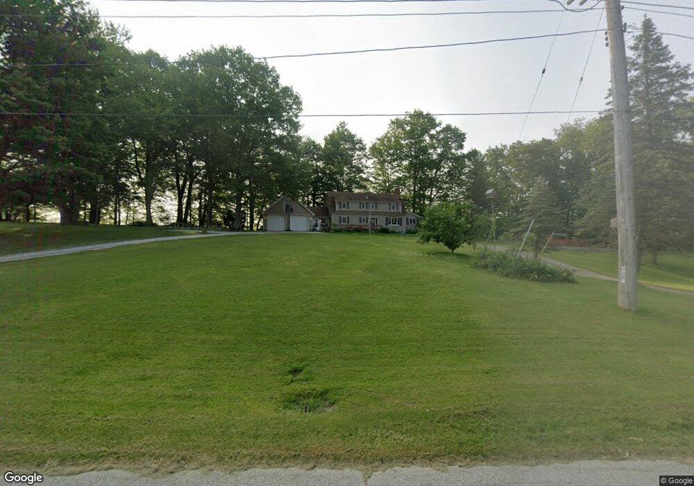
1020 Center Rd Conneaut, OH 44030
Estimated Value: $241,000 - $316,000
4
Beds
3
Baths
2,274
Sq Ft
$126/Sq Ft
Est. Value
About This Home
This home is located at 1020 Center Rd, Conneaut, OH 44030 and is currently estimated at $286,614, approximately $126 per square foot. 1020 Center Rd is a home located in Ashtabula County with nearby schools including Lakeshore Primary Elementary School, Gateway Elementary School, and Conneaut Middle School.
Ownership History
Date
Name
Owned For
Owner Type
Purchase Details
Closed on
Nov 1, 2007
Sold by
Wells Fargo Bank Minnesota Na
Bought by
Distel Curt and Distel Lisa
Current Estimated Value
Home Financials for this Owner
Home Financials are based on the most recent Mortgage that was taken out on this home.
Original Mortgage
$104,800
Outstanding Balance
$66,615
Interest Rate
6.47%
Mortgage Type
Unknown
Estimated Equity
$219,999
Purchase Details
Closed on
Jun 15, 2007
Sold by
Peterson Pete L
Bought by
Wells Fargo Bank Minnesota Na and Home Equity Loan Asset Backed Certificat
Create a Home Valuation Report for This Property
The Home Valuation Report is an in-depth analysis detailing your home's value as well as a comparison with similar homes in the area
Home Values in the Area
Average Home Value in this Area
Purchase History
| Date | Buyer | Sale Price | Title Company |
|---|---|---|---|
| Distel Curt | $131,000 | C T S Title Services Llc | |
| Wells Fargo Bank Minnesota Na | $144,500 | None Available |
Source: Public Records
Mortgage History
| Date | Status | Borrower | Loan Amount |
|---|---|---|---|
| Open | Distel Curt | $104,800 |
Source: Public Records
Tax History
| Year | Tax Paid | Tax Assessment Tax Assessment Total Assessment is a certain percentage of the fair market value that is determined by local assessors to be the total taxable value of land and additions on the property. | Land | Improvement |
|---|---|---|---|---|
| 2024 | $5,438 | $74,340 | $7,490 | $66,850 |
| 2023 | $3,449 | $74,340 | $7,490 | $66,850 |
| 2022 | $3,122 | $59,260 | $5,780 | $53,480 |
| 2021 | $3,177 | $59,260 | $5,780 | $53,480 |
| 2020 | $3,175 | $59,260 | $5,780 | $53,480 |
| 2019 | $3,231 | $59,260 | $4,170 | $55,090 |
| 2018 | $3,080 | $59,260 | $4,170 | $55,090 |
| 2017 | $3,074 | $59,260 | $4,170 | $55,090 |
| 2016 | $2,739 | $57,410 | $4,030 | $53,380 |
| 2015 | $2,766 | $57,410 | $4,030 | $53,380 |
| 2014 | $2,437 | $57,410 | $4,030 | $53,380 |
| 2013 | $2,320 | $56,180 | $4,590 | $51,590 |
Source: Public Records
Map
Nearby Homes
- 6231 Weaver Rd
- 5958 Weaver Rd
- VL Center Rd
- 515 Middle Rd
- 630 Dorman Rd
- 436 Keefus Rd
- 220 Daniels Ave
- 0 Weaver Rd Unit 11673543
- 0 Dorman Rd
- 20 Hillcrest Ct
- 370 E Underridge Rd
- 219 Mill Rd
- 210 W Main Rd
- 805 Main St Unit 807
- 284 W Main Rd
- 202 W Main Rd Unit 132
- 202 W Main Rd Unit 93
- 202 W Main Rd Unit 139
- 50 Oakland Blvd
- 238 Whitney St
- 1030 Center Rd
- 1019 Center Rd
- 1008 Center Rd
- 1031 Center Rd
- 1039 Center Rd
- 1000 Center Rd
- 992 Center Rd
- 986 Center Rd
- 981 Center Rd
- 978 Center Rd
- 970 Center Rd
- 965 Center Rd
- 7 South Rd
- 964 Center Rd
- 962 Center Rd
- 10 S Ridge Rd W
- 30 State Route 7 Rd
- 960 Center Rd
- 0 S Ridge Rd Unit 4298088
- 13 S Ridge Rd E
Your Personal Tour Guide
Ask me questions while you tour the home.