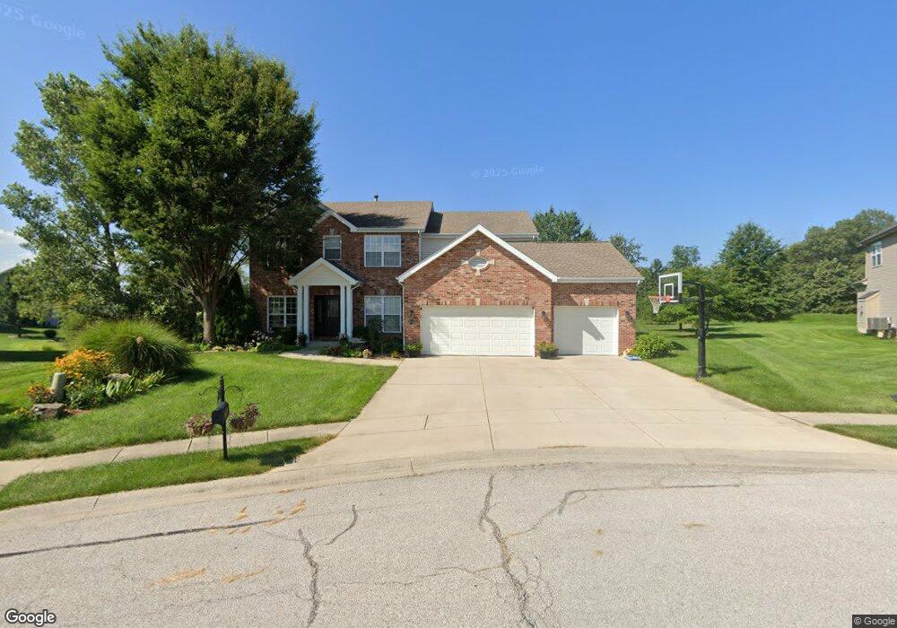
1020 Crooked Stick Dr Caseyville, IL 62232
Estimated Value: $432,000 - $548,000
4
Beds
3
Baths
3,074
Sq Ft
$162/Sq Ft
Est. Value
About This Home
This home is located at 1020 Crooked Stick Dr, Caseyville, IL 62232 and is currently estimated at $498,201, approximately $162 per square foot. 1020 Crooked Stick Dr is a home located in St. Clair County with nearby schools including Schaefer Elementary School, Fulton Junior High School, and O'Fallon Township High School.
Ownership History
Date
Name
Owned For
Owner Type
Purchase Details
Closed on
Aug 27, 2013
Sold by
Brooks Cory P and Brooks Tracie L
Bought by
Alalrd Christopher J and Allard Karen B
Current Estimated Value
Home Financials for this Owner
Home Financials are based on the most recent Mortgage that was taken out on this home.
Original Mortgage
$268,375
Outstanding Balance
$199,395
Interest Rate
4.29%
Mortgage Type
New Conventional
Estimated Equity
$298,806
Purchase Details
Closed on
Jun 21, 2006
Sold by
419 Ocr Inc
Bought by
Brooks Cory P and Brooks Tracie L
Create a Home Valuation Report for This Property
The Home Valuation Report is an in-depth analysis detailing your home's value as well as a comparison with similar homes in the area
Home Values in the Area
Average Home Value in this Area
Purchase History
| Date | Buyer | Sale Price | Title Company |
|---|---|---|---|
| Alalrd Christopher J | $282,500 | Fatic | |
| Brooks Cory P | $60,500 | Benchmark Title Insurance Co |
Source: Public Records
Mortgage History
| Date | Status | Borrower | Loan Amount |
|---|---|---|---|
| Open | Alalrd Christopher J | $268,375 |
Source: Public Records
Tax History Compared to Growth
Tax History
| Year | Tax Paid | Tax Assessment Tax Assessment Total Assessment is a certain percentage of the fair market value that is determined by local assessors to be the total taxable value of land and additions on the property. | Land | Improvement |
|---|---|---|---|---|
| 2024 | $10,228 | $155,430 | $36,200 | $119,230 |
| 2023 | $9,480 | $137,525 | $32,030 | $105,495 |
| 2022 | $9,599 | $132,698 | $30,822 | $101,876 |
| 2021 | $8,945 | $125,947 | $29,254 | $96,693 |
| 2020 | $8,863 | $119,304 | $27,711 | $91,593 |
| 2019 | $8,991 | $119,304 | $27,711 | $91,593 |
| 2018 | $8,953 | $118,397 | $27,435 | $90,962 |
| 2017 | $8,775 | $113,593 | $26,322 | $87,271 |
| 2016 | $8,698 | $111,029 | $25,728 | $85,301 |
| 2014 | $8,670 | $117,710 | $21,077 | $96,633 |
| 2013 | $8,717 | $119,880 | $21,466 | $98,414 |
Source: Public Records
Map
Nearby Homes
- 1012 Crooked Stick Dr
- 28 Geneva Dr
- 107 Bethel Mine Rd
- 690 Vinci Dr
- 305 Forest Oaks Dr
- 1128 Pisa Dr
- 678 Prato Ct
- 7751 N Illinois St
- 7745 N Illinois St
- 124 Long Branch Ln
- 38 Edgewood Ln
- 363 Old Collinsville Rd
- 0 Walker Meadows Subdivision
- 0 Boreal Ridge Subdivision
- 7978 Boreal Ridge
- 1034 Far Oaks Dr
- 8026 Tahoe Ridge
- 0 Tahoe Ridge Subdivision
- 8038 Tahoe Ridge
- 1130 Elbow Hill Ct
- 1016 Crooked Stick Dr
- 1024 Crooked Stick Dr
- 1025 Crooked Stick Dr
- 131 Buckington Ct
- 1028 Crooked Stick Dr
- 127 Buckington Ct
- 1032 Crooked Stick Dr
- 1029 Crooked Stick Dr
- 1008 Crooked Stick Dr
- 109 Hawk Run Ct
- 1009 Crooked Stick Dr
- 135 Buckington Ct
- 121 Buckington Ct
- 105 Hawk Run Ct
- 136 Buckington Ct
- 128 Buckington Ct
- 132 Buckington Ct
- 112 Buckington Ct
- 124 Buckington Ct
- 607 Bethel Mine Rd