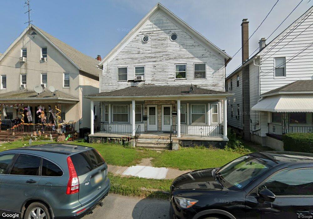
1020 Diamond Ave Unit 1022 Scranton, PA 18508
The Plot NeighborhoodEstimated Value: $176,000 - $270,000
--
Bed
--
Bath
2,040
Sq Ft
$111/Sq Ft
Est. Value
About This Home
This home is located at 1020 Diamond Ave Unit 1022, Scranton, PA 18508 and is currently estimated at $226,000, approximately $110 per square foot. 1020 Diamond Ave Unit 1022 is a home located in Lackawanna County with nearby schools including Isaac Tripp Elementary School, West Scranton Intrmd School, and Scranton High School.
Ownership History
Date
Name
Owned For
Owner Type
Purchase Details
Closed on
Jul 19, 2011
Sold by
Rogel Megan E and Runco Matthew
Bought by
Runco Edward and Runco Eddie
Current Estimated Value
Home Financials for this Owner
Home Financials are based on the most recent Mortgage that was taken out on this home.
Original Mortgage
$50,000
Outstanding Balance
$34,399
Interest Rate
4.51%
Mortgage Type
Commercial
Estimated Equity
$191,601
Purchase Details
Closed on
May 8, 2008
Sold by
The Bank Of Nwe York Trust Company Na
Bought by
Runco Edward and Rogela Megan E
Purchase Details
Closed on
Oct 23, 2006
Sold by
Juice Stephen and Juice Ann Marie
Bought by
Jp Morgan Chase Bank
Create a Home Valuation Report for This Property
The Home Valuation Report is an in-depth analysis detailing your home's value as well as a comparison with similar homes in the area
Home Values in the Area
Average Home Value in this Area
Purchase History
| Date | Buyer | Sale Price | Title Company |
|---|---|---|---|
| Runco Edward | $40,000 | None Available | |
| Runco Edward | $39,000 | None Available | |
| Jp Morgan Chase Bank | $4,442 | None Available |
Source: Public Records
Mortgage History
| Date | Status | Borrower | Loan Amount |
|---|---|---|---|
| Open | Runco Edward | $50,000 |
Source: Public Records
Tax History Compared to Growth
Tax History
| Year | Tax Paid | Tax Assessment Tax Assessment Total Assessment is a certain percentage of the fair market value that is determined by local assessors to be the total taxable value of land and additions on the property. | Land | Improvement |
|---|---|---|---|---|
| 2025 | $3,443 | $10,500 | $2,000 | $8,500 |
| 2024 | $3,151 | $10,500 | $2,000 | $8,500 |
| 2023 | $3,151 | $10,500 | $2,000 | $8,500 |
| 2022 | $3,081 | $10,500 | $2,000 | $8,500 |
| 2021 | $3,081 | $10,500 | $2,000 | $8,500 |
| 2020 | $3,025 | $10,500 | $2,000 | $8,500 |
| 2019 | $2,847 | $10,500 | $2,000 | $8,500 |
| 2018 | $2,847 | $10,500 | $2,000 | $8,500 |
| 2017 | $2,797 | $10,500 | $2,000 | $8,500 |
| 2016 | $0 | $10,500 | $2,000 | $8,500 |
| 2015 | $2,111 | $10,500 | $2,000 | $8,500 |
| 2014 | -- | $10,500 | $2,000 | $8,500 |
Source: Public Records
Map
Nearby Homes
- 1008 Mount Vernon Ave
- 942 Providence Rd
- 1206 Blair Ave Unit Rear
- 938 Providence Rd
- 375 Grove St
- 1227 Providence Rd
- 656 Philo St
- 1123 Court St
- 1311 Short Ave
- 1235 N Sumner Ave
- 991 N Sumner Ave Unit 1/2 L 13
- 1425 Bulwer St
- 1126 W Gibson St
- 0 Philo St Unit GSBSC4763
- 1430 N Main Ave
- 833 Powderly Ct
- 1431 Dorothy St
- 1012 Clearview St
- 1436 Church Ave
- 1513 Meylert Ave
- 1016 Diamond Ave Unit 1018
- 1024 Diamond Ave Unit 1026
- 1016-1018 Diamond Ave
- 1028 Diamond Ave Unit R
- 1028 Diamond Ave
- 1014 Diamond Ave
- 1040-1042 1040-1042 Diamond Ave
- 1030 Diamond Ave
- 1029 31 Diamond Ave
- 1038 Diamond Ave
- 710 Foster St
- 1027 Diamond Ave
- 1036 Diamond Ave Unit 1038
- 1021 Diamond Ave
- 1023 Diamond Ave
- 1025 27 Diamond Ave
- 1017 Diamond Ave Unit 1019
- 1031 Diamond Ave
- 1025 Diamond Ave Unit 27
- 1049 Blair Ave