Estimated Value: $168,323 - $211,000
3
Beds
1
Bath
1,261
Sq Ft
$148/Sq Ft
Est. Value
About This Home
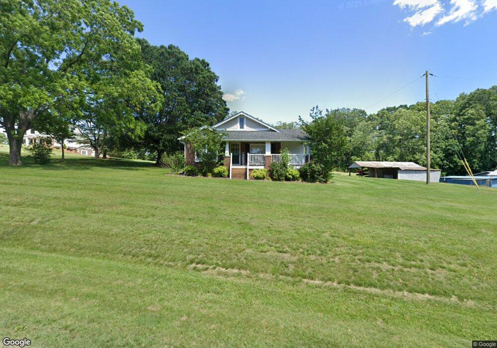
This home is located at 1020 Doc Sams Rd, King, NC 27021 and is currently estimated at $186,581, approximately $147 per square foot. 1020 Doc Sams Rd is a home located in Stokes County with nearby schools including Mount Olive Elementary School, Springdale Elementary School, and Chestnut Grove Middle.
Ownership History
Date
Name
Owned For
Owner Type
Purchase Details
Closed on
Apr 15, 2013
Sold by
Carroll David Brent and Carroll Annie K Ate
Bought by
Moxley Micah Jarryd and Poindexter Genna F
Current Estimated Value
Home Financials for this Owner
Home Financials are based on the most recent Mortgage that was taken out on this home.
Original Mortgage
$71,000
Outstanding Balance
$15,655
Interest Rate
4.25%
Mortgage Type
Adjustable Rate Mortgage/ARM
Estimated Equity
$170,926
Purchase Details
Closed on
Sep 22, 2008
Sold by
Carroll Alexander L and Carroll Dora T
Bought by
Carroll David Brent and Carroll Jeffrey D
Create a Home Valuation Report for This Property
The Home Valuation Report is an in-depth analysis detailing your home's value as well as a comparison with similar homes in the area
Home Values in the Area
Average Home Value in this Area
Purchase History
| Date | Buyer | Sale Price | Title Company |
|---|---|---|---|
| Moxley Micah Jarryd | $70,000 | None Available | |
| Carroll David Brent | -- | Atc |
Source: Public Records
Mortgage History
| Date | Status | Borrower | Loan Amount |
|---|---|---|---|
| Open | Moxley Micah Jarryd | $71,000 |
Source: Public Records
Tax History Compared to Growth
Tax History
| Year | Tax Paid | Tax Assessment Tax Assessment Total Assessment is a certain percentage of the fair market value that is determined by local assessors to be the total taxable value of land and additions on the property. | Land | Improvement |
|---|---|---|---|---|
| 2025 | $636 | $89,000 | $25,200 | $63,800 |
| 2024 | $636 | $59,300 | $18,800 | $40,500 |
| 2023 | $480 | $59,300 | $18,800 | $40,500 |
| 2022 | $439 | $59,300 | $18,800 | $40,500 |
| 2021 | $439 | $59,300 | $18,800 | $40,500 |
Source: Public Records
Map
Nearby Homes
- 3125 YMcA Camp Rd
- 0 Nance Rd
- 1208 Kentland Dr
- 1249 Kentland Dr
- 1160 Capella Ridge Rd
- .64 Ac Kentland Dr Unit .64 Ac
- 1129 Kentland Dr
- 5.25 Ac Capella Ridge Rd Unit 5.25 Ac
- 1034 Kentland Dr
- 00 Covington Rd
- 1065 Reid Rd
- 0 Reid Rd
- 1040 Breezeway Dr
- 108 Nova Ln
- 2889 Mountain View Church Rd
- 2790 Mountain View Church Rd
- 00 Sizemore Rd
- 113 Ravenwood Ct
- 1085 Mystic Ln
- 1458 Merridon Dr
- 3523 YMcA Camp Rd
- 1040 Doc Sams Rd
- 1280 Faulkenberry Ridge Rd
- 1285 Faulkenberry Ridge Rd
- 1112 Doc Sams Rd
- 1249 Faulkenberry Ridge Rd
- 1063 Lunsford Rd
- 1140 Ballfield Rd
- 1140 Ballfield Rd
- 3372 YMcA Camp Rd
- 1168 Faulkenberry Ridge Rd
- 1035 Cherl Rd
- 3.799 Acres Ballfield Rd
- 7.13 acres Ballfield Rd
- 1159 Faulkenberry Ridge Rd
- 16+/- Acres Doc Sams Rd
- 1135 Falkenberry Ridge Rd
- 1135 Faulkenberry Ridge Rd
- 1139 Lunsford Rd
- 1075 Ballfield Rd