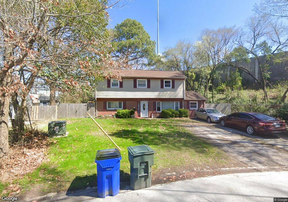
1020 Georgetown Rd Norfolk, VA 23502
Lake Taylor NeighborhoodEstimated Value: $291,309 - $320,000
3
Beds
2
Baths
1,620
Sq Ft
$192/Sq Ft
Est. Value
About This Home
This home is located at 1020 Georgetown Rd, Norfolk, VA 23502 and is currently estimated at $311,577, approximately $192 per square foot. 1020 Georgetown Rd is a home located in Norfolk City with nearby schools including Fairlawn Elementary School and Lake Taylor High School.
Ownership History
Date
Name
Owned For
Owner Type
Purchase Details
Closed on
Sep 20, 2021
Sold by
Stewart Ruby
Bought by
Stewart Elouise
Current Estimated Value
Purchase Details
Closed on
Jul 16, 2021
Sold by
Welch Delorean and Stewart Michael
Bought by
Stewart Elouise
Create a Home Valuation Report for This Property
The Home Valuation Report is an in-depth analysis detailing your home's value as well as a comparison with similar homes in the area
Home Values in the Area
Average Home Value in this Area
Purchase History
| Date | Buyer | Sale Price | Title Company |
|---|---|---|---|
| Stewart Elouise | -- | None Available | |
| Stewart Elouise | -- | None Available |
Source: Public Records
Tax History Compared to Growth
Tax History
| Year | Tax Paid | Tax Assessment Tax Assessment Total Assessment is a certain percentage of the fair market value that is determined by local assessors to be the total taxable value of land and additions on the property. | Land | Improvement |
|---|---|---|---|---|
| 2025 | $3,244 | $259,500 | $69,800 | $189,700 |
| 2024 | $2,979 | $238,300 | $69,800 | $168,500 |
| 2023 | $2,889 | $231,100 | $69,800 | $161,300 |
| 2022 | $2,746 | $219,700 | $61,200 | $158,500 |
| 2021 | $621 | $184,500 | $44,600 | $139,900 |
| 2020 | $0 | $184,500 | $44,600 | $139,900 |
| 2019 | $1,953 | $176,500 | $40,500 | $136,000 |
| 2018 | $1,977 | $171,900 | $40,500 | $131,400 |
| 2017 | $1,981 | $172,300 | $40,500 | $131,800 |
| 2016 | $1,953 | $171,500 | $40,500 | $131,000 |
| 2015 | $1,972 | $171,500 | $40,500 | $131,000 |
| 2014 | $1,972 | $171,500 | $40,500 | $131,000 |
Source: Public Records
Map
Nearby Homes
- 6288 Hudson Ave
- 6340 Hudson Ave
- 1100 George St
- 1209 George St
- 1228 George St
- 6428 Hudson Ave
- 5803 W Hastings Ct
- 5800 W Hastings Ct
- 5956 Blackpoole Ln
- 5813 W Hastings Arch
- 601 Charles Ct
- 1210 Clarence St
- 6408 Stoney Point S
- 645 Red Horse Ln
- 6549 Stoney Point S
- 5900 Margate Ave
- 412 Wellman St
- 6617 Hudson Ave
- 1111 Layton St
- 740 Miss Coral Ln
- 1024 Georgetown Rd
- 1028 Georgetown Rd
- 6116 Lockamy Ln
- 1017 Georgetown Rd
- 1047 Kempsville Rd
- 1032 Georgetown Rd
- 6112 Lockamy Ln
- 1057 Kempsville Rd
- 1021 Georgetown Rd
- 1036 Georgetown Rd
- 6117 Lockamy Ln
- 6121 Lockamy Ln
- 6104 Lockamy Ln
- 6113 Lockamy Ln
- 6109 Lockamy Ln
- 1025 Georgetown Rd
- 1040 Georgetown Rd
- 6100 Lockamy Ln
- 1063 Kempsville Rd
- 6105 Lockamy Ln