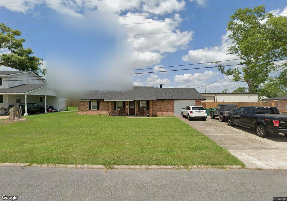
1020 Hickman St Westlake, LA 70669
Estimated Value: $154,000 - $222,000
4
Beds
3
Baths
2,150
Sq Ft
$91/Sq Ft
Est. Value
About This Home
This home is located at 1020 Hickman St, Westlake, LA 70669 and is currently estimated at $195,089, approximately $90 per square foot. 1020 Hickman St is a home located in Calcasieu Parish with nearby schools including Westwood Elementary School, Western Heights Elementary School, and S.P. Arnett Middle School.
Ownership History
Date
Name
Owned For
Owner Type
Purchase Details
Closed on
Dec 28, 2007
Sold by
Burns Derrick Larry and Burns Derrick Linda Jeanette
Bought by
Ellis Derik W and Ellis Dana M
Current Estimated Value
Home Financials for this Owner
Home Financials are based on the most recent Mortgage that was taken out on this home.
Original Mortgage
$163,706
Outstanding Balance
$103,711
Interest Rate
6.23%
Mortgage Type
FHA
Estimated Equity
$91,378
Purchase Details
Closed on
Sep 14, 2007
Sold by
Myers Shane C and Myers Heidi Nicole Borel
Bought by
Derrick Larry
Create a Home Valuation Report for This Property
The Home Valuation Report is an in-depth analysis detailing your home's value as well as a comparison with similar homes in the area
Home Values in the Area
Average Home Value in this Area
Purchase History
| Date | Buyer | Sale Price | Title Company |
|---|---|---|---|
| Ellis Derik W | $165,000 | Landmark Title Services | |
| Derrick Larry | -- | None Available |
Source: Public Records
Mortgage History
| Date | Status | Borrower | Loan Amount |
|---|---|---|---|
| Open | Ellis Derik W | $163,706 |
Source: Public Records
Tax History Compared to Growth
Tax History
| Year | Tax Paid | Tax Assessment Tax Assessment Total Assessment is a certain percentage of the fair market value that is determined by local assessors to be the total taxable value of land and additions on the property. | Land | Improvement |
|---|---|---|---|---|
| 2024 | $663 | $11,480 | $2,500 | $8,980 |
| 2023 | $663 | $11,480 | $2,500 | $8,980 |
| 2022 | $672 | $11,480 | $2,500 | $8,980 |
| 2021 | $384 | $11,480 | $2,500 | $8,980 |
| 2020 | $1,266 | $10,480 | $2,400 | $8,080 |
| 2019 | $1,249 | $9,840 | $860 | $8,980 |
| 2018 | $460 | $9,840 | $860 | $8,980 |
| 2017 | $1,213 | $9,840 | $860 | $8,980 |
| 2016 | $1,034 | $9,840 | $860 | $8,980 |
| 2015 | $1,034 | $9,840 | $860 | $8,980 |
Source: Public Records
Map
Nearby Homes
- 2210 Mccloud St
- 920 Shady Ln
- 2215 Pitre St
- 0 Bee Tree St Unit SWL25000986
- 0 John Stine Rd Unit SWL25000871
- 931 John Stine Rd
- 1036 1/2 Ann St
- 1728 Myrtle St
- 1733 Myrtle St
- 2132 Linda Dr
- 2131 Linda Dr
- 1513 Guillory St
- 822 Shady Ln
- 0 Gandy St
- 1705 Clarence St
- 1806 Gandy St
- 1929 Sikes Ave Unit n/a
- 1816 Gandy St
- 1647 Reserve Dr
- 1653 Reserve Dr
- 1022 Hickman St
- 0 Hickman St
- 1013 Garden Dr
- 1013 Garden St
- 1012 Hickman St
- 1011 Garden Dr
- 1015 Garden Dr
- 1011 Garden St
- 1024 Hickman St
- 1010 Hickman St
- 1017 Hickman St
- 1019 Hickman St
- 1013 Hickman St
- 1009 Garden Dr
- 1017 Garden Dr
- 1026 Hickman St
- 1021 Hickman St
- 1009 Hickman St
- 1007 Garden Rd
- 1007 Garden Dr