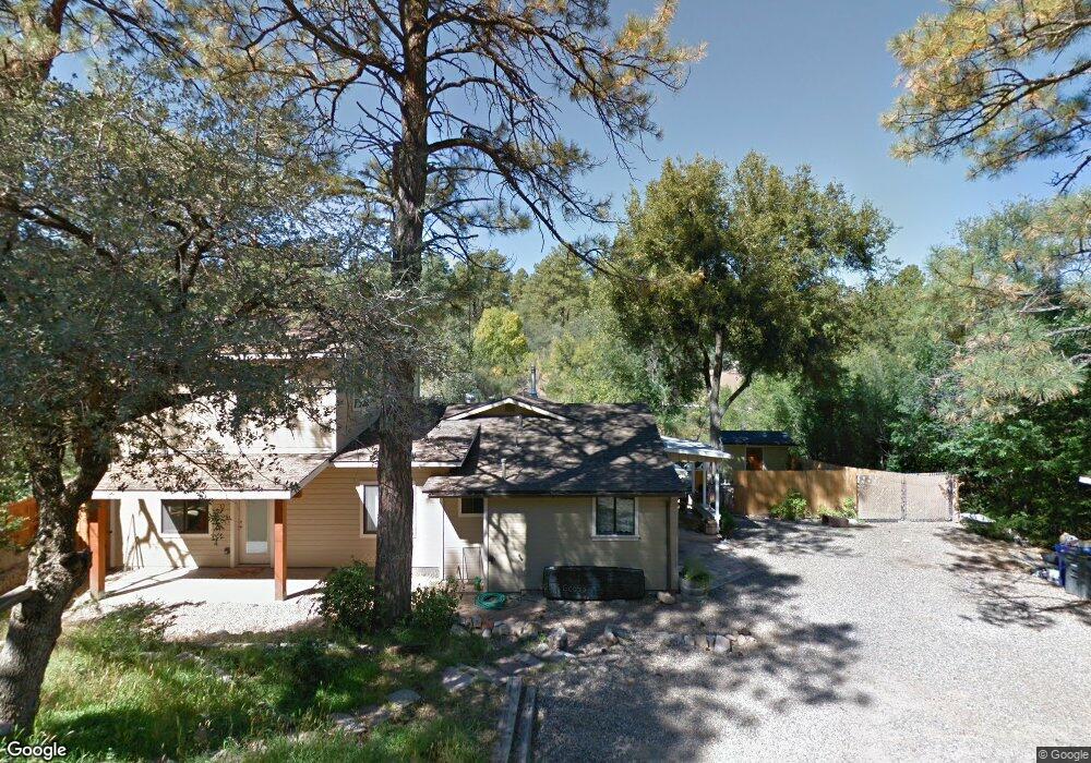
1020 Joseph St Prescott, AZ 86303
Estimated Value: $542,235 - $757,000
Studio
--
Bath
2,262
Sq Ft
$279/Sq Ft
Est. Value
About This Home
This home is located at 1020 Joseph St, Prescott, AZ 86303 and is currently estimated at $632,059, approximately $279 per square foot. 1020 Joseph St is a home located in Yavapai County with nearby schools including Lincoln Elementary School, Granite Mountain Middle School, and Prescott Mile High Middle School.
Ownership History
Date
Name
Owned For
Owner Type
Purchase Details
Closed on
Nov 21, 2009
Sold by
Olmstead Mary Elizabeth
Bought by
Olmstead Mary Elizabeth and The Olmstead Revocable Living
Current Estimated Value
Home Financials for this Owner
Home Financials are based on the most recent Mortgage that was taken out on this home.
Original Mortgage
$35,000
Interest Rate
4.83%
Mortgage Type
New Conventional
Purchase Details
Closed on
Oct 17, 2002
Sold by
Olmstead Elizabeth
Bought by
Olmstead Mary Elizabeth and Olmstead Revocable Living Trus
Purchase Details
Closed on
Apr 26, 1994
Sold by
Olmstead Robert Dean
Bought by
Olmstead M Elizabeth and Olmstead Elizabeth
Home Financials for this Owner
Home Financials are based on the most recent Mortgage that was taken out on this home.
Original Mortgage
$56,800
Interest Rate
7.79%
Create a Home Valuation Report for This Property
The Home Valuation Report is an in-depth analysis detailing your home's value as well as a comparison with similar homes in the area
Purchase History
| Date | Buyer | Sale Price | Title Company |
|---|---|---|---|
| Olmstead Mary Elizabeth | -- | Accommodation | |
| Olmstead Mary Elizabeth | -- | Pioneer Title Agency Inc | |
| Olmstead Mary Elizabeth | -- | -- | |
| Olmstead M Elizabeth | -- | Transamerica Title Ins Co |
Source: Public Records
Mortgage History
| Date | Status | Borrower | Loan Amount |
|---|---|---|---|
| Closed | Olmstead Mary Elizabeth | $35,000 | |
| Closed | Olmstead M Elizabeth | $56,800 | |
| Closed | Olmstead M Elizabeth | $10,000 |
Source: Public Records
Tax History
| Year | Tax Paid | Tax Assessment Tax Assessment Total Assessment is a certain percentage of the fair market value that is determined by local assessors to be the total taxable value of land and additions on the property. | Land | Improvement |
|---|---|---|---|---|
| 2026 | $1,894 | $50,564 | -- | -- |
| 2024 | $1,856 | $50,571 | -- | -- |
| 2023 | $1,856 | $41,974 | $0 | $0 |
| 2022 | $1,819 | $34,614 | $5,574 | $29,040 |
| 2021 | $1,896 | $34,432 | $4,841 | $29,591 |
| 2020 | $1,899 | $0 | $0 | $0 |
| 2019 | $977 | $0 | $0 | $0 |
| 2018 | $943 | $0 | $0 | $0 |
| 2017 | $899 | $0 | $0 | $0 |
| 2016 | $905 | $0 | $0 | $0 |
| 2015 | -- | $0 | $0 | $0 |
| 2014 | -- | $0 | $0 | $0 |
Source: Public Records
Map
Nearby Homes
- 1033 Lucerne Dr
- 1101 White Spar Rd
- 1101 White Spar Rd
- 625 Aspen Way
- 627 W Maricopa Dr
- 910 Old Stage Rd Unit 4B
- 700 White Spar Rd Unit 50
- 719 Pima Rd
- 235 Solar Heights Terrace
- 847 W Clubhouse Dr
- 639 Tiburon Dr
- 1101 S Milton Ave
- 734 E Pine Knoll Dr
- 509 Copper Basin Rd
- 881 Alpha Ln
- 881 Alpha Ln Unit 1
- 829 Alpha Ln Unit 13
- 285 Crestwood E
- 510 Copper Basin Rd Unit 100
- 510 Copper Basin Rd Unit 88
- 1024 Joseph St
- 1026 Joseph St
- 1010 Joseph St
- 1019 S Apache Dr
- 1019 S Apache Dr Unit 1
- 1021 S Apache Dr
- 1009 Joseph St
- 1013 S Apache Dr
- 1027 S Apache Dr
- 1012 S Apache Dr
- 1016 S Apache Dr
- 1014 S Apache
- 1030 S Apache Dr
- 1020 S Apache Dr
- 1080 White Spar Rd
- 0 Clubhouse Dr Unit PAR407955
- 0 Clubhouse Dr Unit PAR891734
- 0 Clubhouse Dr Unit PAR891733
- 0 Clubhouse Dr Unit 928925
- 1000 S Apache Dr
Your Personal Tour Guide
Ask me questions while you tour the home.