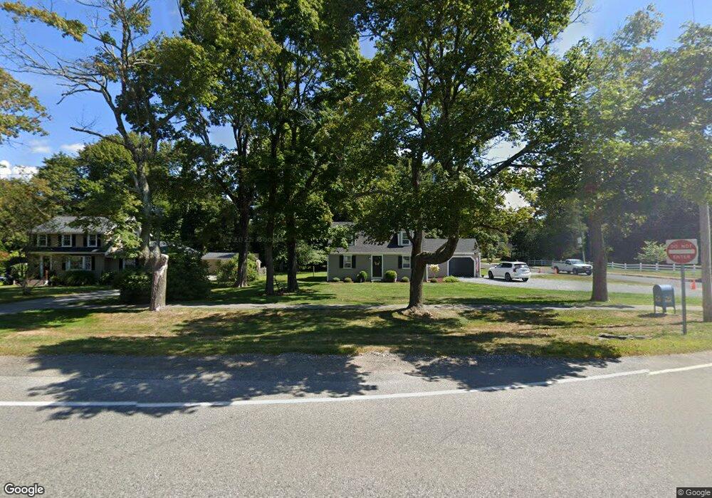
1020 Main St Hingham, MA 02043
South Hingham NeighborhoodEstimated Value: $949,000 - $1,028,000
4
Beds
2
Baths
1,718
Sq Ft
$576/Sq Ft
Est. Value
About This Home
This home is located at 1020 Main St, Hingham, MA 02043 and is currently estimated at $989,702, approximately $576 per square foot. 1020 Main St is a home located in Plymouth County with nearby schools including South Elementary School, Hingham Middle School, and Hingham High School.
Ownership History
Date
Name
Owned For
Owner Type
Purchase Details
Closed on
Mar 7, 2025
Sold by
Associate Solutions Llc
Bought by
Miller Bryan and Miller Kathryn
Current Estimated Value
Home Financials for this Owner
Home Financials are based on the most recent Mortgage that was taken out on this home.
Original Mortgage
$764,000
Outstanding Balance
$757,521
Interest Rate
6.96%
Mortgage Type
Purchase Money Mortgage
Estimated Equity
$232,181
Purchase Details
Closed on
Oct 28, 2024
Sold by
Cela Anton
Bought by
Associate Solutions Llc
Home Financials for this Owner
Home Financials are based on the most recent Mortgage that was taken out on this home.
Original Mortgage
$725,000
Interest Rate
6.2%
Mortgage Type
Purchase Money Mortgage
Purchase Details
Closed on
Aug 4, 2020
Sold by
Wells Fargo Bank Na Tr
Bought by
Cela Anton
Purchase Details
Closed on
Oct 1, 2018
Sold by
Dunphy Robert B and Wells Fargo Bank Na
Bought by
Wells Fargo Bank Na Tr
Purchase Details
Closed on
Dec 15, 2003
Sold by
Mcnerney Gerald F and Mcnerney Maureen P
Bought by
Dunphy Robert B
Purchase Details
Closed on
Oct 1, 1999
Sold by
Brennan Robert J and Brennan Maya C
Bought by
Mcnerney Gerald F and Mcnerney Maureen P
Create a Home Valuation Report for This Property
The Home Valuation Report is an in-depth analysis detailing your home's value as well as a comparison with similar homes in the area
Home Values in the Area
Average Home Value in this Area
Purchase History
| Date | Buyer | Sale Price | Title Company |
|---|---|---|---|
| Miller Bryan | $955,000 | None Available | |
| Miller Bryan | $955,000 | None Available | |
| Associate Solutions Llc | $600,000 | None Available | |
| Associate Solutions Llc | $600,000 | None Available | |
| Associate Solutions Llc | $600,000 | None Available | |
| Cela Anton | $488,000 | None Available | |
| Cela Anton | $488,000 | None Available | |
| Cela Anton | $488,000 | None Available | |
| Wells Fargo Bank Na Tr | $538,900 | -- | |
| Wells Fargo Bank Na Tr | $538,900 | -- | |
| Dunphy Robert B | $520,000 | -- | |
| Mcnerney Gerald F | $340,000 | -- | |
| Wells Fargo Bank Na Tr | $538,900 | -- | |
| Dunphy Robert B | $520,000 | -- | |
| Mcnerney Gerald F | $340,000 | -- |
Source: Public Records
Mortgage History
| Date | Status | Borrower | Loan Amount |
|---|---|---|---|
| Open | Miller Bryan | $764,000 | |
| Closed | Miller Bryan | $764,000 | |
| Previous Owner | Associate Solutions Llc | $725,000 | |
| Previous Owner | Mcnerney Gerald F | $511,200 |
Source: Public Records
Tax History
| Year | Tax Paid | Tax Assessment Tax Assessment Total Assessment is a certain percentage of the fair market value that is determined by local assessors to be the total taxable value of land and additions on the property. | Land | Improvement |
|---|---|---|---|---|
| 2025 | $9,028 | $844,500 | $467,100 | $377,400 |
| 2024 | $8,707 | $802,500 | $467,100 | $335,400 |
| 2023 | $7,569 | $756,900 | $467,100 | $289,800 |
| 2022 | $7,252 | $627,300 | $389,300 | $238,000 |
| 2021 | $7,183 | $608,700 | $389,300 | $219,400 |
| 2020 | $6,910 | $599,300 | $389,300 | $210,000 |
| 2019 | $6,912 | $585,300 | $389,300 | $196,000 |
| 2018 | $6,889 | $585,300 | $389,300 | $196,000 |
| 2017 | $6,842 | $558,500 | $380,600 | $177,900 |
| 2016 | $6,750 | $540,400 | $362,500 | $177,900 |
| 2015 | $6,556 | $523,200 | $345,300 | $177,900 |
Source: Public Records
Map
Nearby Homes
- 22 Longmeadow Rd
- 1 Kerri Ln
- 4 Kerri Ln
- 9 Mast Hill Rd
- 183 Gardner St
- 5 Old County Rd
- 100 Whiting St
- 18 Whiting Ln
- 17 Pine Haven Cir
- 214 Washington St Unit 24
- 214 Washington St Unit 28
- 2 Black Rock Dr Unit 21
- 2 Black Rock Dr
- 32-70 Lazell St
- 251 Prospect St
- 18 Colby St
- 70 Lazell St
- 5 Blueberry Ct
- 55 Turner Rd
- 8 Blueberry Ct
Your Personal Tour Guide
Ask me questions while you tour the home.