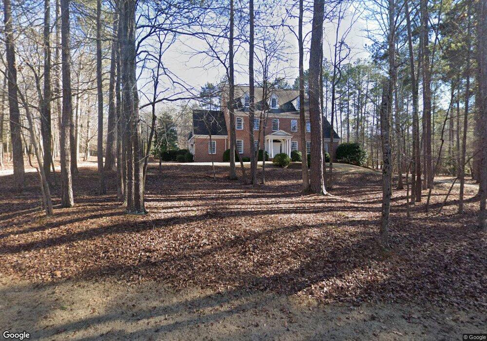
1020 Maple Ct Athens, GA 30606
Skyline NeighborhoodEstimated Value: $898,000 - $1,613,000
--
Bed
--
Bath
5,739
Sq Ft
$201/Sq Ft
Est. Value
About This Home
This home is located at 1020 Maple Ct, Athens, GA 30606 and is currently estimated at $1,155,189, approximately $201 per square foot. 1020 Maple Ct is a home located in Oconee County with nearby schools including Oconee County Primary School, Oconee County Elementary School, and Malcom Bridge Middle School.
Ownership History
Date
Name
Owned For
Owner Type
Purchase Details
Closed on
Feb 6, 2015
Sold by
Cobb Thomas J
Bought by
Cobb Thomas J and Cobb Karen B
Current Estimated Value
Home Financials for this Owner
Home Financials are based on the most recent Mortgage that was taken out on this home.
Original Mortgage
$468,000
Outstanding Balance
$264,502
Interest Rate
3.81%
Mortgage Type
New Conventional
Estimated Equity
$890,687
Purchase Details
Closed on
Feb 8, 2000
Sold by
Thomas Pearline Y
Bought by
Cobb Thomas J
Purchase Details
Closed on
Dec 29, 1999
Sold by
Elkins Robert N
Bought by
Thomas Pearline Y
Purchase Details
Closed on
Apr 7, 1994
Sold by
Thomas Pearline Y
Bought by
Elkins Robert N
Purchase Details
Closed on
Feb 3, 1994
Bought by
Thomas Pearline Y
Create a Home Valuation Report for This Property
The Home Valuation Report is an in-depth analysis detailing your home's value as well as a comparison with similar homes in the area
Home Values in the Area
Average Home Value in this Area
Purchase History
| Date | Buyer | Sale Price | Title Company |
|---|---|---|---|
| Cobb Thomas J | -- | -- | |
| Cobb Thomas J | $70,000 | -- | |
| Thomas Pearline Y | $48,000 | -- | |
| Elkins Robert N | $48,000 | -- | |
| Thomas Pearline Y | $38,000 | -- |
Source: Public Records
Mortgage History
| Date | Status | Borrower | Loan Amount |
|---|---|---|---|
| Open | Cobb Thomas J | $468,000 |
Source: Public Records
Tax History Compared to Growth
Tax History
| Year | Tax Paid | Tax Assessment Tax Assessment Total Assessment is a certain percentage of the fair market value that is determined by local assessors to be the total taxable value of land and additions on the property. | Land | Improvement |
|---|---|---|---|---|
| 2024 | $7,415 | $414,549 | $39,600 | $374,949 |
| 2023 | $7,771 | $396,140 | $39,600 | $356,540 |
| 2022 | $7,621 | $354,330 | $39,600 | $314,730 |
| 2021 | $7,577 | $326,588 | $39,600 | $286,988 |
| 2020 | $7,479 | $321,858 | $39,600 | $282,258 |
| 2019 | $7,231 | $311,184 | $39,600 | $271,584 |
| 2018 | $7,194 | $303,091 | $39,600 | $263,491 |
| 2017 | $7,194 | $303,091 | $39,600 | $263,491 |
| 2016 | $7,166 | $301,926 | $39,600 | $262,326 |
| 2015 | $6,662 | $280,161 | $39,600 | $240,561 |
| 2014 | $6,077 | $249,760 | $39,600 | $210,160 |
| 2013 | -- | $264,624 | $44,000 | $220,624 |
Source: Public Records
Map
Nearby Homes
- 1340 Old Epps Bridge Rd
- 137 Timothy Park Ln
- 136 Timothy Park Ln
- 190 Kirkwood Dr
- 140 Cypress Manor Ln
- 1050 Chestnut Glen
- 1720 Timothy Rd
- 165 Canterbury Dr
- 145 Holly Falls Dr
- 1771 Timothy Rd
- 1010 Springview Ct
- 461 Oglethorpe Ave
- 1845 Olympus Ct
- 1847 Olympus Ct
- 1842 Olympus Ct
- 101 Wood Lake Dr Unit 307
- 132 Branford Place
- 780 Kings Rd
- 114 Telfair Place
- 0 Maple Ct
- 1010 Laurel Place
- 1021 Laurel Place
- 1021 Maple Ct
- 1041 Laurel Place
- 1061 Laurel Place
- 1040 Maple Ct
- 1320 Tanglebrook Dr
- 0 Tanglebrook Dr Unit 7300908
- 0 Tanglebrook Dr Unit 7147853
- 0 Tanglebrook Dr Unit 7093515
- 0 Tanglebrook Dr Unit 8354327
- 0 Tanglebrook Dr Unit 8325820
- 0 Tanglebrook Dr Unit 8318170
- 0 Tanglebrook Dr Unit 8616068
- 0 Tanglebrook Dr Unit 8371805
- 0 Tanglebrook Dr Unit 8189588
- 0 Tanglebrook Dr Unit 7500849
- 0 Tanglebrook Dr Unit 7249448
- 0 Tanglebrook Dr Unit 7223566