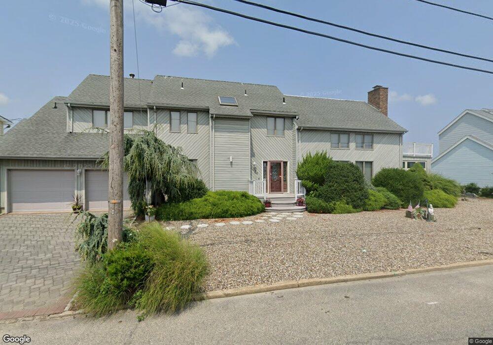
1020 Montauk Dr Forked River, NJ 08731
Lacey Township NeighborhoodEstimated Value: $851,281 - $1,178,000
5
Beds
4
Baths
2,715
Sq Ft
$364/Sq Ft
Est. Value
About This Home
This home is located at 1020 Montauk Dr, Forked River, NJ 08731 and is currently estimated at $988,070, approximately $363 per square foot. 1020 Montauk Dr is a home located in Ocean County with nearby schools including Lacey Township High School.
Ownership History
Date
Name
Owned For
Owner Type
Purchase Details
Closed on
Nov 13, 2019
Sold by
Cardaci Edith and Cardaci Philip Personal Reside
Bought by
Shelley Diane M and Cardaci Michael P
Current Estimated Value
Purchase Details
Closed on
Dec 22, 1998
Sold by
Cardaci Philip
Bought by
Reside Philip Cardaci Qualified Personal
Purchase Details
Closed on
Sep 30, 1993
Sold by
Schaeberle Robert
Bought by
Cardac Philip and Cardac Edith
Create a Home Valuation Report for This Property
The Home Valuation Report is an in-depth analysis detailing your home's value as well as a comparison with similar homes in the area
Home Values in the Area
Average Home Value in this Area
Purchase History
| Date | Buyer | Sale Price | Title Company |
|---|---|---|---|
| Shelley Diane M | -- | None Available | |
| Shelley Diane M | -- | None Available | |
| Reside Philip Cardaci Qualified Personal | -- | -- | |
| Residen Edith Cardaci Qualified Personal | -- | -- | |
| Cardaci Philip | -- | -- | |
| Cardac Philip | $287,000 | -- |
Source: Public Records
Tax History Compared to Growth
Tax History
| Year | Tax Paid | Tax Assessment Tax Assessment Total Assessment is a certain percentage of the fair market value that is determined by local assessors to be the total taxable value of land and additions on the property. | Land | Improvement |
|---|---|---|---|---|
| 2025 | $12,642 | $498,900 | $239,000 | $259,900 |
| 2024 | $11,819 | $498,900 | $239,000 | $259,900 |
| 2023 | $11,290 | $498,900 | $239,000 | $259,900 |
| 2022 | $11,290 | $498,900 | $239,000 | $259,900 |
| 2021 | $11,101 | $498,900 | $239,000 | $259,900 |
| 2020 | $10,746 | $498,900 | $239,000 | $259,900 |
| 2019 | $10,557 | $498,900 | $239,000 | $259,900 |
| 2018 | $10,432 | $498,900 | $239,000 | $259,900 |
| 2017 | $10,193 | $498,900 | $239,000 | $259,900 |
| 2016 | $10,153 | $498,900 | $239,000 | $259,900 |
| 2015 | $9,699 | $498,900 | $239,000 | $259,900 |
| 2014 | $9,890 | $575,000 | $359,000 | $216,000 |
Source: Public Records
Map
Nearby Homes
- 1011 Neosho Dr
- 813 Tiller Dr
- 823 Forepeak Dr
- 709 Richmond Dr
- 836 Spar Dr
- 814 Ensign Dr
- 607 Ranger Dr
- 877 Sunrise Blvd
- 416 Irons St
- 308 Pine Forest Ln
- 318 Riviera Dr
- 107 Fernwood Ln
- 507 Laurelwood Dr
- 111 Greenwood Ln
- 119 Driftwood Ln
- 320 Cedar Dr
- 502 Teakwood Dr
- 207 Sunset Dr
- 905 Bowsprit Point
- 202 Cedar Dr
- 1018 Montauk Dr
- 1022 Montauk Dr
- 1017 Montauk Dr
- 0 Montauk Dr Unit 22003210
- 0 Montauk Dr
- 1016 Montauk Dr
- 1018 Osage Dr
- 1015 Montauk Dr
- 1024 Montauk Dr
- 1012 Montauk Dr
- 1010 Montauk Dr
- 1011 Montauk Dr
- 1017 Osage Dr
- 1008 Montauk Dr
- 1026 Montauk Dr
- 1009 Montauk Dr
- 1001 Osage Dr
- 1006 Montauk Dr
- 1016 Osage Dr
- 1002 Osage Dr