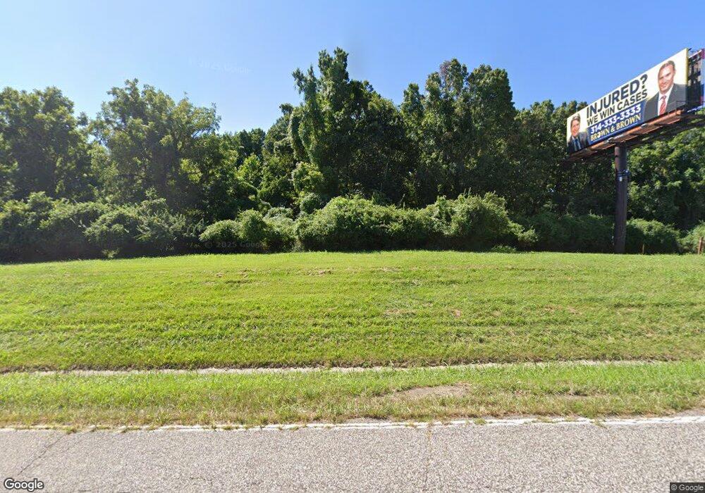
1020 Pershall Rd Saint Louis, MO 63137
--
Bed
--
Bath
--
Sq Ft
15.53
Acres
About This Home
This home is located at 1020 Pershall Rd, Saint Louis, MO 63137. 1020 Pershall Rd is a home located in St. Louis County with nearby schools including Larimore Elementary School, Southeast Middle School, and Hazelwood East High School.
Ownership History
Date
Name
Owned For
Owner Type
Purchase Details
Closed on
Jul 21, 2025
Sold by
Collector Of Revenue
Bought by
1020 Pershall Llc
Purchase Details
Closed on
Mar 1, 2009
Sold by
J W Realty L L C
Bought by
Temple Of Praise Church
Purchase Details
Closed on
Aug 2, 2002
Sold by
Project Lilac and Project Kenran
Bought by
Jw Realty Llc
Home Financials for this Owner
Home Financials are based on the most recent Mortgage that was taken out on this home.
Original Mortgage
$505,020
Interest Rate
6.6%
Mortgage Type
Credit Line Revolving
Create a Home Valuation Report for This Property
The Home Valuation Report is an in-depth analysis detailing your home's value as well as a comparison with similar homes in the area
Home Values in the Area
Average Home Value in this Area
Purchase History
| Date | Buyer | Sale Price | Title Company |
|---|---|---|---|
| 1020 Pershall Llc | $3,000 | None Listed On Document | |
| Temple Of Praise Church | -- | None Available | |
| Jw Realty Llc | -- | -- |
Source: Public Records
Mortgage History
| Date | Status | Borrower | Loan Amount |
|---|---|---|---|
| Previous Owner | Jw Realty Llc | $505,020 |
Source: Public Records
Tax History Compared to Growth
Tax History
| Year | Tax Paid | Tax Assessment Tax Assessment Total Assessment is a certain percentage of the fair market value that is determined by local assessors to be the total taxable value of land and additions on the property. | Land | Improvement |
|---|---|---|---|---|
| 2025 | $20,894 | $162,400 | $162,400 | -- |
| 2024 | $20,894 | $162,400 | $162,400 | -- |
| 2023 | $20,880 | $162,400 | $162,400 | $0 |
| 2022 | $22,337 | $162,400 | $162,400 | $0 |
| 2021 | $21,716 | $162,400 | $162,400 | $0 |
| 2020 | $26,941 | $194,880 | $194,880 | $0 |
| 2019 | $25,931 | $194,880 | $194,880 | $0 |
| 2018 | $27,001 | $194,880 | $194,880 | $0 |
| 2017 | $26,067 | $194,880 | $194,880 | $0 |
| 2016 | $26,262 | $194,880 | $194,880 | $0 |
| 2015 | $26,015 | $194,880 | $194,880 | $0 |
| 2014 | -- | $194,880 | $194,880 | $0 |
Source: Public Records
Map
Nearby Homes
- 1050 Fry #B Ln
- 10940 John James Dr
- 147 Monteith Cir
- 151 Brigadoon Cir
- 277 Roderick Dr
- 10602 Moidart Cir
- 10617 Dunkeld Cir
- 10655 Glen Garry Rd
- 248 Perthshire Rd
- 209 Grampian Rd
- 205 Grampian Rd
- 10632 Glen Garry Rd
- 211 Perthshire Rd
- 324 Shepley Dr
- 10601 Spring Garden Dr
- 10624 Spring Garden Dr
- 329 Midlothian Rd
- 252 Midlothian Rd
- 204 Tay Rd
- 224 Tay Rd
- 1056 Fry Ln
- 1054 Fry Ln
- 1041 Fry Ln
- 1005 Fry Ln
- 1044 Pershall Rd
- 1030 Fry Ln
- 1023 Fry Ln
- 1050 Fry Ln
- 11011 Huson Valley Dr
- 1000 Fry Ln
- 1420 Byrd Manor Ln
- 1416 Byrd Manor Ln
- 11011 Mollerus Dr
- 1437 Byrd Manor Ln
- 1441 Byrd Manor Ln
- 1441Lot 59A Byrd Ln
- 909 Dunn Rd
- 11303 Dunn View Dr
- 10953 John James (Lot 3a) Dr
- 11043 Mollerus Dr
