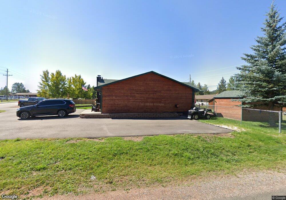
1020 Rampart Range Rd Woodland Park, CO 80863
Estimated Value: $446,493 - $476,000
3
Beds
2
Baths
1,744
Sq Ft
$264/Sq Ft
Est. Value
About This Home
This home is located at 1020 Rampart Range Rd, Woodland Park, CO 80863 and is currently estimated at $459,873, approximately $263 per square foot. 1020 Rampart Range Rd is a home located in Teller County with nearby schools including Merit Academy, Woodland Park Junior/Senior High School, and Colorado Springs Christian School.
Ownership History
Date
Name
Owned For
Owner Type
Purchase Details
Closed on
Jul 28, 2017
Sold by
Tindall John W and Tindall Linda M
Bought by
Hardcastle Paul and Hardcastle Christina M
Current Estimated Value
Home Financials for this Owner
Home Financials are based on the most recent Mortgage that was taken out on this home.
Original Mortgage
$212,087
Outstanding Balance
$176,731
Interest Rate
3.91%
Mortgage Type
New Conventional
Estimated Equity
$283,142
Purchase Details
Closed on
Nov 30, 2004
Sold by
Lile Michael W and Lile Karen E
Bought by
Tindall Jon W and Tindall Linda M
Create a Home Valuation Report for This Property
The Home Valuation Report is an in-depth analysis detailing your home's value as well as a comparison with similar homes in the area
Home Values in the Area
Average Home Value in this Area
Purchase History
| Date | Buyer | Sale Price | Title Company |
|---|---|---|---|
| Hardcastle Paul | $216,000 | Empire Title Co Springs Llc | |
| Tindall Jon W | $146,000 | Security Title |
Source: Public Records
Mortgage History
| Date | Status | Borrower | Loan Amount |
|---|---|---|---|
| Open | Hardcastle Paul | $212,087 |
Source: Public Records
Tax History Compared to Growth
Tax History
| Year | Tax Paid | Tax Assessment Tax Assessment Total Assessment is a certain percentage of the fair market value that is determined by local assessors to be the total taxable value of land and additions on the property. | Land | Improvement |
|---|---|---|---|---|
| 2024 | $2,057 | $26,000 | $4,553 | $21,447 |
| 2023 | $2,057 | $26,000 | $4,550 | $21,450 |
| 2022 | $1,741 | $21,460 | $3,350 | $18,110 |
| 2021 | $1,782 | $22,070 | $3,440 | $18,630 |
| 2020 | $1,459 | $18,500 | $2,540 | $15,960 |
| 2019 | $1,450 | $18,500 | $0 | $0 |
| 2018 | $1,206 | $15,060 | $0 | $0 |
| 2017 | $1,208 | $15,060 | $0 | $0 |
| 2016 | $1,048 | $13,020 | $0 | $0 |
| 2015 | $1,137 | $13,020 | $0 | $0 |
| 2014 | $1,148 | $13,020 | $0 | $0 |
Source: Public Records
Map
Nearby Homes
- 1013 Fullview St
- 920 Forest Edge Rd
- 1230 Cottontail Trail
- 620 Chipmunk Dr
- 1051 Forest Hill Rd
- 10 Ollie Ct
- TBD Rolling Park Dr
- 418 N Baldwin St
- 1157 Forest Edge Rd
- 1005 Mountain View Rd
- 840 E Kellys Rd
- 940 E Kelleys Rd
- 401 Forest Edge Rd Unit B8
- 303 E Lake Ave
- 205 N Laurel St
- 1320 Forest Edge Rd
- 222 N Laurel St Unit E
- 401 E Midland Ave
- 300 W Kelly Rd
- 201 S Boundary St
- 1014 Rampart Range Rd
- 1021 Fullview St
- 710 N Park Dr
- 1006 Rampart Range Rd
- 704 N Park Dr
- 1005 Fullview St
- 787 Westwood Trace
- 785 Westwood Trace
- 1020 Fullview St
- 783 Westwood Trace
- 1010 Fullview St
- 781 Westwood Trace
- 614 N Park Dr
- 918 Rampart Range Rd
- 919 Fullview St
- 1000 Fullview St
- 786 Westwood Trace
- 610 N Park Dr
- 784 Westwood Trace
- 1021 N Baldwin St