B
Seller's Agent in 2013
Barbara Lawson
Century 21 KIMA Properties
Estimated Value: $126,851 - $148,000
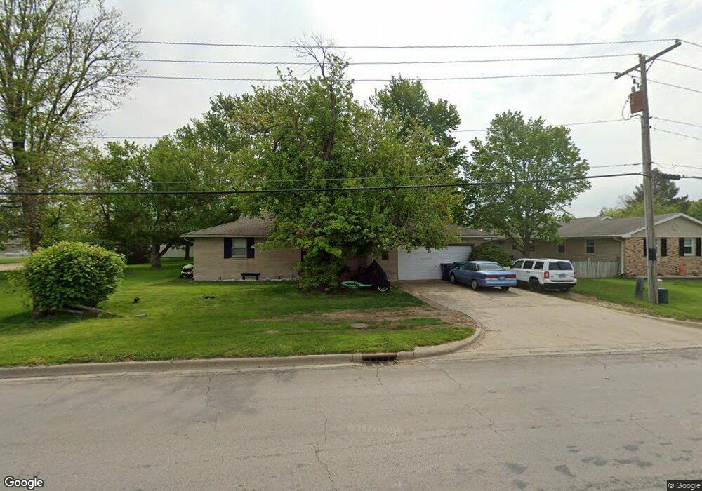
Affordable three bedroom, 1 1/2 bath ranch on the east side of Mattoon. Covered patio, fenced yard back yard and two car garage. Needs some tlc. Being sold "as is".
Last Agent to Sell the Property
Barbara Lawson
Century 21 KIMA Properties License #475126660 Listed on: 08/08/2013

| Date | Buyer | Sale Price | Title Company |
|---|---|---|---|
| Cavazos Rebecca R | -- | None Available | |
| Cavazos Alberto G | $66,000 | -- |
| Date | Status | Borrower | Loan Amount |
|---|---|---|---|
| Open | Cavazos Rebecca R | $70,000 | |
| Closed | Cavazos Alberto G | $76,000 |
| Date | Event | Price | List to Sale | Price per Sq Ft |
|---|---|---|---|---|
| 10/08/2013 10/08/13 | Sold | $66,000 | 0.0% | $48 / Sq Ft |
| 08/30/2013 08/30/13 | Pending | -- | -- | -- |
| 08/08/2013 08/08/13 | For Sale | $66,000 | -- | $48 / Sq Ft |
| Year | Tax Paid | Tax Assessment Tax Assessment Total Assessment is a certain percentage of the fair market value that is determined by local assessors to be the total taxable value of land and additions on the property. | Land | Improvement |
|---|---|---|---|---|
| 2024 | $2,905 | $34,186 | $3,172 | $31,014 |
| 2023 | $2,699 | $30,523 | $2,832 | $27,691 |
| 2022 | $2,626 | $30,018 | $2,785 | $27,233 |
| 2021 | $2,633 | $27,572 | $5,226 | $22,346 |
| 2020 | $2,605 | $28,568 | $5,415 | $23,153 |
| 2019 | $2,563 | $27,572 | $5,226 | $22,346 |
| 2018 | $2,520 | $27,572 | $5,226 | $22,346 |
| 2017 | $2,512 | $27,572 | $5,226 | $22,346 |
| 2016 | $2,460 | $27,572 | $5,226 | $22,346 |
| 2015 | $704 | $27,572 | $5,226 | $22,346 |
| 2014 | $704 | $27,572 | $5,226 | $22,346 |
| 2013 | $704 | $27,572 | $5,226 | $22,346 |
B
Seller's Agent in 2013
Barbara Lawson
Century 21 KIMA Properties
C
Buyer's Agent in 2013
Cory Sanders
Sanders & Company
(217) 235-4848
58 in this area
148 Total Sales
Source: Central Illinois Board of REALTORS®
MLS Number: 4219336
APN: 07-2-13727-000