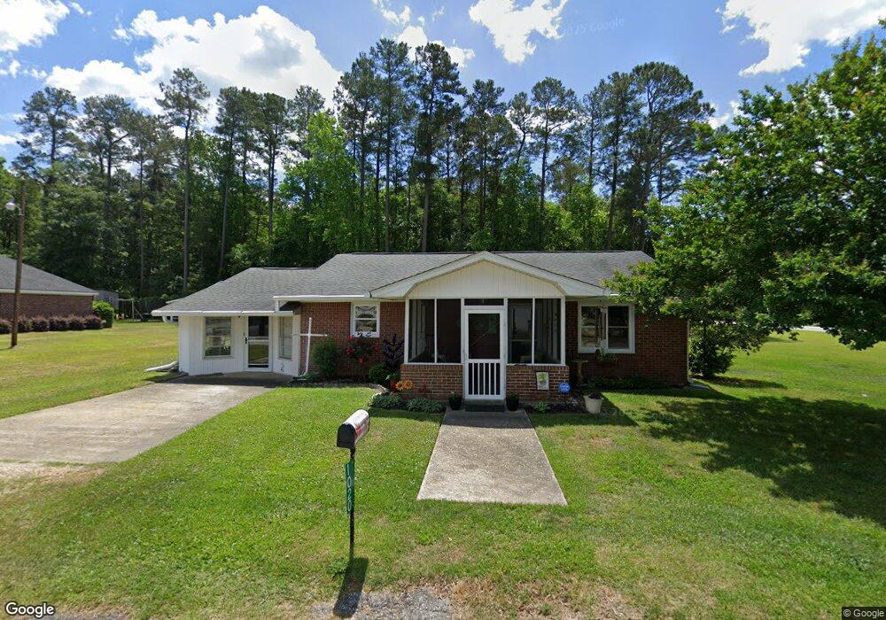
1020 Saint Matthews Ln Manning, SC 29102
Estimated Value: $162,000 - $423,000
Studio
--
Bath
1,617
Sq Ft
$162/Sq Ft
Est. Value
About This Home
This home is located at 1020 Saint Matthews Ln, Manning, SC 29102 and is currently estimated at $262,116, approximately $162 per square foot. 1020 Saint Matthews Ln is a home.
Ownership History
Date
Name
Owned For
Owner Type
Purchase Details
Closed on
Oct 24, 2019
Sold by
Ducan Claudia
Bought by
Claudia Marie Ducan Ret
Current Estimated Value
Purchase Details
Closed on
Feb 27, 2006
Sold by
Ubben Verna L
Bought by
Duncan David and Duncan Claudia
Home Financials for this Owner
Home Financials are based on the most recent Mortgage that was taken out on this home.
Original Mortgage
$65,440
Interest Rate
6.04%
Mortgage Type
New Conventional
Create a Home Valuation Report for This Property
The Home Valuation Report is an in-depth analysis detailing your home's value as well as a comparison with similar homes in the area
Home Values in the Area
Average Home Value in this Area
Purchase History
We collect this data history from publicly available records. To have your information removed, we recommend requesting removal directly through your county’s website.
| Date | Buyer | Sale Price | Title Company |
|---|---|---|---|
| Claudia Marie Ducan Ret | -- | -- | |
| Duncan David | $81,800 | None Available |
Source: Public Records
Mortgage History
We collect this data history from publicly available records. To have your information removed, we recommend requesting removal directly through your county’s website.
| Date | Status | Borrower | Loan Amount |
|---|---|---|---|
| Previous Owner | Duncan David | $65,440 |
Source: Public Records
Tax History
| Year | Tax Paid | Tax Assessment Tax Assessment Total Assessment is a certain percentage of the fair market value that is determined by local assessors to be the total taxable value of land and additions on the property. | Land | Improvement |
|---|---|---|---|---|
| 2025 | $572 | $4,612 | $880 | $3,732 |
| 2024 | $572 | $4,612 | $880 | $3,732 |
| 2023 | $562 | $4,612 | $880 | $3,732 |
| 2022 | $936 | $4,612 | $880 | $3,732 |
| 2021 | $820 | $4,301 | $831 | $3,470 |
| 2020 | $820 | $4,552 | $880 | $3,672 |
| 2019 | $760 | $4,552 | $880 | $3,672 |
| 2018 | $714 | $4,301 | $0 | $0 |
| 2017 | $681 | $4,101 | $0 | $0 |
| 2016 | $659 | $4,101 | $0 | $0 |
| 2015 | $610 | $3,740 | $880 | $2,860 |
| 2014 | $600 | $3,740 | $880 | $2,860 |
| 2013 | -- | $3,740 | $880 | $2,860 |
Source: Public Records
Map
Nearby Homes
- 1386 Forest Lake Dr
- 2112 Lake Shore Dr
- 2222 Lakeshore Dr
- 1408 Deercreek Dr
- 2193 Lakeshore Dr
- 1317 Lakeview Dr
- 1284 Pocahontas Cir
- 10841 S Carolina 260 Unit 1+2
- 10841 Hwy 260 Unit 1 & 2
- 10841 Hwy 260
- 1665 Lakeshore Dr
- 1057 Limerick Ln
- 1156 W A Gamble Rd
- 25 Plantation Dr
- 29 Plantation Dr
- 1677 Clearview Dr
- 108 Plantation Dr
- 1341 Winding Pond Rd
- 152 Plantation Dr
- 42 N Lake Cir
- 1042 Saint Matthews Ln
- 1091 Saint Matthews Ln
- 1049 Forest Lake Dr
- 1092 Saint Matthews Ln
- 10133 Hwy 260
- 1006 Forest Lake Dr
- 1032 Forest Lake Dr
- 1020 Forest Lake Dr
- 1046 Forest Lake Dr
- Lot # 31 Saint Matthews Ln
- 0 Saint Matthews Ln
- 1090 Herring Dr
- 1089 Forest Lake Dr
- 10256 Hwy 260
- 10273 Hwy 260
- 1060 Forest Lake Dr
- 1072 Forest Lake Dr
- 1111 Forest Lake Dr
- 1096 Forest Lake Dr
- 1133 Forest Lake Dr
Your Personal Tour Guide
Ask me questions while you tour the home.