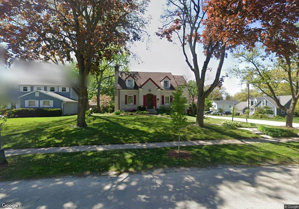
1020 Stoddard Ave Wheaton, IL 60187
Hawthorne NeighborhoodEstimated Value: $537,788 - $764,000
Studio
1
Bath
1,993
Sq Ft
$323/Sq Ft
Est. Value
About This Home
This home is located at 1020 Stoddard Ave, Wheaton, IL 60187 and is currently estimated at $642,947, approximately $322 per square foot. 1020 Stoddard Ave is a home located in DuPage County with nearby schools including Washington Elementary School, Franklin Middle School, and Wheaton North High School.
Ownership History
Date
Name
Owned For
Owner Type
Purchase Details
Closed on
Feb 25, 2014
Sold by
Hall Drostan and Hall Hal Dorothy
Bought by
Hall Drostan and Hall Ariane
Current Estimated Value
Home Financials for this Owner
Home Financials are based on the most recent Mortgage that was taken out on this home.
Original Mortgage
$336,000
Outstanding Balance
$257,357
Interest Rate
4.62%
Mortgage Type
New Conventional
Estimated Equity
$385,590
Purchase Details
Closed on
Sep 28, 2000
Sold by
Meyer Julie J
Bought by
Hall Drostan and Hall Dorothy
Home Financials for this Owner
Home Financials are based on the most recent Mortgage that was taken out on this home.
Original Mortgage
$284,000
Interest Rate
8.03%
Purchase Details
Closed on
Jul 22, 1999
Sold by
Allen Wayne Edward
Bought by
Meyer Julie J
Purchase Details
Closed on
Sep 1, 1998
Sold by
Kole Marc M and Kole Colleen M
Bought by
Allen Wayne Edward and Meyer Julie J
Home Financials for this Owner
Home Financials are based on the most recent Mortgage that was taken out on this home.
Original Mortgage
$263,500
Interest Rate
5.75%
Purchase Details
Closed on
Aug 25, 1994
Sold by
Wechter Byron D and Wechter Mary A
Bought by
Kole Marc M and Kole Colleen M
Create a Home Valuation Report for This Property
The Home Valuation Report is an in-depth analysis detailing your home's value as well as a comparison with similar homes in the area
Home Values in the Area
Average Home Value in this Area
Purchase History
| Date | Buyer | Sale Price | Title Company |
|---|---|---|---|
| Hall Drostan | -- | Executive Land Title | |
| Hall Drostan | $355,000 | -- | |
| Meyer Julie J | -- | -- | |
| Allen Wayne Edward | $310,000 | -- | |
| Kole Marc M | $252,000 | Attorneys Title Guaranty Fun |
Source: Public Records
Mortgage History
| Date | Status | Borrower | Loan Amount |
|---|---|---|---|
| Open | Hall Drostan | $336,000 | |
| Closed | Hall Drostan | $284,000 | |
| Previous Owner | Allen Wayne Edward | $263,500 |
Source: Public Records
Tax History
| Year | Tax Paid | Tax Assessment Tax Assessment Total Assessment is a certain percentage of the fair market value that is determined by local assessors to be the total taxable value of land and additions on the property. | Land | Improvement |
|---|---|---|---|---|
| 2024 | $10,655 | $173,324 | $31,527 | $141,797 |
| 2023 | $10,241 | $159,540 | $29,020 | $130,520 |
| 2022 | $10,027 | $150,780 | $27,430 | $123,350 |
| 2021 | $9,993 | $147,200 | $26,780 | $120,420 |
| 2020 | $9,963 | $145,830 | $26,530 | $119,300 |
| 2019 | $9,735 | $141,980 | $25,830 | $116,150 |
| 2018 | $9,303 | $134,440 | $24,330 | $110,110 |
| 2017 | $9,164 | $129,480 | $23,430 | $106,050 |
| 2016 | $9,042 | $124,300 | $22,490 | $101,810 |
| 2015 | $8,974 | $118,590 | $21,460 | $97,130 |
| 2014 | $9,381 | $121,700 | $20,080 | $101,620 |
| 2013 | $9,140 | $122,070 | $20,140 | $101,930 |
Source: Public Records
Map
Nearby Homes
- 820 Cherry St
- 1607 Stoddard Ave
- 582 Glendale Ave
- 412 Lawrence Ave
- 404 Lawrence Ave
- 1603 Ashton Ct
- 808 Bridle Ln
- 328 Lorraine St
- 1906 N Summit St
- 123 S Blanchard St
- 314 E Jefferson Ave
- 110 Travers Ave
- 488 Newton Ave
- 312 E Lincoln Ave
- 2009 Mackenzie Place
- 111 S Lorraine Rd
- 213 S Summit St
- 1017 N Main St
- 1115 N Main St
- 1017 Tartan Ct
- 1016 Stoddard Ave
- 1010 Stoddard Ave
- 1106 E Forest Ave
- 1017 Eddy Ct
- 1117 E Forest Ave
- 1121 E Forest Ave
- 1006 Stoddard Ave
- 1009 Eddy Ct
- 1107 E Forest Ave
- 1021 Stoddard Ave
- 1013 Stoddard Ave
- 1002 Stoddard Ave
- 1116 Stoddard Ave
- 1103 E Forest Ave
- 1001 Eddy Ct
- 924 Stoddard Ave
- 1049 E Forest Ave
- 925 Eddy Ct
- 1214 E Forest Ave
- 927 Stoddard Ave
Your Personal Tour Guide
Ask me questions while you tour the home.