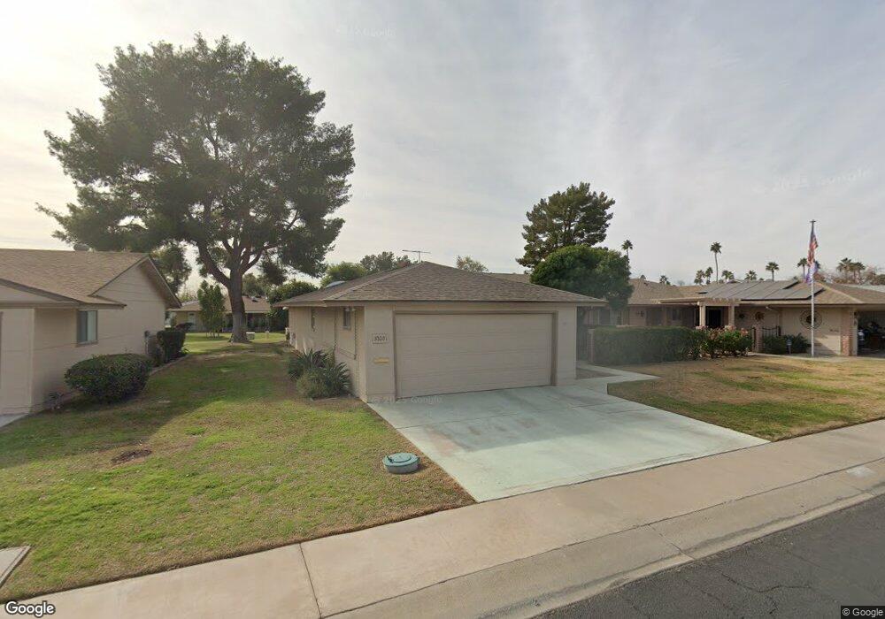
10201 W Candlewood Dr Unit 34 Sun City, AZ 85351
Estimated Value: $233,271 - $294,000
--
Bed
2
Baths
1,683
Sq Ft
$162/Sq Ft
Est. Value
About This Home
This home is located at 10201 W Candlewood Dr Unit 34, Sun City, AZ 85351 and is currently estimated at $271,818, approximately $161 per square foot. 10201 W Candlewood Dr Unit 34 is a home located in Maricopa County with nearby schools including Desert Mirage Elementary School, Ombudsman - Northwest Charter, and Peoria Accelerated High School.
Ownership History
Date
Name
Owned For
Owner Type
Purchase Details
Closed on
Dec 9, 1998
Sold by
Stout Harold E
Bought by
Ross Alyn Earl and Ross Bonnie L
Current Estimated Value
Home Financials for this Owner
Home Financials are based on the most recent Mortgage that was taken out on this home.
Original Mortgage
$76,000
Interest Rate
6.66%
Mortgage Type
New Conventional
Purchase Details
Closed on
Sep 29, 1995
Sold by
Stout Mary S and Mary S Nelson E
Bought by
Crowder Patricia
Create a Home Valuation Report for This Property
The Home Valuation Report is an in-depth analysis detailing your home's value as well as a comparison with similar homes in the area
Home Values in the Area
Average Home Value in this Area
Purchase History
| Date | Buyer | Sale Price | Title Company |
|---|---|---|---|
| Ross Alyn Earl | $96,000 | North American Title Agency | |
| Crowder Patricia | -- | -- | |
| Stout Harold E | -- | -- |
Source: Public Records
Mortgage History
| Date | Status | Borrower | Loan Amount |
|---|---|---|---|
| Closed | Ross Alyn Earl | $76,000 |
Source: Public Records
Tax History Compared to Growth
Tax History
| Year | Tax Paid | Tax Assessment Tax Assessment Total Assessment is a certain percentage of the fair market value that is determined by local assessors to be the total taxable value of land and additions on the property. | Land | Improvement |
|---|---|---|---|---|
| 2025 | $967 | $11,972 | -- | -- |
| 2024 | $872 | $11,402 | -- | -- |
| 2023 | $872 | $19,860 | $3,970 | $15,890 |
| 2022 | $821 | $17,360 | $3,470 | $13,890 |
| 2021 | $848 | $15,730 | $3,140 | $12,590 |
| 2020 | $825 | $14,020 | $2,800 | $11,220 |
| 2019 | $814 | $13,410 | $2,680 | $10,730 |
| 2018 | $784 | $11,870 | $2,370 | $9,500 |
| 2017 | $757 | $10,400 | $2,080 | $8,320 |
| 2016 | $398 | $8,550 | $1,710 | $6,840 |
| 2015 | $678 | $8,300 | $1,660 | $6,640 |
Source: Public Records
Map
Nearby Homes
- 10114 W Royal Oak Rd Unit 20
- 10137 W Forrester Dr Unit 20
- 10114 W Candlewood Dr
- 10127 W Forrester Dr
- 10134 W Forrester Dr
- 13410 N Cedar Dr Unit 20
- 10225 W Thunderbird Blvd
- 10229 W Bolivar Dr
- 13626 N Tan Tara Point
- 10112 W Forrester Dr
- 10330 W Thunderbird Blvd Unit A308
- 10330 W Thunderbird Blvd Unit B110
- 10330 W Thunderbird Blvd Unit A332
- 10330 W Thunderbird Blvd Unit A125
- 10330 W Thunderbird Blvd Unit A304
- 10330 W Thunderbird Blvd Unit A127
- 10330 W Thunderbird Blvd Unit B103
- 10330 W Thunderbird Blvd Unit C326
- 10330 W Thunderbird Blvd Unit A321
- 10330 W Thunderbird Blvd Unit A333
- 10203 W Candlewood Dr
- 10131 W Candlewood Dr Unit 35
- 10129 W Candlewood Dr
- 10205 W Candlewood Dr
- 10204 W Royal Oak Rd Unit 24
- 10202 W Royal Oak Rd Unit 20
- 10227 W Forrester Dr Unit 65
- 10120 W Royal Oak Rd
- 10206 W Royal Oak Rd Unit 25
- 10207 W Candlewood Dr Unit 20
- 10132 W Candlewood Dr
- 10208 W Royal Oak Rd Unit 26
- 10225 W Forrester Dr Unit 66
- 10130 W Candlewood Dr
- 10118 W Royal Oak Rd
- 10228 W Forrester Dr
- 10209 W Candlewood Dr
- 10125 W Candlewood Dr Unit 38
- 10210 W Royal Oak Rd Unit 20
- 10226 W Forrester Dr