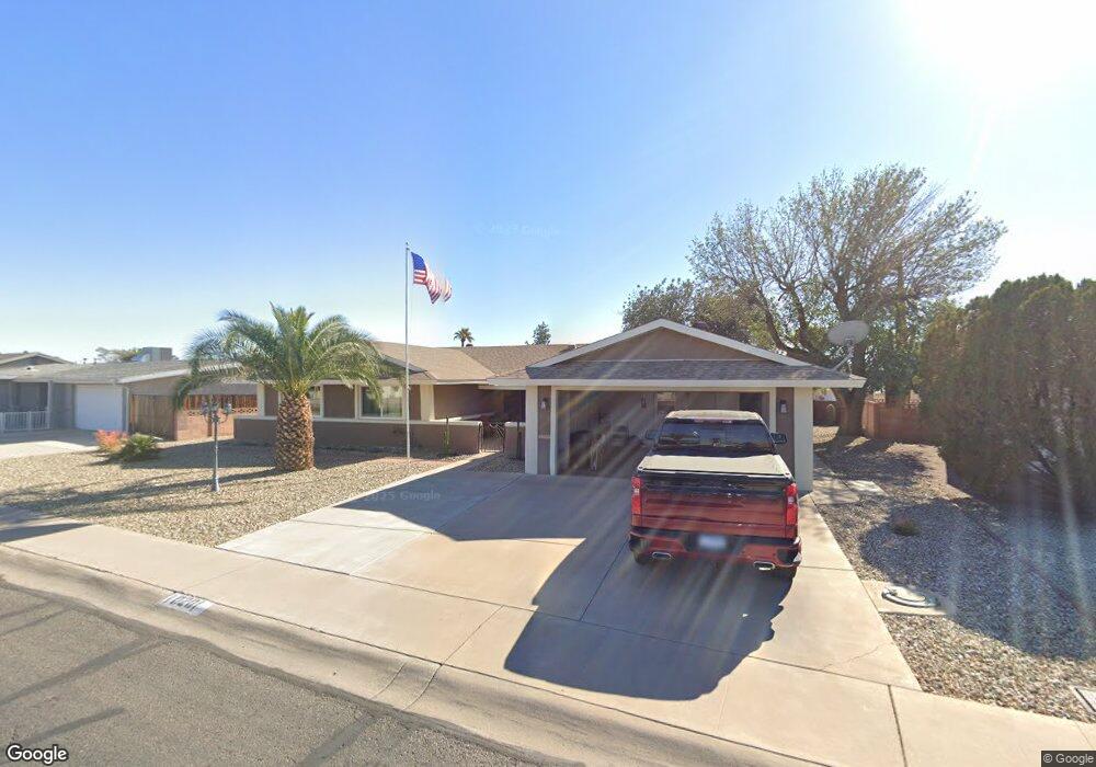
10201 W Peoria Ave Sun City, AZ 85351
Estimated Value: $273,649 - $341,000
--
Bed
2
Baths
2,086
Sq Ft
$154/Sq Ft
Est. Value
About This Home
This home is located at 10201 W Peoria Ave, Sun City, AZ 85351 and is currently estimated at $321,662, approximately $154 per square foot. 10201 W Peoria Ave is a home located in Maricopa County with nearby schools including Ombudsman - Northwest Charter and Peoria Accelerated High School.
Ownership History
Date
Name
Owned For
Owner Type
Purchase Details
Closed on
Sep 10, 2013
Sold by
Buysse Robert and Buysse Jiane
Bought by
Winter Home Llc
Current Estimated Value
Purchase Details
Closed on
Feb 23, 2005
Sold by
Mcmillin Raymond and Mcmillin Helen
Bought by
Buysse Robert and Buysse Diane
Purchase Details
Closed on
Mar 6, 1996
Sold by
Payne Jack L and Payne Bonnie F
Bought by
Mcmillin Raymond and Mcmillin Helen
Home Financials for this Owner
Home Financials are based on the most recent Mortgage that was taken out on this home.
Original Mortgage
$69,000
Interest Rate
5.87%
Mortgage Type
New Conventional
Purchase Details
Closed on
Nov 20, 1995
Sold by
Nink Margaretha M
Bought by
Payne Jack L and Payne Bonnie F
Home Financials for this Owner
Home Financials are based on the most recent Mortgage that was taken out on this home.
Original Mortgage
$57,600
Interest Rate
7.48%
Mortgage Type
New Conventional
Create a Home Valuation Report for This Property
The Home Valuation Report is an in-depth analysis detailing your home's value as well as a comparison with similar homes in the area
Home Values in the Area
Average Home Value in this Area
Purchase History
| Date | Buyer | Sale Price | Title Company |
|---|---|---|---|
| Winter Home Llc | -- | None Available | |
| Buysse Robert | $165,000 | -- | |
| Mcmillin Raymond | $93,000 | United Title Agency | |
| Payne Jack L | $72,000 | United Title Agency |
Source: Public Records
Mortgage History
| Date | Status | Borrower | Loan Amount |
|---|---|---|---|
| Previous Owner | Mcmillin Raymond | $69,000 | |
| Previous Owner | Payne Jack L | $57,600 |
Source: Public Records
Tax History Compared to Growth
Tax History
| Year | Tax Paid | Tax Assessment Tax Assessment Total Assessment is a certain percentage of the fair market value that is determined by local assessors to be the total taxable value of land and additions on the property. | Land | Improvement |
|---|---|---|---|---|
| 2025 | $1,212 | $13,597 | -- | -- |
| 2024 | $1,093 | $12,950 | -- | -- |
| 2023 | $1,093 | $24,210 | $4,840 | $19,370 |
| 2022 | $1,027 | $18,920 | $3,780 | $15,140 |
| 2021 | $1,051 | $17,870 | $3,570 | $14,300 |
| 2020 | $1,025 | $15,830 | $3,160 | $12,670 |
| 2019 | $1,016 | $14,630 | $2,920 | $11,710 |
| 2018 | $985 | $13,070 | $2,610 | $10,460 |
| 2017 | $956 | $11,400 | $2,280 | $9,120 |
| 2016 | $896 | $10,620 | $2,120 | $8,500 |
| 2015 | $852 | $9,620 | $1,920 | $7,700 |
Source: Public Records
Map
Nearby Homes
- 10102 W Deanne Dr Unit 6
- 10076 W Peoria Ave
- 10314 W Deanne Dr
- 10614 N 103rd Ave
- 10635 N 103rd Ave
- 10027 W Tarrytown Ave Unit 6
- 10010 W Deanne Dr
- 10002 W Deanne Dr
- 10351 W Pinehurst Dr
- 10345 W Peoria Ave Unit 5
- 10318 W Corte Del Sol Este Unit 21
- 10323 W Deanne Dr
- 10034 W Concord Ave
- 10013 W Lakeview Cir N
- 10240 W Concord Ave
- 10425 N Balboa Dr
- 10404 W Audrey Dr
- 10341 W Clair Dr
- 10410 W Audrey Dr Unit 8
- 10426 W Deanne Dr Unit 15
- 10209 W Peoria Ave
- 10113 W Peoria Ave
- 10124 W Deanne Dr
- 10130 W Deanne Dr Unit 6
- 10118 W Deanne Dr
- 10213 W Peoria Ave
- 10109 W Peoria Ave Unit 5
- 10134 W Deanne Dr Unit 6
- 10110 W Deanne Dr
- 10202 W Peoria Ave
- 10221 W Peoria Ave
- 10101 W Peoria Ave
- 10125 W Deanne Dr
- 10210 W Peoria Ave
- 10116 W Peoria Ave
- 10119 W Deanne Dr
- 10131 W Deanne Dr
- 10202 W Deanne Dr
- 10214 W Peoria Ave
- 10110 W Peoria Ave