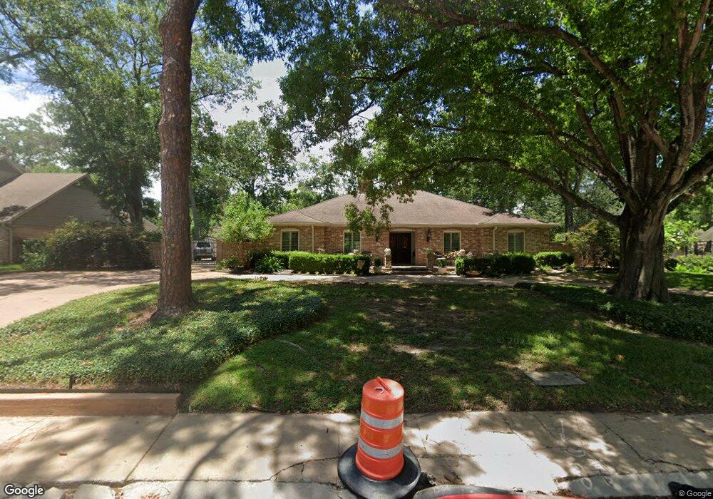
10202 Briar Dr Houston, TX 77042
Briar Forest NeighborhoodEstimated Value: $929,000 - $1,100,827
4
Beds
4
Baths
2,601
Sq Ft
$389/Sq Ft
Est. Value
About This Home
This home is located at 10202 Briar Dr, Houston, TX 77042 and is currently estimated at $1,012,207, approximately $389 per square foot. 10202 Briar Dr is a home located in Harris County with nearby schools including Walnut Bend Elementary School, Paul Revere Middle School, and Westside High School.
Ownership History
Date
Name
Owned For
Owner Type
Purchase Details
Closed on
Apr 15, 2011
Sold by
Golemon Harry A and Golemon Johanna B
Bought by
Edwards Owen Brandt and Edwards Catherine Anne
Current Estimated Value
Home Financials for this Owner
Home Financials are based on the most recent Mortgage that was taken out on this home.
Original Mortgage
$417,000
Outstanding Balance
$289,301
Interest Rate
4.92%
Mortgage Type
New Conventional
Estimated Equity
$722,906
Purchase Details
Closed on
Aug 26, 1994
Sold by
Melcher Janice Dougall
Bought by
Golemon Harry A and Golemon Johanna B
Purchase Details
Closed on
Jan 5, 1994
Sold by
Lindsay David W and Lindsay Lucy M
Bought by
Shapland James Jay and Shapland Caron Lee
Home Financials for this Owner
Home Financials are based on the most recent Mortgage that was taken out on this home.
Original Mortgage
$195,200
Interest Rate
7.29%
Create a Home Valuation Report for This Property
The Home Valuation Report is an in-depth analysis detailing your home's value as well as a comparison with similar homes in the area
Home Values in the Area
Average Home Value in this Area
Purchase History
| Date | Buyer | Sale Price | Title Company |
|---|---|---|---|
| Edwards Owen Brandt | -- | Alamo Title Company | |
| Golemon Harry A | -- | -- | |
| Shapland James Jay | -- | Stewart Title Houston Divisi |
Source: Public Records
Mortgage History
| Date | Status | Borrower | Loan Amount |
|---|---|---|---|
| Open | Edwards Owen Brandt | $417,000 | |
| Previous Owner | Shapland James Jay | $195,200 |
Source: Public Records
Tax History Compared to Growth
Tax History
| Year | Tax Paid | Tax Assessment Tax Assessment Total Assessment is a certain percentage of the fair market value that is determined by local assessors to be the total taxable value of land and additions on the property. | Land | Improvement |
|---|---|---|---|---|
| 2025 | $7,866 | $1,081,831 | $535,838 | $545,993 |
| 2024 | $7,866 | $997,374 | $535,838 | $461,536 |
| 2023 | $7,866 | $927,095 | $535,838 | $391,257 |
| 2022 | $15,545 | $895,300 | $535,838 | $359,462 |
| 2021 | $14,958 | $641,800 | $428,670 | $213,130 |
| 2020 | $15,019 | $641,907 | $428,670 | $213,237 |
| 2019 | $14,170 | $560,000 | $428,670 | $131,330 |
| 2018 | $5,350 | $388,865 | $285,780 | $103,085 |
| 2017 | $15,869 | $627,571 | $285,780 | $341,791 |
| 2016 | $17,700 | $700,000 | $285,780 | $414,220 |
| 2015 | -- | $700,000 | $285,780 | $414,220 |
| 2014 | -- | $630,890 | $285,780 | $345,110 |
Source: Public Records
Map
Nearby Homes
- 10212 Longmont Dr Unit 44/7
- 10121 Valley Forge Dr
- 10034 Bordley Dr
- 10010 Bordley Dr
- 10323 Pine Forest Rd
- 10378 Briar Forest Dr Unit 32/5
- 10324 Briar Forest Dr Unit 28
- 10276 Briar Forest Dr Unit 25
- 10042 Briar Forest Dr
- 10034 Briar Forest Dr
- 10317 Briar Forest Dr Unit 214
- 10118 Briar Rose Dr
- 1537 W Sam Houston Pkwy S
- 10031 Inwood Dr
- 1691 W Sam Houston Pkwy S
- 1003 Blue Willow Dr
- 1 Woodstone St
- 8 Woodstone St
- 10303 Chevy Chase Dr
- 10614 Lynbrook Dr
- 10203 Preston Crest Dr
- 10207 Preston Crest Dr
- 918 Seagler Rd
- 10211 Preston Crest Dr
- 10215 Preston Crest Dr
- 828 Seagler Rd
- 928 Seagler Rd
- 810 Seagler Rd
- 10203 Briar Dr
- 812 Remington Glade Dr
- 10115 Lynbrook Hollow St
- 810 Remington Glade Dr
- 806 Remington Glade Dr
- 10114 Lynbrook Hollow St
- 10146 Valley Forge Dr Unit 1
- 10144 Valley Forge Dr Unit 2
- 10203 Sugar Hill Dr
- 802 Remington Glade Dr
- 10111 Lynbrook Hollow St
- 10142 Valley Forge Dr Unit 3