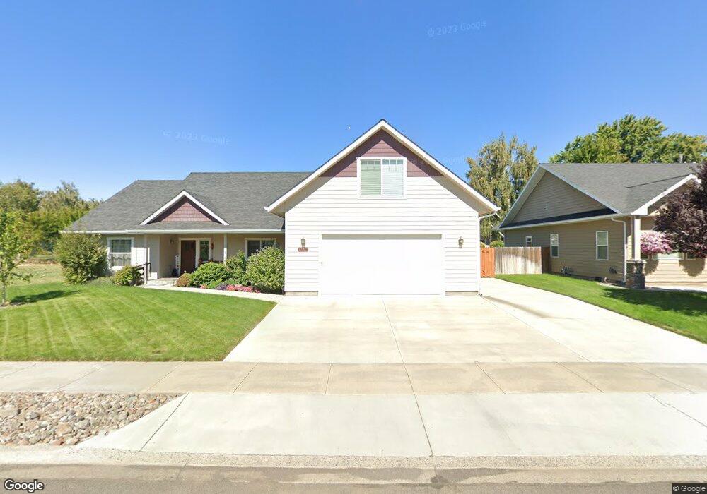
10202 Leonard Ln Unit 7 Island City, OR 97850
Estimated Value: $429,534 - $541,000
3
Beds
3
Baths
2,082
Sq Ft
$233/Sq Ft
Est. Value
About This Home
This home is located at 10202 Leonard Ln Unit 7, Island City, OR 97850 and is currently estimated at $485,267, approximately $233 per square foot. 10202 Leonard Ln Unit 7 is a home located in Union County with nearby schools including La Grande High School, The Marian Academy, and Lighthouse Apostolic Academy.
Ownership History
Date
Name
Owned For
Owner Type
Purchase Details
Closed on
Jul 19, 2016
Sold by
Lester Land Company Inc
Bought by
Wallace Thomas and Wallace Peggy
Current Estimated Value
Create a Home Valuation Report for This Property
The Home Valuation Report is an in-depth analysis detailing your home's value as well as a comparison with similar homes in the area
Home Values in the Area
Average Home Value in this Area
Purchase History
| Date | Buyer | Sale Price | Title Company |
|---|---|---|---|
| Wallace Thomas | $76,600 | Eastern Oregon Title Inc |
Source: Public Records
Tax History Compared to Growth
Tax History
| Year | Tax Paid | Tax Assessment Tax Assessment Total Assessment is a certain percentage of the fair market value that is determined by local assessors to be the total taxable value of land and additions on the property. | Land | Improvement |
|---|---|---|---|---|
| 2025 | $3,442 | $254,880 | $60,600 | $194,280 |
| 2024 | $3,318 | $247,460 | $58,840 | $188,620 |
| 2023 | $3,273 | $240,260 | $57,120 | $183,140 |
| 2022 | $3,188 | $233,264 | $55,455 | $177,809 |
| 2021 | $3,111 | $226,470 | $54,042 | $172,428 |
| 2020 | $2,974 | $219,874 | $52,545 | $167,329 |
| 2019 | $2,920 | $213,470 | $51,162 | $162,308 |
| 2018 | $2,846 | $207,253 | $47,003 | $160,250 |
| 2017 | $1,662 | $120,967 | $30,057 | $90,910 |
| 2016 | $401 | $29,182 | $29,182 | $0 |
| 2015 | $385 | $28,333 | $28,333 | $0 |
| 2014 | $321 | $27,508 | $27,508 | $0 |
| 2013 | -- | $26,707 | $26,707 | $0 |
Source: Public Records
Map
Nearby Homes
- 10913 Kristin Way
- 10907 Kristin Way
- 10601 Jeff Ln
- 10603 Greg Ln
- 10605 Greg Ln
- 10701 Greg Ln
- 10703 Greg Ln
- 10604 Greg Ln
- 10804 Carrie Way
- 10807 Carrie Way
- 10808 Carrie Way
- 10806 Carrie Way
- 0 Mcalister Rd
- 10504 G Ct
- 1705 E Glacier St
- 10203 S Mcalister Rd
- 0 Walton Rd Unit 546563801
- 1809 26th St Unit 21
- 1809 26th St
- 1809 26th St Unit 12
- 10202 Leonard Ln
- 10204 Leonard Ln Unit 8
- 10204 Leonard Ln
- 10112 Leonard Ln
- 10201 Mount Fanny Ave
- 10109 Mount Fanny Ave
- 10206 Leonard Ln
- 10201 Mt Fanny Ave
- 10203 Mount Fanny Ave
- 10201 Leonard Ln
- 10110 Leonard Ln
- 10110 Leonard Ln
- 10203 Leonard Ln
- 10205 Leonard Ln
- 10107 Mount Fanny Ave
- 10205 Mount Fanny Ave
- 10109 Leonard Ln
- 10208 Leonard Ln Unit 10
- 10908 Harris St
- 10207 Leonard Ln