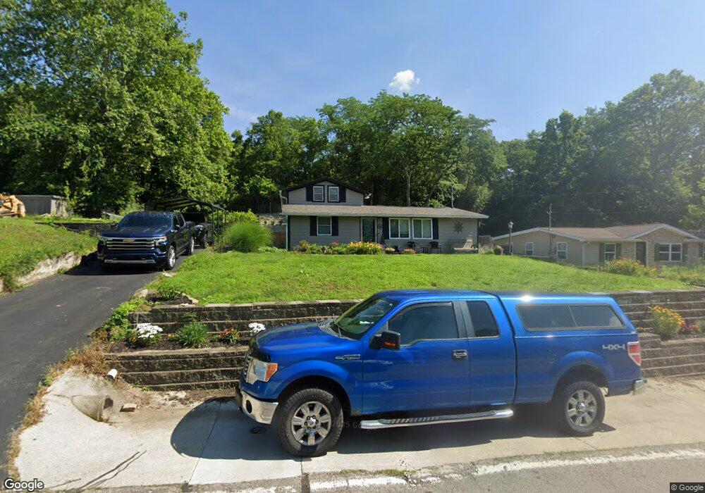
10202 Lincoln Rd Camp Dennison, OH 45111
Estimated Value: $213,000 - $325,000
2
Beds
1
Bath
1,740
Sq Ft
$152/Sq Ft
Est. Value
About This Home
This home is located at 10202 Lincoln Rd, Camp Dennison, OH 45111 and is currently estimated at $264,493, approximately $152 per square foot. 10202 Lincoln Rd is a home located in Hamilton County with nearby schools including Indian Hill Primary School, Indian Hill Elementary School, and Indian Hill Middle School.
Ownership History
Date
Name
Owned For
Owner Type
Purchase Details
Closed on
Aug 21, 2024
Sold by
Schatzman Craig J and Schatzman Robyn
Bought by
Schatzman Craig J
Current Estimated Value
Purchase Details
Closed on
May 25, 2019
Sold by
Schatzman Craig J and Schatzman Robyn
Bought by
Schatzman Craig J
Home Financials for this Owner
Home Financials are based on the most recent Mortgage that was taken out on this home.
Original Mortgage
$61,533
Interest Rate
4.1%
Mortgage Type
New Conventional
Purchase Details
Closed on
Feb 14, 1997
Sold by
Fogle David C and Fogle Lucinda F
Bought by
Schatzman Craig J
Home Financials for this Owner
Home Financials are based on the most recent Mortgage that was taken out on this home.
Original Mortgage
$68,400
Interest Rate
7.74%
Create a Home Valuation Report for This Property
The Home Valuation Report is an in-depth analysis detailing your home's value as well as a comparison with similar homes in the area
Home Values in the Area
Average Home Value in this Area
Purchase History
| Date | Buyer | Sale Price | Title Company |
|---|---|---|---|
| Schatzman Craig J | -- | None Listed On Document | |
| Schatzman Craig J | -- | Servicelink | |
| Schatzman Craig J | $76,000 | -- |
Source: Public Records
Mortgage History
| Date | Status | Borrower | Loan Amount |
|---|---|---|---|
| Previous Owner | Schatzman Craig J | $61,533 | |
| Previous Owner | Schatzman Craig J | $68,400 |
Source: Public Records
Tax History Compared to Growth
Tax History
| Year | Tax Paid | Tax Assessment Tax Assessment Total Assessment is a certain percentage of the fair market value that is determined by local assessors to be the total taxable value of land and additions on the property. | Land | Improvement |
|---|---|---|---|---|
| 2024 | $2,936 | $67,257 | $11,120 | $56,137 |
| 2023 | $2,918 | $67,257 | $11,120 | $56,137 |
| 2022 | $2,535 | $47,303 | $9,989 | $37,314 |
| 2021 | $2,475 | $47,303 | $9,989 | $37,314 |
| 2020 | $2,238 | $47,303 | $9,989 | $37,314 |
| 2019 | $2,098 | $43,800 | $9,251 | $34,549 |
| 2018 | $2,102 | $43,800 | $9,251 | $34,549 |
| 2017 | $1,994 | $43,800 | $9,251 | $34,549 |
| 2016 | $1,929 | $41,927 | $9,527 | $32,400 |
| 2015 | $1,943 | $41,927 | $9,527 | $32,400 |
| 2014 | $1,910 | $41,927 | $9,527 | $32,400 |
| 2013 | $1,920 | $40,706 | $9,251 | $31,455 |
Source: Public Records
Map
Nearby Homes
- 221 Miami Lakes Dr
- 5 White Water Way
- 674 Hobby Horse Ln
- 18 Big Oak Ln
- 5763 Price Rd
- 732 St Rt 28
- 772 Price Knoll Ln
- 764 Forest Ave
- 12 Valley View Cir
- 8200 Kroger Farm Rd
- 574 Main St
- 5880 Stonebridge Cir
- 5633 Happy Hollow Rd
- 5884 Stonebridge Cir
- 22 Robbie Ridge
- Hoover Plan at Hawley Farms
- Rockford Plan at Hawley Farms
- Truman Plan at Hawley Farms
- Longwood Plan at Hawley Farms
- Avalon Plan at Hawley Farms
- 10210 Lincoln Rd
- 10198 Lincoln Rd
- 10190 Lincoln Rd
- 10182 Lincoln Rd
- 10205 Lincoln Rd
- 10201 Lincoln Rd
- 10209 Lincoln Rd
- 10178 Lincoln Rd
- 10195 Lincoln Rd
- 10189 Lincoln Rd
- 10183 Lincoln Rd
- 10170 Lincoln Rd
- 10179 Lincoln Rd
- 10162 Lincoln Rd
- 10171 Lincoln Rd
- 10227 Lincoln Rd
- 10167 Lincoln Rd
- 10156 Lincoln Rd
- 10161 Lincoln Rd
- 7888 Munson St