Estimated Value: $731,450 - $840,000
4
Beds
3
Baths
2,732
Sq Ft
$286/Sq Ft
Est. Value
About This Home
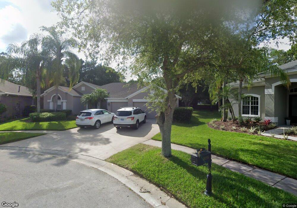
This home is located at 10202 Millport Dr, Tampa, FL 33626 and is currently estimated at $781,613, approximately $286 per square foot. 10202 Millport Dr is a home located in Hillsborough County with nearby schools including Westchase Elementary School, Davidsen Middle School, and Alonso High School.
Ownership History
Date
Name
Owned For
Owner Type
Purchase Details
Closed on
Jul 9, 1998
Sold by
Kapugi Jeffery J and Kapugi A
Bought by
Forehand Steven and Forehand Cheryl H
Current Estimated Value
Home Financials for this Owner
Home Financials are based on the most recent Mortgage that was taken out on this home.
Original Mortgage
$166,250
Outstanding Balance
$34,140
Interest Rate
7.04%
Mortgage Type
New Conventional
Estimated Equity
$747,473
Purchase Details
Closed on
Aug 21, 1996
Sold by
Ih Tampa Homes Corp
Bought by
Kapugi Jeffery J and Kapugi Laurie A
Home Financials for this Owner
Home Financials are based on the most recent Mortgage that was taken out on this home.
Original Mortgage
$162,500
Interest Rate
8.4%
Mortgage Type
New Conventional
Create a Home Valuation Report for This Property
The Home Valuation Report is an in-depth analysis detailing your home's value as well as a comparison with similar homes in the area
Home Values in the Area
Average Home Value in this Area
Purchase History
| Date | Buyer | Sale Price | Title Company |
|---|---|---|---|
| Forehand Steven | $175,000 | -- | |
| Kapugi Jeffery J | $180,600 | -- |
Source: Public Records
Mortgage History
| Date | Status | Borrower | Loan Amount |
|---|---|---|---|
| Open | Kapugi Jeffery J | $166,250 | |
| Previous Owner | Kapugi Jeffery J | $162,500 |
Source: Public Records
Tax History Compared to Growth
Tax History
| Year | Tax Paid | Tax Assessment Tax Assessment Total Assessment is a certain percentage of the fair market value that is determined by local assessors to be the total taxable value of land and additions on the property. | Land | Improvement |
|---|---|---|---|---|
| 2024 | $5,387 | $265,546 | -- | -- |
| 2023 | $5,180 | $257,812 | $0 | $0 |
| 2022 | $4,842 | $250,303 | $0 | $0 |
| 2021 | $4,753 | $243,013 | $0 | $0 |
| 2020 | $4,659 | $239,658 | $0 | $0 |
| 2019 | $4,544 | $234,270 | $0 | $0 |
| 2018 | $4,448 | $229,902 | $0 | $0 |
| 2017 | $4,397 | $367,508 | $0 | $0 |
| 2016 | $4,661 | $220,542 | $0 | $0 |
| 2015 | $4,799 | $219,009 | $0 | $0 |
| 2014 | $4,773 | $217,271 | $0 | $0 |
| 2013 | -- | $214,060 | $0 | $0 |
Source: Public Records
Map
Nearby Homes
- 10455 Green Links Dr
- 10232 Millport Dr
- 10502 Castleford Way
- 10309 Marchmont Ct
- 10409 Lightner Bridge Dr
- 10364 Lightner Bridge Dr
- 10026 Seymour Way
- 10021 Brompton Dr
- 10001 Seymour Way
- 10605 Tavistock Dr
- 10136 Kingsbridge Ave
- 10639 Gretna Green Dr
- 9986 Stockbridge Dr
- The Bartow Plan at Westchase Station
- The Archer Plan at Westchase Station
- 10552 Greencrest Dr
- 11215 Clayridge Dr
- 11121 Clayridge Dr
- 11222 Clayridge Dr
- 11506 Crowned Sparrow Ln
- 10204 Millport Dr
- 10201 Millport Dr
- 10206 Millport Dr
- 10203 Millport Dr
- 10338 Millport Dr
- 10208 Millport Dr
- 10336 Millport Dr
- 10437 Green Links Dr
- 10439 Green Links Dr
- 10210 Millport Dr
- 10441 Green Links Dr
- 10435 Green Links Dr
- 10334 Millport Dr
- 10017 Bridgeton Dr
- 10443 Green Links Dr
- 10339 Millport Dr
- 10433 Green Links Dr
- 10212 Millport Dr
- 10015 Bridgeton Dr
- 10445 Green Links Dr