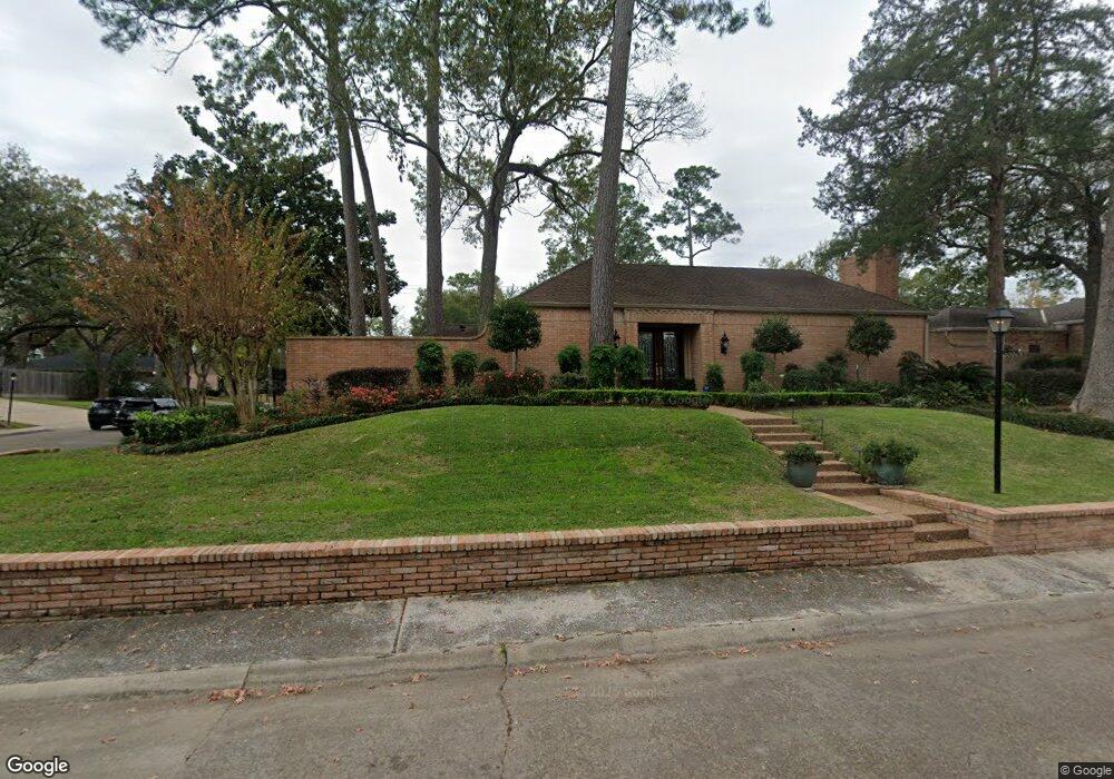
10203 Briar Dr Houston, TX 77042
Briar Forest NeighborhoodEstimated Value: $900,000 - $1,150,000
4
Beds
3
Baths
3,866
Sq Ft
$265/Sq Ft
Est. Value
About This Home
This home is located at 10203 Briar Dr, Houston, TX 77042 and is currently estimated at $1,022,747, approximately $264 per square foot. 10203 Briar Dr is a home located in Harris County with nearby schools including Walnut Bend Elementary School, Paul Revere Middle School, and Westside High School.
Ownership History
Date
Name
Owned For
Owner Type
Purchase Details
Closed on
Mar 22, 1999
Sold by
Yates William A
Bought by
Y2me Partners Ltd
Current Estimated Value
Purchase Details
Closed on
Mar 16, 1995
Sold by
Buchanan Jeanne A and Morgenthaler George J
Bought by
Yates William A and Yates Kathleen R
Home Financials for this Owner
Home Financials are based on the most recent Mortgage that was taken out on this home.
Original Mortgage
$264,000
Interest Rate
8.86%
Create a Home Valuation Report for This Property
The Home Valuation Report is an in-depth analysis detailing your home's value as well as a comparison with similar homes in the area
Home Values in the Area
Average Home Value in this Area
Purchase History
| Date | Buyer | Sale Price | Title Company |
|---|---|---|---|
| Y2me Partners Ltd | -- | -- | |
| Yates William A | -- | Texas American Title Company |
Source: Public Records
Mortgage History
| Date | Status | Borrower | Loan Amount |
|---|---|---|---|
| Previous Owner | Yates William A | $264,000 |
Source: Public Records
Tax History Compared to Growth
Tax History
| Year | Tax Paid | Tax Assessment Tax Assessment Total Assessment is a certain percentage of the fair market value that is determined by local assessors to be the total taxable value of land and additions on the property. | Land | Improvement |
|---|---|---|---|---|
| 2025 | $6,891 | $835,102 | $465,908 | $369,194 |
| 2024 | $6,891 | $808,539 | $465,908 | $342,631 |
| 2023 | $6,891 | $860,000 | $465,908 | $394,092 |
| 2022 | $18,774 | $904,000 | $465,908 | $438,092 |
| 2021 | $18,065 | $799,286 | $465,908 | $333,378 |
| 2020 | $17,064 | $704,643 | $465,908 | $238,735 |
| 2019 | $18,167 | $717,919 | $465,908 | $252,011 |
| 2018 | $8,169 | $527,400 | $248,484 | $278,916 |
| 2017 | $21,068 | $844,400 | $248,484 | $595,916 |
| 2016 | $19,153 | $899,649 | $248,484 | $651,165 |
| 2015 | $9,406 | $795,000 | $248,484 | $546,516 |
| 2014 | $9,406 | $631,500 | $248,484 | $383,016 |
Source: Public Records
Map
Nearby Homes
- 10212 Longmont Dr Unit 44/7
- 10121 Valley Forge Dr
- 10034 Bordley Dr
- 10010 Bordley Dr
- 10323 Pine Forest Rd
- 10378 Briar Forest Dr Unit 32/5
- 10324 Briar Forest Dr Unit 28
- 10276 Briar Forest Dr Unit 25
- 10042 Briar Forest Dr
- 10034 Briar Forest Dr
- 10317 Briar Forest Dr Unit 214
- 10118 Briar Rose Dr
- 1537 W Sam Houston Pkwy S
- 10031 Inwood Dr
- 1691 W Sam Houston Pkwy S
- 1003 Blue Willow Dr
- 1 Woodstone St
- 8 Woodstone St
- 10303 Chevy Chase Dr
- 10614 Lynbrook Dr
- 928 Seagler Rd
- 828 Seagler Rd
- 10303 Lynbrook Hollow St
- 918 Seagler Rd
- 812 Remington Glade Dr
- 10215 Preston Crest Dr
- 10211 Preston Crest Dr
- 810 Remington Glade Dr
- 10202 Briar Dr
- 10207 Preston Crest Dr
- 810 Seagler Rd
- 10302 Lynbrook Hollow St
- 806 Remington Glade Dr
- 10307 Lynbrook Hollow St
- 10203 Preston Crest Dr
- 802 Remington Glade Dr
- 10306 Lynbrook Hollow St
- 10311 Lynbrook Hollow St
- 10146 Valley Forge Dr Unit 1
- 1202 Seagler Rd