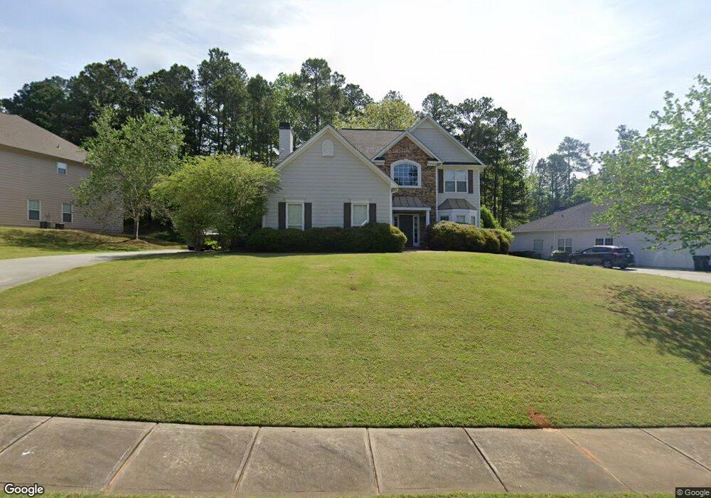
10203 N Links Dr Covington, GA 30014
Estimated Value: $327,462 - $433,000
--
Bed
3
Baths
2,656
Sq Ft
$150/Sq Ft
Est. Value
About This Home
This home is located at 10203 N Links Dr, Covington, GA 30014 and is currently estimated at $398,116, approximately $149 per square foot. 10203 N Links Dr is a home located in Newton County with nearby schools including East Newton Elementary School, Cousins Middle School, and Eastside High School.
Ownership History
Date
Name
Owned For
Owner Type
Purchase Details
Closed on
Nov 9, 2017
Sold by
2017 & 2 Ih Borrower Lp
Bought by
Thr Georgia Lp
Current Estimated Value
Purchase Details
Closed on
Nov 12, 2014
Sold by
Thr Georgia Lp
Bought by
2014 3 Ih Borrower Lp
Purchase Details
Closed on
Apr 10, 2013
Sold by
Lunsford House Properties
Bought by
Thr Georgia Lp
Purchase Details
Closed on
Feb 19, 2013
Sold by
Nationstar Mtg Llc
Bought by
Lunsford House Properties Llc
Purchase Details
Closed on
Dec 4, 2012
Sold by
Shaw Fred
Bought by
Nationstar Mtg Llc
Purchase Details
Closed on
Jan 31, 2005
Sold by
Gmac Model Fin Inc
Bought by
Shaw Fred and Shaw Sherry
Home Financials for this Owner
Home Financials are based on the most recent Mortgage that was taken out on this home.
Original Mortgage
$180,000
Interest Rate
5.88%
Mortgage Type
New Conventional
Create a Home Valuation Report for This Property
The Home Valuation Report is an in-depth analysis detailing your home's value as well as a comparison with similar homes in the area
Home Values in the Area
Average Home Value in this Area
Purchase History
| Date | Buyer | Sale Price | Title Company |
|---|---|---|---|
| Thr Georgia Lp | -- | -- | |
| 2014 3 Ih Borrower Lp | -- | -- | |
| Thr Georgia Lp | $150,000 | -- | |
| Lunsford House Properties Llc | $119,000 | -- | |
| Nationstar Mtg Llc | $149,369 | -- | |
| Shaw Fred | $225,000 | -- |
Source: Public Records
Mortgage History
| Date | Status | Borrower | Loan Amount |
|---|---|---|---|
| Previous Owner | Shaw Fred | $180,000 |
Source: Public Records
Tax History Compared to Growth
Tax History
| Year | Tax Paid | Tax Assessment Tax Assessment Total Assessment is a certain percentage of the fair market value that is determined by local assessors to be the total taxable value of land and additions on the property. | Land | Improvement |
|---|---|---|---|---|
| 2024 | $3,453 | $114,360 | $12,237 | $102,123 |
| 2023 | $3,716 | $114,360 | $13,200 | $101,160 |
| 2022 | $3,129 | $96,280 | $13,200 | $83,080 |
| 2021 | $3,449 | $94,960 | $13,200 | $81,760 |
| 2020 | $3,162 | $79,280 | $13,200 | $66,080 |
| 2019 | $2,537 | $62,440 | $10,960 | $51,480 |
| 2018 | $1,283 | $62,440 | $10,960 | $51,480 |
| 2017 | $2,566 | $62,440 | $13,200 | $49,240 |
| 2016 | $2,285 | $55,600 | $10,000 | $45,600 |
| 2015 | $2,523 | $61,320 | $10,000 | $51,320 |
| 2014 | $2,310 | $56,160 | $0 | $0 |
Source: Public Records
Map
Nearby Homes
- 10155 Malcolm Dr
- 10110 Malcolm Ct
- 10184 Malcolm Dr
- 130 S Links Dr
- 8193 Monticello St
- 7703 Fawn Cir
- 8 Jackson Rd
- 7762 Fawn Cir
- 75 Woodfield Rd
- 8239 High Lake Terrace SE
- 13262 Tolstoy Dr
- 72 Woodfield Rd
- 10216 Azalea Dr
- 9176 Carr Cir SW
- 0 Petty St Unit 10547316
- 0 Petty St Unit 7640177
- 345 River Walk Farm Unit LOT 5
- 7155 Petty St SW
- 330 River Walk Farm
- 323 River Walk Farm
- 10203 N Links Dr
- 10203 N Links Dr Unit 10203
- 10215 N Links Dr Unit 72
- 10215 N Links Dr
- 10193 N Links Dr Unit 1A
- 10183 N Links Dr
- 10204 N Links Dr
- 10196 N Links Dr Unit 1A
- 10225 N Links Dr
- 10214 N Links Dr Unit 1A
- 10186 N Links Dr Unit 1A
- 10173 N Links Dr Unit 1A
- 10176 N Links Dr Unit 1A
- 10166 N Links Dr
- 10163 N Links Dr
- 10156 N Links Dr Unit 1A
- 10153 N Links Dr Unit 10153
- 10153 N Links Dr
- 10153 N Links Dr
- 15 S Links Dr