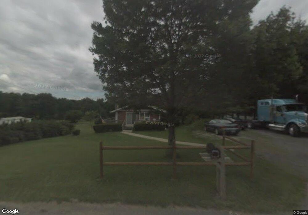
10205 Route 28 Brockway, PA 15824
Estimated Value: $76,000 - $221,000
--
Bed
--
Bath
792
Sq Ft
$167/Sq Ft
Est. Value
About This Home
This home is located at 10205 Route 28, Brockway, PA 15824 and is currently estimated at $132,156, approximately $166 per square foot. 10205 Route 28 is a home located in Jefferson County with nearby schools including Northside Elementary School, Pinecreek Elementary School, and Hickory Grove Elementary School.
Ownership History
Date
Name
Owned For
Owner Type
Purchase Details
Closed on
Apr 25, 2024
Sold by
Chesnutt David M and Chesnutt Gretchen S
Bought by
Chesnutt David M
Current Estimated Value
Purchase Details
Closed on
May 16, 2017
Sold by
Chesnutt David M
Bought by
Chesnutt David M and Chesnutt Gretchen S
Purchase Details
Closed on
Jan 9, 2012
Sold by
Moortimer William A and Mortimer Irma L
Bought by
Chestnut David M
Home Financials for this Owner
Home Financials are based on the most recent Mortgage that was taken out on this home.
Original Mortgage
$38,800
Interest Rate
3.21%
Mortgage Type
New Conventional
Create a Home Valuation Report for This Property
The Home Valuation Report is an in-depth analysis detailing your home's value as well as a comparison with similar homes in the area
Home Values in the Area
Average Home Value in this Area
Purchase History
| Date | Buyer | Sale Price | Title Company |
|---|---|---|---|
| Chesnutt David M | -- | None Listed On Document | |
| Chesnutt David M | -- | None Available | |
| Chestnut David M | $48,500 | None Available |
Source: Public Records
Mortgage History
| Date | Status | Borrower | Loan Amount |
|---|---|---|---|
| Previous Owner | Chestnut David M | $38,800 |
Source: Public Records
Tax History Compared to Growth
Tax History
| Year | Tax Paid | Tax Assessment Tax Assessment Total Assessment is a certain percentage of the fair market value that is determined by local assessors to be the total taxable value of land and additions on the property. | Land | Improvement |
|---|---|---|---|---|
| 2025 | $1,496 | $31,100 | $3,830 | $27,270 |
| 2024 | $1,465 | $31,100 | $3,830 | $27,270 |
| 2023 | $1,457 | $31,100 | $3,830 | $27,270 |
| 2022 | $1,457 | $31,100 | $3,830 | $27,270 |
| 2021 | $1,429 | $31,100 | $3,830 | $27,270 |
| 2020 | $1,429 | $31,100 | $3,830 | $27,270 |
| 2019 | $1,414 | $31,100 | $3,830 | $27,270 |
| 2018 | $1,383 | $31,100 | $3,830 | $27,270 |
| 2017 | $1,351 | $31,100 | $3,830 | $27,270 |
| 2016 | $1,315 | $31,100 | $3,830 | $27,270 |
| 2015 | -- | $31,100 | $3,830 | $27,270 |
| 2012 | -- | $31,800 | $3,830 | $27,970 |
Source: Public Records
Map
Nearby Homes
- 0 Coal Glen Rd
- 10217 Pennsylvania 28
- 725 Russel Rd
- 5546 Stevenson Hill Rd
- 19 Salandra Ln
- 1144 Shaffer Rd
- 00 Pennsylvania 830
- 3539 Stevenson Hill Rd
- 4908 Pennsylvania 28
- 3243 Stevenson Hill Rd
- 737 Crooked Pine Trail
- 765 Laurel Run Rd
- 559 Buskirk Rd
- 1074 10th Ave
- 0 U S 219
- 4000 Sulgar Rd
- 1549 Main St
- 970 Baghdad Rd
- 23682 Pennsylvania 949
- 924 Elm St
- 10171 Route 28
- 10267 Route 28
- 10144 Route 28
- 10063 Route 28
- 10106 Route 28
- 129 Reitz Crossing Rd
- 10240 Route 28
- 9969 Route 28
- 10445 Route 28
- 9922 Route 28
- 10496 Route 28
- 10274 Route 28
- 9878 Route 28
- 10535 Route 28
- 9877 Route 28
- 9875 Route 28
- 9650 Route 28
- 10675 Route 28
- 9731 Route 28
- 314 Grapevine Ln