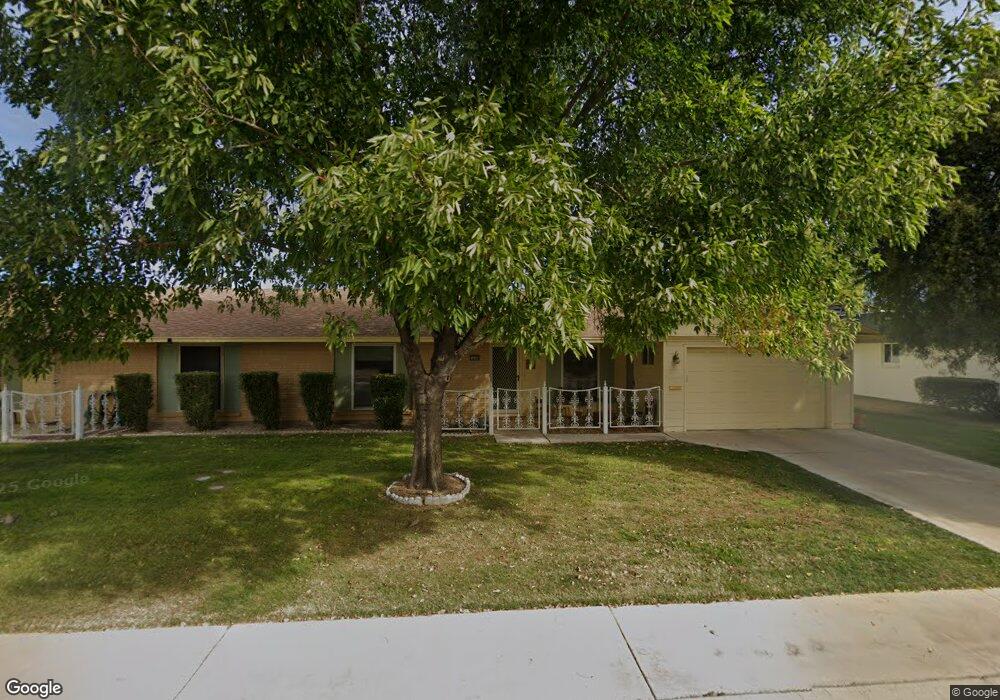
10206 W Forrester Dr Sun City, AZ 85351
Estimated Value: $195,502 - $271,000
--
Bed
2
Baths
1,377
Sq Ft
$172/Sq Ft
Est. Value
About This Home
This home is located at 10206 W Forrester Dr, Sun City, AZ 85351 and is currently estimated at $236,876, approximately $172 per square foot. 10206 W Forrester Dr is a home located in Maricopa County with nearby schools including Desert Mirage Elementary School, Ombudsman - Northwest Charter, and Peoria Accelerated High School.
Ownership History
Date
Name
Owned For
Owner Type
Purchase Details
Closed on
Mar 10, 1998
Sold by
Shea Leslie H and Shea Doris K
Bought by
Michaelson Marilyn
Current Estimated Value
Home Financials for this Owner
Home Financials are based on the most recent Mortgage that was taken out on this home.
Original Mortgage
$61,000
Outstanding Balance
$11,199
Interest Rate
7.06%
Mortgage Type
New Conventional
Estimated Equity
$225,677
Create a Home Valuation Report for This Property
The Home Valuation Report is an in-depth analysis detailing your home's value as well as a comparison with similar homes in the area
Home Values in the Area
Average Home Value in this Area
Purchase History
| Date | Buyer | Sale Price | Title Company |
|---|---|---|---|
| Michaelson Marilyn | $78,900 | Ati Title Agency |
Source: Public Records
Mortgage History
| Date | Status | Borrower | Loan Amount |
|---|---|---|---|
| Open | Michaelson Marilyn | $61,000 |
Source: Public Records
Tax History Compared to Growth
Tax History
| Year | Tax Paid | Tax Assessment Tax Assessment Total Assessment is a certain percentage of the fair market value that is determined by local assessors to be the total taxable value of land and additions on the property. | Land | Improvement |
|---|---|---|---|---|
| 2025 | $818 | $10,125 | -- | -- |
| 2024 | $738 | $9,643 | -- | -- |
| 2023 | $738 | $18,430 | $3,680 | $14,750 |
| 2022 | $694 | $15,430 | $3,080 | $12,350 |
| 2021 | $717 | $13,880 | $2,770 | $11,110 |
| 2020 | $698 | $12,250 | $2,450 | $9,800 |
| 2019 | $688 | $11,580 | $2,310 | $9,270 |
| 2018 | $663 | $10,210 | $2,040 | $8,170 |
| 2017 | $640 | $8,920 | $1,780 | $7,140 |
| 2016 | $600 | $7,270 | $1,450 | $5,820 |
| 2015 | $574 | $7,210 | $1,440 | $5,770 |
Source: Public Records
Map
Nearby Homes
- 10134 W Forrester Dr
- 10137 W Forrester Dr Unit 20
- 10229 W Bolivar Dr
- 10127 W Forrester Dr
- 10114 W Candlewood Dr
- 10114 W Royal Oak Rd Unit 20
- 13410 N Cedar Dr Unit 20
- 10112 W Forrester Dr
- 13620 N Hawthorn Dr
- 10309 W Floriade Dr Unit 18
- 13626 N Tan Tara Point
- 13636 N Redwood Dr Unit 203
- 13614 N Hawthorn Dr
- 13828 N Whispering Lake Dr
- 10012 W Bolivar Dr
- 13836 N Kaanapali Dr
- 13832 N Crown Point
- 13606 N Redwood Dr Unit 209
- 10225 W Thunderbird Blvd
- 13825 N Kaanapali Dr
- 10208 W Forrester Dr Unit 126
- 10204 W Forrester Dr Unit 124
- 10209 W Bolivar Dr Unit 154
- 10210 W Forrester Dr
- 10202 W Forrester Dr Unit 123
- 10213 W Bolivar Dr
- 10213 W Bolivar Dr Unit 153
- 10205 W Bolivar Dr
- 10205 W Forrester Dr Unit 20
- 10207 W Forrester Dr
- 10201 W Bolivar Dr Unit 156
- 10217 W Bolivar Dr
- 10212 W Forrester Dr Unit 128
- 10203 W Forrester Dr Unit 71
- 10140 W Forrester Dr
- 10201 W Forrester Dr
- 10221 W Bolivar Dr
- 10157 W Bolivar Dr
- 10138 W Forrester Dr Unit 21
- 10214 W Forrester Dr Unit 129