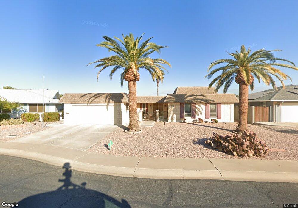
10208 W Cheryl Dr Sun City, AZ 85351
Estimated Value: $291,327 - $351,000
3
Beds
2
Baths
2,082
Sq Ft
$159/Sq Ft
Est. Value
About This Home
This home is located at 10208 W Cheryl Dr, Sun City, AZ 85351 and is currently estimated at $331,332, approximately $159 per square foot. 10208 W Cheryl Dr is a home located in Maricopa County with nearby schools including Ombudsman - Northwest Charter and Peoria Accelerated High School.
Ownership History
Date
Name
Owned For
Owner Type
Purchase Details
Closed on
Jun 8, 2012
Sold by
Swari Leroy E and Swari Elizabeth Ann
Bought by
Swari Leroy E and Swari Elizabeth Ann
Current Estimated Value
Purchase Details
Closed on
Sep 23, 2005
Sold by
Swari Leroy E and Swari Elizabeth Ann
Bought by
Swari Leroy E and Swari Elizabeth Ann
Purchase Details
Closed on
Oct 2, 2003
Sold by
Lawson Nell K
Bought by
Swari Leroy E and Swari Elizabeth Ann
Home Financials for this Owner
Home Financials are based on the most recent Mortgage that was taken out on this home.
Original Mortgage
$134,500
Outstanding Balance
$63,582
Interest Rate
6.4%
Mortgage Type
VA
Estimated Equity
$267,750
Purchase Details
Closed on
Aug 2, 1994
Sold by
Mcguiness Lois S
Bought by
Lawson William D and Lawson Nell K
Create a Home Valuation Report for This Property
The Home Valuation Report is an in-depth analysis detailing your home's value as well as a comparison with similar homes in the area
Home Values in the Area
Average Home Value in this Area
Purchase History
| Date | Buyer | Sale Price | Title Company |
|---|---|---|---|
| Swari Leroy E | -- | None Available | |
| Swari Leroy E | -- | -- | |
| Swari Leroy E | $134,500 | First American Title Ins Co | |
| Lawson William D | $93,000 | United Title Agency |
Source: Public Records
Mortgage History
| Date | Status | Borrower | Loan Amount |
|---|---|---|---|
| Open | Swari Leroy E | $134,500 |
Source: Public Records
Tax History Compared to Growth
Tax History
| Year | Tax Paid | Tax Assessment Tax Assessment Total Assessment is a certain percentage of the fair market value that is determined by local assessors to be the total taxable value of land and additions on the property. | Land | Improvement |
|---|---|---|---|---|
| 2025 | $904 | $15,770 | -- | -- |
| 2024 | $811 | $15,019 | -- | -- |
| 2023 | $811 | $26,030 | $5,200 | $20,830 |
| 2022 | $759 | $20,500 | $4,100 | $16,400 |
| 2021 | $765 | $19,320 | $3,860 | $15,460 |
| 2020 | $733 | $17,120 | $3,420 | $13,700 |
| 2019 | $723 | $16,150 | $3,230 | $12,920 |
| 2018 | $666 | $14,900 | $2,980 | $11,920 |
| 2017 | $646 | $13,380 | $2,670 | $10,710 |
| 2016 | $594 | $12,760 | $2,550 | $10,210 |
| 2015 | $552 | $11,520 | $2,300 | $9,220 |
Source: Public Records
Map
Nearby Homes
- 10131 W Cheryl Dr Unit 6D
- 10166 W Cinnebar Ave
- 10302 W Cheryl Dr Unit D
- 10240 W Concord Ave
- 10034 W Concord Ave
- 9939 W Ironwood Dr Unit 6D
- 10022 W Mountain View Rd
- 10316 W Salem Dr Unit 6D
- 9815 N 103rd Ave
- 9834 N Balboa Dr
- 10109 W Mountain View Rd
- 9925 W Mountain View Rd Unit 27
- 9915 W Mountain View Rd
- 10405 W Andover Ave
- 9891 N Balboa Dr
- 10341 W Clair Dr
- 10440 W Cheryl Dr
- 10027 W Tarrytown Ave Unit 6
- 10014 W Mission Ln
- 10102 W Deanne Dr Unit 6
- 10202 W Cheryl Dr
- 10216 W Cheryl Dr
- 10219 W Cumberland Dr
- 10144 W Cheryl Dr
- 10207 W Cheryl Dr
- 9838 N 102nd Dr
- 10201 W Cheryl Dr
- 10225 W Cumberland Dr Unit 6
- 10201 W Cumberland Dr
- 10143 W Cheryl Dr
- 10143 W Cheryl Dr Unit 6D
- 9832 N 102nd Dr
- 10138 W Cheryl Dr
- 10214 W Cumberland Dr
- 10231 W Cumberland Dr
- 10139 W Cumberland Dr
- 10208 W Cumberland Dr Unit 6
- 10214 W Cinnebar Ave
- 10208 W Cinnebar Ave
- 10220 W Cumberland Dr