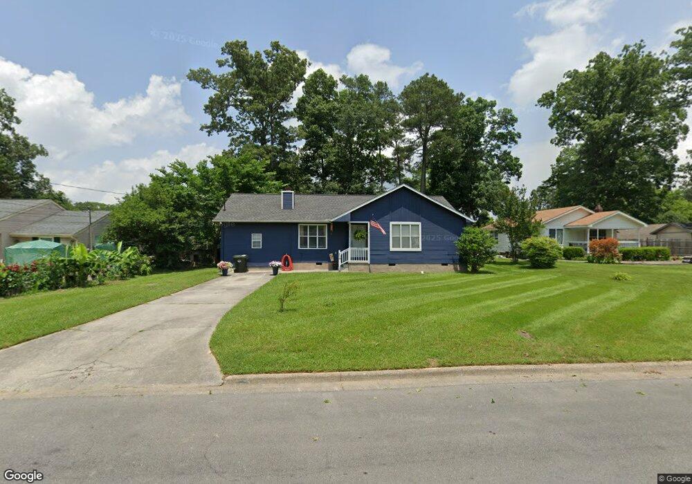
1021 Delaware Dr Dalton, GA 30721
Estimated Value: $215,159 - $261,000
Studio
2
Baths
1,380
Sq Ft
$175/Sq Ft
Est. Value
About This Home
This home is located at 1021 Delaware Dr, Dalton, GA 30721 and is currently estimated at $241,790, approximately $175 per square foot. 1021 Delaware Dr is a home located in Whitfield County with nearby schools including Park Creek Elementary School, Dalton High School, and Christian Heritage School.
Ownership History
Date
Name
Owned For
Owner Type
Purchase Details
Closed on
Jan 23, 2024
Sold by
Paulk Rollins Margaret and Rollins Roger V
Bought by
Butters Llc
Current Estimated Value
Purchase Details
Closed on
Jan 7, 2016
Sold by
Rollins Andrew
Bought by
Rollins Margaret Paulk and Roger Rollins V
Purchase Details
Closed on
Aug 22, 2008
Sold by
Not Provided
Bought by
Rollins Andrew
Purchase Details
Closed on
Apr 1, 2008
Sold by
Not Provided
Bought by
Rollins Andrew
Purchase Details
Closed on
Aug 1, 1998
Bought by
Baltra Johnnie L
Create a Home Valuation Report for This Property
The Home Valuation Report is an in-depth analysis detailing your home's value as well as a comparison with similar homes in the area
Purchase History
| Date | Buyer | Sale Price | Title Company |
|---|---|---|---|
| Butters Llc | -- | None Listed On Document | |
| Rollins Margaret Paulk | -- | -- | |
| Rollins Andrew | -- | -- | |
| Rollins Andrew | $74,220 | -- | |
| Baltra Johnnie L | $78,000 | -- |
Source: Public Records
Tax History
| Year | Tax Paid | Tax Assessment Tax Assessment Total Assessment is a certain percentage of the fair market value that is determined by local assessors to be the total taxable value of land and additions on the property. | Land | Improvement |
|---|---|---|---|---|
| 2025 | $2,360 | $77,585 | $12,800 | $64,785 |
| 2024 | $2,360 | $77,585 | $12,800 | $64,785 |
| 2023 | $1,987 | $53,748 | $10,000 | $43,748 |
| 2022 | $1,580 | $45,884 | $7,350 | $38,534 |
| 2021 | $1,587 | $46,009 | $7,350 | $38,659 |
| 2020 | $1,648 | $46,009 | $7,350 | $38,659 |
| 2019 | $1,700 | $46,009 | $7,350 | $38,659 |
| 2018 | $1,664 | $44,372 | $7,350 | $37,022 |
| 2017 | $1,602 | $44,372 | $7,350 | $37,022 |
| 2016 | $1,376 | $37,878 | $3,969 | $33,909 |
| 2014 | $1,191 | $36,074 | $3,780 | $32,294 |
| 2013 | -- | $36,074 | $3,780 | $32,294 |
Source: Public Records
Map
Nearby Homes
- 812 Park Creek Way
- 1114 Underwood St
- 311 Shady Ln
- 1216 Frazier Dr
- 0 Underwood St Unit 129860
- 916 Avenue E
- 1326 Veterans Dr
- Lot 5 Avenue E
- 717 Morningside Dr
- 928 Avenue C
- 601 Juniper Ave
- 1133 Orman St
- 533 Underwood St
- 301B Fields Ave
- 825 Martin Luther King jr Blvd
- 00 Glenwood Ave
- 1119 Acme St
- 204 N Bogle St
- 404 Paige St
- 171 Keith St
- 1019 Delaware Dr
- 1023 Delaware Dr
- 1026 Delaware Dr
- 1024 Connecticut Dr
- 1017 Delaware Dr
- 1026 Connecticut Dr
- 1022 Connecticut Dr
- 1025 Delaware Dr
- 1024 Delaware Dr
- 905 Frazier Dr
- 1020 Connecticut Dr
- 1020 Delaware Dr
- 1015 Delaware Dr
- 903 Frazier Dr
- 1028 Connecticut Dr
- 1018 Connecticut Dr
- 1018 Delaware Dr
- 1003 Frazier Dr
- 829 Frazier Dr
- 834 Frazier Dr
Your Personal Tour Guide
Ask me questions while you tour the home.