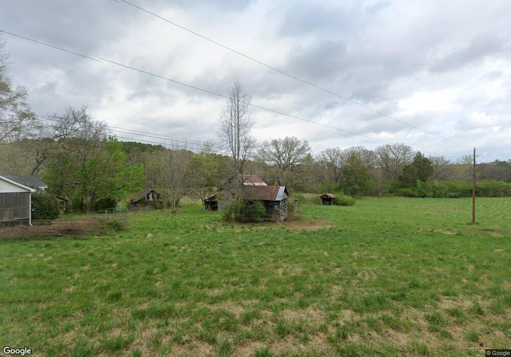
1021 Dry Creek Rd Cedartown, GA 30125
Estimated Value: $119,000 - $186,000
2
Beds
1
Bath
944
Sq Ft
$156/Sq Ft
Est. Value
About This Home
This home is located at 1021 Dry Creek Rd, Cedartown, GA 30125 and is currently estimated at $147,481, approximately $156 per square foot. 1021 Dry Creek Rd is a home located in Polk County with nearby schools including Cedar Christian School.
Ownership History
Date
Name
Owned For
Owner Type
Purchase Details
Closed on
Jan 31, 2024
Sold by
Hopkins R Stanley
Bought by
Dodd Ronald Craig and Dodd Tina
Current Estimated Value
Purchase Details
Closed on
Sep 17, 1985
Sold by
Hopkins Robert H
Bought by
Hopkins Robert H
Purchase Details
Closed on
Mar 11, 1977
Sold by
Parish Grover C
Bought by
Hopkins Robert H
Purchase Details
Closed on
Jul 15, 1965
Bought by
Parish Grover C
Create a Home Valuation Report for This Property
The Home Valuation Report is an in-depth analysis detailing your home's value as well as a comparison with similar homes in the area
Home Values in the Area
Average Home Value in this Area
Purchase History
| Date | Buyer | Sale Price | Title Company |
|---|---|---|---|
| Dodd Ronald Craig | -- | -- | |
| Dodd Ronald Craig | $100,000 | -- | |
| Hopkins Robert H | -- | -- | |
| Hopkins Robert H | -- | -- | |
| Parish Grover C | -- | -- |
Source: Public Records
Tax History Compared to Growth
Tax History
| Year | Tax Paid | Tax Assessment Tax Assessment Total Assessment is a certain percentage of the fair market value that is determined by local assessors to be the total taxable value of land and additions on the property. | Land | Improvement |
|---|---|---|---|---|
| 2024 | $798 | $52,880 | $26,172 | $26,708 |
| 2023 | $722 | $43,792 | $26,172 | $17,620 |
| 2022 | $461 | $32,812 | $17,448 | $15,364 |
| 2021 | $467 | $32,812 | $17,448 | $15,364 |
| 2020 | $468 | $32,812 | $17,448 | $15,364 |
| 2019 | $456 | $30,316 | $17,448 | $12,868 |
| 2018 | $458 | $29,944 | $17,448 | $12,496 |
| 2017 | $448 | $29,944 | $17,448 | $12,496 |
| 2016 | $472 | $30,846 | $18,991 | $11,854 |
| 2015 | $476 | $30,963 | $18,991 | $11,972 |
| 2014 | $478 | $30,963 | $18,991 | $11,972 |
Source: Public Records
Map
Nearby Homes
- 323 Mountain Home Rd
- 148 Persons Rd
- 0 Mountain Home Rd Unit 1020-B 10351940
- 0 Mountain Home Rd Unit 1020-C 10351948
- 0 Mountain Home Rd Unit 1020-A 10351930
- 374 Seab Green Rd
- 1849 Prior Station Rd Unit 77.57 ACRES
- 1849 Prior Station Rd
- 1200 N Cave Spring St
- 424 Michael Blvd
- 39 Summerwind Dr
- 383 Valley Grove Rd
- 0 Cave Spring Rd Unit 10631588
- 0 Cave Spring Rd Unit 7671027
- 208 Silverthorn Way
- 100 Lee Ave
- 382 5th St
- 820 Potash Rd
- 35 Harris Loop
- 293 4th St
- 1089 Dry Creek Rd
- 990 Dry Creek Rd
- 0 Parrish Rd Unit 8099417
- 0 Parrish Rd Unit 5953365
- 0 Parrish Rd Unit 8312396
- 0 Parrish Rd Unit 5938531
- 0 Parrish Rd Unit 8294072
- 0 Parrish Rd Unit 8228989
- 0 Parrish Rd Unit 5882633
- 0 Parrish Rd Unit TR 10 2832010
- 0 Parrish Rd
- 0 Parrish Rd Unit 7400393
- 0 Parrish Rd Unit 10314898
- 0 Parrish Rd Unit 10240776
- 0 Parrish Rd Unit 7323339
- 0 Parrish Rd Unit 7585030
- 0 Parrish Rd Unit 7246920
- 0 Parrish Rd Unit 8109590
- 0 Parrish Rd Unit 5785084
- 0 Parrish Rd Unit 8507517