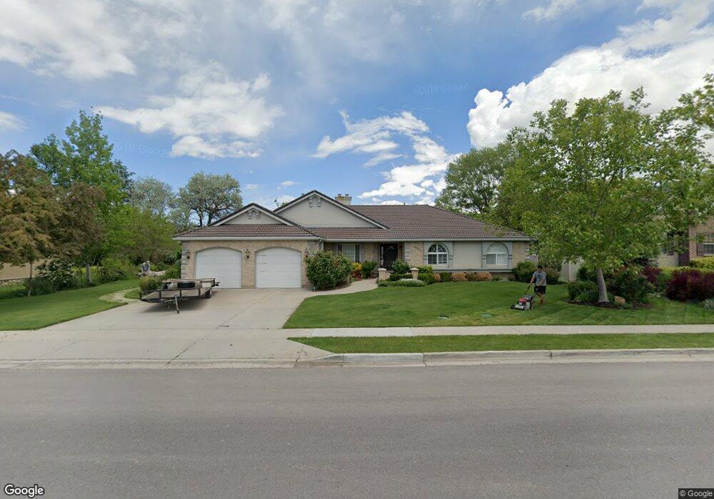
1021 E 1100 N American Fork, UT 84003
Estimated Value: $829,000 - $1,250,000
7
Beds
5
Baths
4,864
Sq Ft
$201/Sq Ft
Est. Value
About This Home
This home is located at 1021 E 1100 N, American Fork, UT 84003 and is currently estimated at $975,938, approximately $200 per square foot. 1021 E 1100 N is a home located in Utah County with nearby schools including Deerfield Elementary School, Mountain Ridge Junior High School, and American Fork High School.
Ownership History
Date
Name
Owned For
Owner Type
Purchase Details
Closed on
Feb 8, 2022
Sold by
Craig Gary M
Bought by
Craig Living Trust
Current Estimated Value
Purchase Details
Closed on
Aug 16, 2016
Sold by
Noth Kenneth W and Noth Cheryl A
Bought by
Craig Gary M and Craig Mry Kay
Home Financials for this Owner
Home Financials are based on the most recent Mortgage that was taken out on this home.
Original Mortgage
$260,000
Interest Rate
3.41%
Mortgage Type
New Conventional
Purchase Details
Closed on
Aug 28, 2008
Sold by
Carlisle Robert J and Carlisle Diane E
Bought by
North Kenneth W and North Cheryl A
Home Financials for this Owner
Home Financials are based on the most recent Mortgage that was taken out on this home.
Original Mortgage
$413,250
Interest Rate
6.59%
Mortgage Type
Purchase Money Mortgage
Purchase Details
Closed on
Dec 24, 2003
Sold by
Johnson Nolan E and Johnson Cathy C
Bought by
Carlisle Robert J and Carlisle Diane E
Purchase Details
Closed on
Jun 10, 1997
Sold by
Carlisle Robert Jay and Carlisle Diane
Bought by
Carlisle Robert J and Carlisle Diane E
Purchase Details
Closed on
Mar 13, 1997
Sold by
Carlisle Robert Jay and Carlisle Diane E
Bought by
Carlisle Robert J and Carlisle Diane E
Create a Home Valuation Report for This Property
The Home Valuation Report is an in-depth analysis detailing your home's value as well as a comparison with similar homes in the area
Home Values in the Area
Average Home Value in this Area
Purchase History
| Date | Buyer | Sale Price | Title Company |
|---|---|---|---|
| Craig Living Trust | -- | Boyack Merrilee A | |
| Craig Gary M | -- | Real Advantage Titleins | |
| North Kenneth W | -- | Signature Title Insurance A | |
| Carlisle Robert J | -- | Signature Title | |
| Carlisle Robert J | -- | -- | |
| Carlisle Robert J | -- | -- |
Source: Public Records
Mortgage History
| Date | Status | Borrower | Loan Amount |
|---|---|---|---|
| Previous Owner | Craig Gary M | $260,000 | |
| Previous Owner | North Kenneth W | $413,250 |
Source: Public Records
Tax History
| Year | Tax Paid | Tax Assessment Tax Assessment Total Assessment is a certain percentage of the fair market value that is determined by local assessors to be the total taxable value of land and additions on the property. | Land | Improvement |
|---|---|---|---|---|
| 2025 | $3,664 | $442,255 | -- | -- |
| 2024 | $3,441 | $407,055 | $0 | $0 |
| 2023 | $3,441 | $405,405 | $0 | $0 |
| 2022 | $3,213 | $373,560 | $0 | $0 |
| 2021 | $2,821 | $512,300 | $181,000 | $331,300 |
| 2020 | $2,743 | $483,100 | $167,600 | $315,500 |
| 2019 | $2,588 | $471,400 | $155,900 | $315,500 |
| 2018 | $2,662 | $463,600 | $148,100 | $315,500 |
| 2017 | $2,651 | $249,150 | $0 | $0 |
| 2016 | $2,853 | $249,150 | $0 | $0 |
| 2015 | $2,724 | $225,775 | $0 | $0 |
| 2014 | $2,471 | $202,015 | $0 | $0 |
Source: Public Records
Map
Nearby Homes
- 1077 N 950 E
- 1045 N 930 E Unit 58
- 1125 N 1270 E
- 3518 N 1450 W
- 9587 N 4500 W
- 1121 E 580 N
- 4675 W Ferguson Way
- 4979 W Willowbank Dr
- 4552 W Windsor Cir
- 9752 N Dorchester Dr
- 4531 W Cambridge Dr
- 462 N 950 E Unit 5
- 837 E 475 N
- 5032 W Northwood Ln
- 912 E Ellens St Unit 1
- 5061 W Evergreen Ln
- 4968 W Evergreen Ln
- 470 N 950 E Unit LOT 6
- 5034 W Green Ash Ln
- 5042 W Green Ash Ln
- 1047 E 1100 N
- 983 E 1100 N
- 1016 E 1100 N
- 1016 E 1100 N Unit 41
- 1002 E 1100 N Unit 40
- 1002 E 1100 N
- 1143 N 1050 E
- 1131 N 1050 E
- 1088 N 980 E Unit 28
- 1088 N 980 E
- 1046 E 1100 N Unit 43
- 1046 E 1100 N
- 1017 E 1060 N
- 1001 E 1060 N
- 1033 E 1060 N Unit 22
- 1033 E 1060 N
- 1081 E 1100 N
- 1155 N 1050 E
- 1072 N 980 E
- 1132 N 1050 E
Your Personal Tour Guide
Ask me questions while you tour the home.