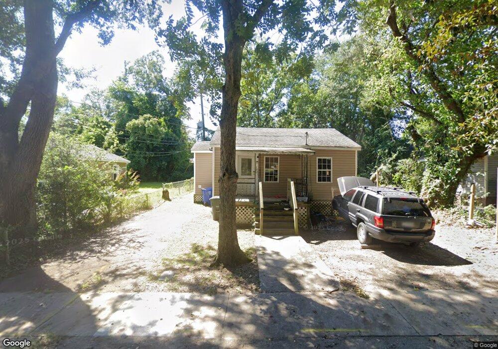
1021 Howe St Columbia, SC 29205
Rosewood NeighborhoodEstimated Value: $83,000 - $173,000
2
Beds
1
Bath
678
Sq Ft
$189/Sq Ft
Est. Value
About This Home
This home is located at 1021 Howe St, Columbia, SC 29205 and is currently estimated at $127,861, approximately $188 per square foot. 1021 Howe St is a home located in Richland County with nearby schools including Rosewood Elementary School, Hand Middle School, and Dreher High School.
Ownership History
Date
Name
Owned For
Owner Type
Purchase Details
Closed on
Dec 27, 2010
Sold by
Pearce Margaret S and Pearce Michael K
Bought by
Wk Investment Properties Llc
Current Estimated Value
Home Financials for this Owner
Home Financials are based on the most recent Mortgage that was taken out on this home.
Original Mortgage
$30,400
Outstanding Balance
$916
Interest Rate
4.4%
Mortgage Type
Purchase Money Mortgage
Estimated Equity
$126,945
Purchase Details
Closed on
Jun 7, 2002
Sold by
Professional Investors Inc
Bought by
Pearce Margaret S and Pearce Michael K
Home Financials for this Owner
Home Financials are based on the most recent Mortgage that was taken out on this home.
Original Mortgage
$25,500
Interest Rate
6.77%
Purchase Details
Closed on
Nov 8, 1999
Sold by
Ann Gantt Cecilia
Bought by
Martin Luther King Jr Memorial Baptist C
Create a Home Valuation Report for This Property
The Home Valuation Report is an in-depth analysis detailing your home's value as well as a comparison with similar homes in the area
Home Values in the Area
Average Home Value in this Area
Purchase History
| Date | Buyer | Sale Price | Title Company |
|---|---|---|---|
| Wk Investment Properties Llc | $38,000 | -- | |
| Pearce Margaret S | $26,000 | -- | |
| Professional Investors Inc | $17,000 | -- | |
| Martin Luther King Jr Memorial Baptist C | -- | -- |
Source: Public Records
Mortgage History
| Date | Status | Borrower | Loan Amount |
|---|---|---|---|
| Open | Wk Investment Properties Llc | $30,400 | |
| Previous Owner | Pearce Margaret S | $25,500 |
Source: Public Records
Tax History Compared to Growth
Tax History
| Year | Tax Paid | Tax Assessment Tax Assessment Total Assessment is a certain percentage of the fair market value that is determined by local assessors to be the total taxable value of land and additions on the property. | Land | Improvement |
|---|---|---|---|---|
| 2024 | $987 | $35,300 | $0 | $0 |
| 2023 | $967 | $1,228 | $0 | $0 |
| 2022 | $887 | $30,700 | $8,000 | $22,700 |
| 2021 | $894 | $1,840 | $0 | $0 |
| 2020 | $907 | $1,840 | $0 | $0 |
| 2019 | $909 | $1,840 | $0 | $0 |
| 2018 | $880 | $1,760 | $0 | $0 |
| 2017 | $856 | $1,760 | $0 | $0 |
| 2016 | $833 | $1,760 | $0 | $0 |
| 2015 | $828 | $1,760 | $0 | $0 |
| 2014 | $820 | $29,300 | $0 | $0 |
| 2013 | -- | $1,760 | $0 | $0 |
Source: Public Records
Map
Nearby Homes
- 2212 Kingswood Dr
- 23 Graymont Cir
- 2729 Kingswood Dr
- 2728 Holt Dr
- 2410 Superior St
- 1085 Shop Rd Unit 145
- 1085 Shop Rd Unit 419
- 1085 Shop Rd Unit 425
- 1085 Shop Rd Unit 414
- 2218 Rosewood Dr
- 316 S Edisto Ave
- 309 S Edisto Ave
- 1064 Key Rd
- 911 Airport Blvd
- 1731 Maplewood Dr
- 2600 Kiawah Ave
- 312 S Woodrow St
- 1035 S Holly St
- 1200 Bluff Rd Unit 14
- 121 Saluda Ave