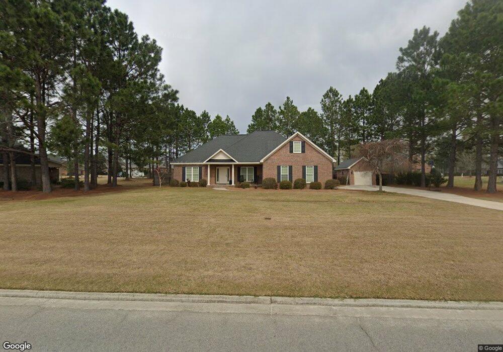
1021 Johnson Dr Statesboro, GA 30461
Estimated Value: $442,198 - $507,000
4
Beds
3
Baths
2,350
Sq Ft
$199/Sq Ft
Est. Value
About This Home
This home is located at 1021 Johnson Dr, Statesboro, GA 30461 and is currently estimated at $468,550, approximately $199 per square foot. 1021 Johnson Dr is a home located in Bulloch County with nearby schools including Brooklet Elementary School, Southeast Bulloch High School, and Southeast Bulloch Middle School.
Ownership History
Date
Name
Owned For
Owner Type
Purchase Details
Closed on
Aug 16, 2013
Sold by
Nesmith Construction Inc
Bought by
Bekqeli Colston Windham Blake and Bekqeli Colston Jeta
Current Estimated Value
Home Financials for this Owner
Home Financials are based on the most recent Mortgage that was taken out on this home.
Original Mortgage
$165,000
Outstanding Balance
$122,705
Interest Rate
4.39%
Mortgage Type
New Conventional
Estimated Equity
$345,845
Purchase Details
Closed on
Apr 15, 2013
Sold by
Johnson Run Llc
Bought by
Nesmith Construction Inc
Create a Home Valuation Report for This Property
The Home Valuation Report is an in-depth analysis detailing your home's value as well as a comparison with similar homes in the area
Home Values in the Area
Average Home Value in this Area
Purchase History
| Date | Buyer | Sale Price | Title Company |
|---|---|---|---|
| Bekqeli Colston Windham Blake | $220,000 | -- | |
| Nesmith Construction Inc | $16,500 | -- |
Source: Public Records
Mortgage History
| Date | Status | Borrower | Loan Amount |
|---|---|---|---|
| Open | Bekqeli Colston Windham Blake | $165,000 |
Source: Public Records
Tax History Compared to Growth
Tax History
| Year | Tax Paid | Tax Assessment Tax Assessment Total Assessment is a certain percentage of the fair market value that is determined by local assessors to be the total taxable value of land and additions on the property. | Land | Improvement |
|---|---|---|---|---|
| 2024 | $3,397 | $156,520 | $26,000 | $130,520 |
| 2023 | $3,488 | $147,160 | $16,000 | $131,160 |
| 2022 | $2,789 | $129,570 | $16,000 | $113,570 |
| 2021 | $2,547 | $115,614 | $16,000 | $99,614 |
| 2020 | $2,483 | $112,089 | $16,000 | $96,089 |
| 2019 | $2,282 | $102,644 | $6,448 | $96,196 |
| 2018 | $2,329 | $100,817 | $6,448 | $94,369 |
| 2017 | $2,243 | $96,147 | $6,448 | $89,699 |
| 2016 | $2,225 | $93,188 | $6,448 | $86,740 |
| 2015 | $2,158 | $90,102 | $6,448 | $83,654 |
| 2014 | $1,948 | $90,102 | $6,448 | $83,654 |
Source: Public Records
Map
Nearby Homes
- 6302 C T Place
- 1016 Johnson Dr
- 4026 Denton Loop
- 252 Hagin Ln
- 1603 Lennox Rd
- 893 W Lane St
- 0 E Highway 80 Hwy Unit 10490324
- 1805 Nottingham Rd
- 19477 Us Highway 80 E
- 1008 Cobb Rd
- 713 W Lane St
- 10544 Burkhalter Rd
- 302 Providence Trace
- 302 Providence Trc
- 720 Ogeechee Dr E
- 0 George Moore Rd Unit SA333925
- 0 George Moore Rd Unit 10559523
- 731 Ogeechee Dr E
- 684 Frances Ln
- 202 Birdsill St
- 3098 Mccall Blvd
- 3074 Mccall Blvd
- 4002 Denton Loop
- 3100 Mccall Blvd Unit 13
- 1020 Johnson Dr
- 1020 Johnson Dr Unit 11
- 0 Mccall Blvd Unit 135 7545353
- 0 Mccall Blvd Unit 3251144
- 0 Mccall Blvd Unit LOT 59 7044448
- 0 Mccall Blvd Unit LOT 13 7150301
- 0 Mccall Blvd Unit 136 7505561
- 0 Mccall Blvd Unit 135 7505556
- 0 Mccall Blvd Unit 177 7498508
- 0 Mccall Blvd Unit 176 7498505
- 0 Mccall Blvd Unit 159 7498467
- 0 Mccall Blvd Unit 174 7498262
- 0 Mccall Blvd Unit 134 7498233
- 0 Mccall Blvd Unit 132 7498228
- 0 Mccall Blvd Unit 155 7498219
- 0 Mccall Blvd Unit 151 7498204