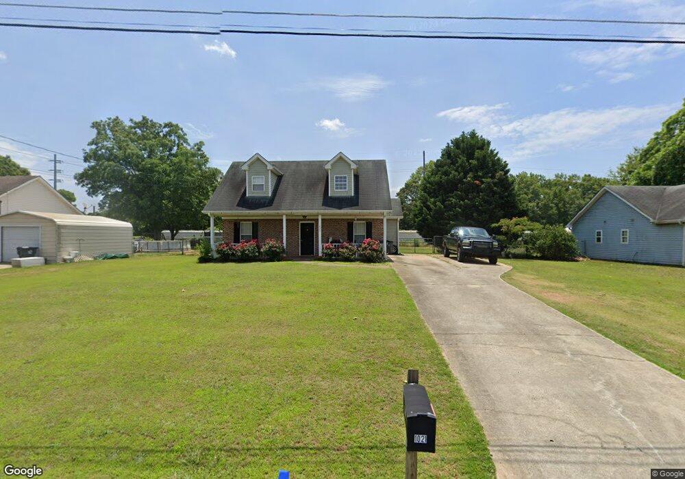
1021 Joseph Ln Social Circle, GA 30025
Estimated Value: $244,000 - $279,000
--
Bed
--
Bath
1,268
Sq Ft
$205/Sq Ft
Est. Value
About This Home
This home is located at 1021 Joseph Ln, Social Circle, GA 30025 and is currently estimated at $259,378, approximately $204 per square foot. 1021 Joseph Ln is a home located in Walton County with nearby schools including Social Circle Primary School, Social Circle Elementary School, and Social Circle Middle School.
Ownership History
Date
Name
Owned For
Owner Type
Purchase Details
Closed on
Aug 7, 2006
Sold by
Hsbc Mtg Svcs Inc
Bought by
Craig Deeeta M
Current Estimated Value
Purchase Details
Closed on
May 2, 2006
Sold by
Walker Cheryl M
Bought by
Hsbc Mtg Svcs Inc
Purchase Details
Closed on
Feb 28, 2005
Sold by
Richard Paul D
Bought by
Walker Cheryl M
Home Financials for this Owner
Home Financials are based on the most recent Mortgage that was taken out on this home.
Original Mortgage
$83,200
Interest Rate
7.88%
Mortgage Type
New Conventional
Purchase Details
Closed on
Jul 30, 1999
Sold by
Morrow David
Bought by
Richard Paul D
Home Financials for this Owner
Home Financials are based on the most recent Mortgage that was taken out on this home.
Original Mortgage
$79,246
Interest Rate
7.66%
Mortgage Type
FHA
Create a Home Valuation Report for This Property
The Home Valuation Report is an in-depth analysis detailing your home's value as well as a comparison with similar homes in the area
Home Values in the Area
Average Home Value in this Area
Purchase History
| Date | Buyer | Sale Price | Title Company |
|---|---|---|---|
| Craig Deeeta M | $97,000 | -- | |
| Hsbc Mtg Svcs Inc | $88,502 | -- | |
| Walker Cheryl M | $104,000 | -- | |
| Richard Paul D | $79,900 | -- |
Source: Public Records
Mortgage History
| Date | Status | Borrower | Loan Amount |
|---|---|---|---|
| Previous Owner | Walker Cheryl M | $83,200 | |
| Previous Owner | Richard Paul D | $79,246 |
Source: Public Records
Tax History Compared to Growth
Tax History
| Year | Tax Paid | Tax Assessment Tax Assessment Total Assessment is a certain percentage of the fair market value that is determined by local assessors to be the total taxable value of land and additions on the property. | Land | Improvement |
|---|---|---|---|---|
| 2024 | $3,261 | $91,680 | $16,000 | $75,680 |
| 2023 | $909 | $87,320 | $14,400 | $72,920 |
| 2022 | $788 | $75,680 | $12,000 | $63,680 |
| 2021 | $576 | $55,320 | $8,000 | $47,320 |
| 2020 | $549 | $51,440 | $8,000 | $43,440 |
| 2019 | $542 | $47,600 | $8,000 | $39,600 |
| 2018 | $519 | $47,600 | $8,000 | $39,600 |
| 2017 | $1,835 | $43,920 | $8,000 | $35,920 |
| 2016 | $393 | $34,680 | $8,000 | $26,680 |
| 2015 | $361 | $32,120 | $8,000 | $24,120 |
| 2014 | -- | $30,760 | $0 | $0 |
Source: Public Records
Map
Nearby Homes
- 241 E Ash St
- 582 S Cherokee Rd
- 603 Lakewood Dr SW
- 159 S Forest Ave
- 207 E Hightower Trail
- 357 W Hightower Trail
- 135 N Dogwood Ave
- Adrian Plan at Conner Springs
- Sinclair Plan at Conner Springs
- Shiloh Plan at Conner Springs
- Mira Plan at Conner Springs
- Hemingway Plan at Conner Springs
- Harding Plan at Conner Springs
- Tucker Front Porch Plan at Conner Springs
- 127 Holly St NE
- 432 Chestnut St
- 177 ORWELL Drive
- 304 Dogwood Ave
- 381 Crossroads Dr
- 226 Rogue Rd
- 1025 Joseph Ln
- 1017 Joseph Ln
- 1029 Joseph Ln
- 1013 Joseph Ln
- 1020 Joseph Ln
- 1016 Joseph Ln
- 1024 Joseph Ln
- 1028 Joseph Ln
- 1008 Joseph Ln Unit 28
- 1008 Joseph Ln
- 1033 Joseph Ln
- 1009 Joseph Ln
- 370 Hickory St SW
- 400 Hickory St
- 400 Hickory St SW
- 1039 Joseph Ln
- 362 Hickory St SW Unit 8
- 362 Hickory St SW
- 1032 Joseph Ln