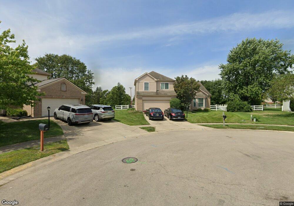
1021 Kirkwall Ct Miamisburg, OH 45342
Estimated Value: $310,000 - $381,000
3
Beds
2
Baths
1,883
Sq Ft
$179/Sq Ft
Est. Value
About This Home
This home is located at 1021 Kirkwall Ct, Miamisburg, OH 45342 and is currently estimated at $337,748, approximately $179 per square foot. 1021 Kirkwall Ct is a home located in Montgomery County with nearby schools including Miamisburg High School and Bethel Baptist School.
Ownership History
Date
Name
Owned For
Owner Type
Purchase Details
Closed on
Jun 11, 2014
Sold by
Barhorst Ann M and Culp Ann M
Bought by
Culp Donald R
Current Estimated Value
Home Financials for this Owner
Home Financials are based on the most recent Mortgage that was taken out on this home.
Original Mortgage
$148,750
Interest Rate
4.18%
Mortgage Type
Future Advance Clause Open End Mortgage
Purchase Details
Closed on
Mar 27, 2002
Sold by
Barhorst Teresa A
Bought by
Culp Donald R and Culp Ann M
Home Financials for this Owner
Home Financials are based on the most recent Mortgage that was taken out on this home.
Original Mortgage
$150,400
Interest Rate
6.37%
Mortgage Type
Purchase Money Mortgage
Create a Home Valuation Report for This Property
The Home Valuation Report is an in-depth analysis detailing your home's value as well as a comparison with similar homes in the area
Home Values in the Area
Average Home Value in this Area
Purchase History
| Date | Buyer | Sale Price | Title Company |
|---|---|---|---|
| Culp Donald R | -- | None Available | |
| Culp Donald R | $177,000 | -- |
Source: Public Records
Mortgage History
| Date | Status | Borrower | Loan Amount |
|---|---|---|---|
| Closed | Culp Donald R | $148,750 | |
| Closed | Culp Donald R | $150,400 |
Source: Public Records
Tax History Compared to Growth
Tax History
| Year | Tax Paid | Tax Assessment Tax Assessment Total Assessment is a certain percentage of the fair market value that is determined by local assessors to be the total taxable value of land and additions on the property. | Land | Improvement |
|---|---|---|---|---|
| 2024 | $5,878 | $92,710 | $19,550 | $73,160 |
| 2023 | $5,878 | $92,710 | $19,550 | $73,160 |
| 2022 | $5,245 | $69,710 | $14,700 | $55,010 |
| 2021 | $4,638 | $69,710 | $14,700 | $55,010 |
| 2020 | $4,635 | $69,710 | $14,700 | $55,010 |
| 2019 | $4,323 | $59,730 | $10,500 | $49,230 |
| 2018 | $4,337 | $59,730 | $10,500 | $49,230 |
| 2017 | $4,308 | $59,730 | $10,500 | $49,230 |
| 2016 | $4,087 | $54,610 | $10,500 | $44,110 |
| 2015 | $4,007 | $54,610 | $10,500 | $44,110 |
| 2014 | $4,007 | $54,610 | $10,500 | $44,110 |
| 2012 | -- | $60,440 | $15,960 | $44,480 |
Source: Public Records
Map
Nearby Homes
- 2127 Carrington Ln
- 2141 Rosina Dr
- 1131 Castleton Ct
- 1157 Bonniebrook Dr
- 736 Decker Dr
- 1734 Rosina Dr
- 712 Decker Dr
- 628 Jamestown Dr
- 2279 Rosina Dr
- 00 Benner Rd
- 1808 Burnside Dr
- 1 Pendle Point
- 902 Althea Dr
- 1035 Woods View Ct
- 807 Dunaway St
- 766 Dunaway St
- 615 Burnside Dr
- 1013 S Heincke Rd
- 1826 Ashley Dr
- 3902 Augusta Rd
- 1025 Kirkwall Ct
- 1011 Kirkwall Ct
- 1886 Sulky Trail
- 1892 Sulky Trail
- 1020 Kirkwall Ct
- 1100 S Gebhart Church Rd
- 1880 Sulky Trail
- 1898 Sulky Trail
- 2040 Rosina Dr
- 1874 Sulky Trail
- 2015 Rosina Dr
- 2025 Rosina Dr
- 2035 Rosina Dr
- 2073 Leis Rd
- 2083 Leis Rd
- 2063 Leis Rd
- 2060 Rosina Dr
- 1895 Brandonhall Dr
- 1868 Sulky Trail
- 1887 Sulky Trail