Estimated Value: $304,775 - $620,000
--
Bed
--
Bath
--
Sq Ft
6,273
Sq Ft Lot
About This Home
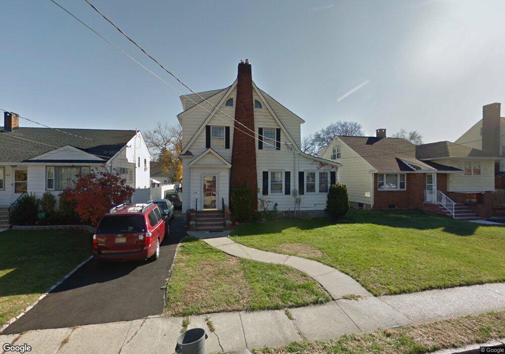
This home is located at 1021 Lorraine Ave, Union, NJ 07083 and is currently estimated at $528,194. 1021 Lorraine Ave is a home located in Union County with nearby schools including Livingston Elementary School, Union High School, and St Michael Parish School.
Ownership History
Date
Name
Owned For
Owner Type
Purchase Details
Closed on
Apr 4, 2007
Sold by
Holte Josh and Holte Michelle
Bought by
Lancaster Linda S and Lancaster Elizabeth A
Current Estimated Value
Home Financials for this Owner
Home Financials are based on the most recent Mortgage that was taken out on this home.
Original Mortgage
$205,000
Outstanding Balance
$124,221
Interest Rate
6.19%
Mortgage Type
Purchase Money Mortgage
Estimated Equity
$403,973
Purchase Details
Closed on
Feb 27, 1998
Sold by
Panichi Iole
Bought by
Holte Josh and Holte Michelle
Home Financials for this Owner
Home Financials are based on the most recent Mortgage that was taken out on this home.
Original Mortgage
$156,695
Interest Rate
6.93%
Mortgage Type
FHA
Create a Home Valuation Report for This Property
The Home Valuation Report is an in-depth analysis detailing your home's value as well as a comparison with similar homes in the area
Home Values in the Area
Average Home Value in this Area
Purchase History
| Date | Buyer | Sale Price | Title Company |
|---|---|---|---|
| Lancaster Linda S | $415,000 | Fidelity Natl Title Ins Co | |
| Holte Josh | $162,000 | -- |
Source: Public Records
Mortgage History
| Date | Status | Borrower | Loan Amount |
|---|---|---|---|
| Open | Lancaster Linda S | $205,000 | |
| Previous Owner | Holte Josh | $156,695 |
Source: Public Records
Tax History Compared to Growth
Tax History
| Year | Tax Paid | Tax Assessment Tax Assessment Total Assessment is a certain percentage of the fair market value that is determined by local assessors to be the total taxable value of land and additions on the property. | Land | Improvement |
|---|---|---|---|---|
| 2025 | $10,885 | $48,700 | $20,900 | $27,800 |
| 2024 | $10,553 | $48,700 | $20,900 | $27,800 |
| 2023 | $10,553 | $48,700 | $20,900 | $27,800 |
| 2022 | $10,186 | $48,700 | $20,900 | $27,800 |
| 2021 | $9,939 | $48,700 | $20,900 | $27,800 |
| 2020 | $9,741 | $48,700 | $20,900 | $27,800 |
| 2019 | $9,610 | $48,700 | $20,900 | $27,800 |
| 2018 | $9,446 | $48,700 | $20,900 | $27,800 |
| 2017 | $9,307 | $48,700 | $20,900 | $27,800 |
| 2016 | $8,968 | $48,100 | $20,900 | $27,200 |
| 2015 | $8,819 | $48,100 | $20,900 | $27,200 |
| 2014 | $8,621 | $48,100 | $20,900 | $27,200 |
Source: Public Records
Map
Nearby Homes
- 1370 Beverly Rd
- 969 Arnet Ave
- 1322 Marcella Dr
- 750 Midland Blvd
- 875 Salem Rd
- 1393 Cornell Place
- 1040 Cranbrook Rd
- 365 Broadwell Ave
- 314 Fitzpatrick St
- 328 Minute Arms Rd
- 795 Colonial Arms Rd
- 1267 Erhardt St
- 292 Crann St
- 507 Locust Ave
- 790 Green Ln Unit A1
- 553 Harvard Ave
- 717 Winchester Ave
- 557 Yale Ave
- 286 Mclean Place
- 1084 Woodland Ave
- 1017 Lorraine Ave
- 1025 Lorraine Ave
- 1013 Lorraine Ave
- 1029 Lorraine Ave
- 1020 Sterling Rd
- 1016 Sterling Rd
- 1024 Sterling Rd
- 1033 Lorraine Ave
- 1028 Sterling Rd
- 1012 Sterling Rd
- 1020 Lorraine Ave
- 1016 Lorraine Ave
- 1028 Lorraine Ave
- 1030 Sterling Rd
- 1037 Lorraine Ave
- 1030 Lorraine Ave
- 1012 Lorraine Ave
- 1010 Sterling Rd
- 1008 Lorraine Ave
- 1032 Lorraine Ave