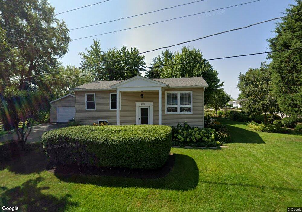
1021 Mayfield Dr Unit 2 Round Lake Beach, IL 60073
Estimated Value: $230,000 - $248,000
--
Bed
1
Bath
925
Sq Ft
$261/Sq Ft
Est. Value
About This Home
This home is located at 1021 Mayfield Dr Unit 2, Round Lake Beach, IL 60073 and is currently estimated at $241,115, approximately $260 per square foot. 1021 Mayfield Dr Unit 2 is a home located in Lake County with nearby schools including Raymond Ellis Elementary School, Round Lake Middle School, and Round Lake High School.
Ownership History
Date
Name
Owned For
Owner Type
Purchase Details
Closed on
Jun 1, 1995
Sold by
Hunt Myron L and Hunt Lola
Bought by
Ochoa Manuel and Ochoa Raul
Current Estimated Value
Home Financials for this Owner
Home Financials are based on the most recent Mortgage that was taken out on this home.
Original Mortgage
$87,300
Interest Rate
7.9%
Purchase Details
Closed on
Mar 10, 1994
Sold by
Hernandez Adan and Hernandez Adam
Bought by
Hunt Myron L and Hunt Lola F
Create a Home Valuation Report for This Property
The Home Valuation Report is an in-depth analysis detailing your home's value as well as a comparison with similar homes in the area
Home Values in the Area
Average Home Value in this Area
Purchase History
| Date | Buyer | Sale Price | Title Company |
|---|---|---|---|
| Ochoa Manuel | $90,000 | Chicago Title Insurance Co | |
| Hunt Myron L | -- | -- |
Source: Public Records
Mortgage History
| Date | Status | Borrower | Loan Amount |
|---|---|---|---|
| Closed | Ochoa Manuel | $87,300 |
Source: Public Records
Tax History Compared to Growth
Tax History
| Year | Tax Paid | Tax Assessment Tax Assessment Total Assessment is a certain percentage of the fair market value that is determined by local assessors to be the total taxable value of land and additions on the property. | Land | Improvement |
|---|---|---|---|---|
| 2024 | $5,520 | $74,050 | $12,013 | $62,037 |
| 2023 | $5,120 | $64,725 | $10,500 | $54,225 |
| 2022 | $5,120 | $57,523 | $9,039 | $48,484 |
| 2021 | $5,158 | $52,678 | $8,688 | $43,990 |
| 2020 | $4,932 | $50,121 | $8,266 | $41,855 |
| 2019 | $4,780 | $48,087 | $7,931 | $40,156 |
| 2018 | $4,409 | $44,310 | $7,630 | $36,680 |
| 2017 | $3,749 | $41,680 | $7,177 | $34,503 |
| 2016 | $3,570 | $38,475 | $6,625 | $31,850 |
| 2015 | $3,443 | $35,149 | $6,052 | $29,097 |
| 2014 | $2,216 | $27,579 | $5,904 | $21,675 |
| 2012 | $2,256 | $21,661 | $6,167 | $15,494 |
Source: Public Records
Map
Nearby Homes
- 931 N Fairfield Rd
- 915 Mayfield Dr
- 1037 N Village Dr Unit 3
- 905 Buena Vista Dr
- 1160 N Red Oak Cir Unit 1160-1
- 347 N Red Oak Cir Unit 406
- 1248 N Red Oak Cir Unit 2
- 1316 N Red Oak Cir Unit 2
- 1110 N Fairfield Rd
- 1443 Spring Brook Ct Unit 1C
- 123 Nasa Cir
- 1256 N Split Oak Cir
- 1221 N Village Dr
- 1315 Cherokee Dr
- 1506 Spring Brook Ct Unit 2C
- 1376 W Split Oak Cir
- 1475 W Sedgewood Ct
- 1477 W Sedgewood Ct
- 24513 W Stub Ave
- 1506 W Turtle Creek Ln
- 1007 Barberry Ln
- 1022 Mayfield Dr Unit 2
- 1005 Barberry Ln
- 1017 Barberry Ln
- 1003 Barberry Ln
- 1010 Barberry Ln
- 1008 Barberry Ln
- 1019 Barberry Ln
- 1006 Barberry Ln
- 1102 Mayfield Dr
- 1001 Barberry Ln Unit 2
- 1018 Barberry Ln
- 1004 Barberry Ln
- 1021 Barberry Ln
- 1002 Barberry Ln
- 1002 Barberry Ln Unit 2
- 927 Barberry Ln
- 1020 Barberry Ln
- 1023 Barberry Ln
- 1108 Mayfield Dr