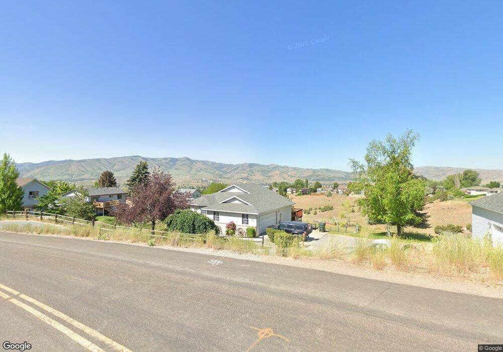
1021 Mount McGuire Dr Pocatello, ID 83201
Northeast Pocatello NeighborhoodEstimated Value: $407,000 - $519,000
5
Beds
3
Baths
2,710
Sq Ft
$165/Sq Ft
Est. Value
About This Home
This home is located at 1021 Mount McGuire Dr, Pocatello, ID 83201 and is currently estimated at $447,359, approximately $165 per square foot. 1021 Mount McGuire Dr is a home located in Bannock County with nearby schools including Washington Elementary School, Franklin Middle School, and Century High School.
Ownership History
Date
Name
Owned For
Owner Type
Purchase Details
Closed on
Jul 25, 2018
Sold by
Rodnick Kenneth J and Rodnick Cheryl E
Bought by
Serve Kinta and Serve Mark
Current Estimated Value
Home Financials for this Owner
Home Financials are based on the most recent Mortgage that was taken out on this home.
Original Mortgage
$91,000
Outstanding Balance
$78,865
Interest Rate
4.5%
Mortgage Type
New Conventional
Estimated Equity
$368,494
Create a Home Valuation Report for This Property
The Home Valuation Report is an in-depth analysis detailing your home's value as well as a comparison with similar homes in the area
Home Values in the Area
Average Home Value in this Area
Purchase History
| Date | Buyer | Sale Price | Title Company |
|---|---|---|---|
| Serve Kinta | -- | Pioneer Title Pocatello |
Source: Public Records
Mortgage History
| Date | Status | Borrower | Loan Amount |
|---|---|---|---|
| Open | Serve Kinta | $91,000 |
Source: Public Records
Tax History Compared to Growth
Tax History
| Year | Tax Paid | Tax Assessment Tax Assessment Total Assessment is a certain percentage of the fair market value that is determined by local assessors to be the total taxable value of land and additions on the property. | Land | Improvement |
|---|---|---|---|---|
| 2024 | $3,089 | $365,368 | $74,000 | $291,368 |
| 2023 | $3,792 | $393,595 | $74,000 | $319,595 |
| 2022 | $3,792 | $319,312 | $67,000 | $252,312 |
| 2021 | $3,273 | $319,312 | $67,000 | $252,312 |
| 2020 | $2,585 | $264,056 | $54,270 | $209,786 |
| 2019 | $2,700 | $239,237 | $71,449 | $167,788 |
| 2018 | $2,118 | $189,827 | $47,633 | $142,194 |
| 2017 | $2,101 | $189,827 | $47,633 | $142,194 |
| 2016 | $2,088 | $189,827 | $47,633 | $142,194 |
| 2015 | $2,221 | $0 | $0 | $0 |
| 2012 | -- | $187,126 | $47,633 | $139,493 |
Source: Public Records
Map
Nearby Homes
- 2946 Birdie Thompson Dr
- 2702 Birdie Thompson Dr
- 3440 Somerset Dr
- 1200 Hospital Way
- TBD Eagles Landing
- 367 La Montagna Strada
- 291 La Valle Strada
- 4444 E Center St
- 4456 Center St
- 508 Vista Dr
- 514 Vista Dr
- 2303 Siena Dr
- 564 Vista Dr
- 4492 E Center St
- 1818 E Terry St
- 2338 Siena Dr
- 4514 E Center St
- 8997 W Buckskin Rd
- 33 Temple Ave
- 140 N 19th Ave
- 989 Mount McGuire Dr
- 2866 Silverwood Place
- 2888 Silverwood Place
- 2850 Silverwood Place
- 1028 Mount McGuire Dr
- 2832 Silverwood Place
- 1016 Mount McGuire Dr
- 1046 Mount McGuire Dr
- 2869 Silverwood Place
- 2855 Silverwood Place
- 2833 Silverwood Place
- 2816 Silverwood Place
- 998 Mount McGuire Dr
- 1057 Cache Peak Way
- 2800 Silverwood Place
- 986 Mount McGuire Dr
- 2815 Silverwood Place
- TBD Mount McGuire Unit Lot43
- TBD Mount McGuire