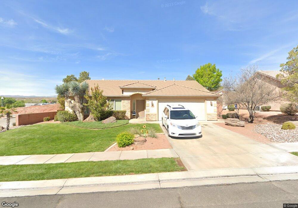
1021 N 2190 W Saint George, UT 84770
Estimated Value: $429,421 - $499,000
3
Beds
2
Baths
1,505
Sq Ft
$308/Sq Ft
Est. Value
About This Home
This home is located at 1021 N 2190 W, Saint George, UT 84770 and is currently estimated at $463,355, approximately $307 per square foot. 1021 N 2190 W is a home located in Washington County with nearby schools including Snow Canyon Middle School, Red Mountain School, and Lava Ridge Intermediate School.
Ownership History
Date
Name
Owned For
Owner Type
Purchase Details
Closed on
Dec 23, 2024
Sold by
Perino Lloyd E
Bought by
Lloyd Perino Revocable Trust and Perino
Current Estimated Value
Purchase Details
Closed on
Jul 3, 2013
Sold by
Gull Patricia Ann and Gull Family Trust
Bought by
Perino Lloyd
Home Financials for this Owner
Home Financials are based on the most recent Mortgage that was taken out on this home.
Original Mortgage
$147,000
Interest Rate
3.79%
Mortgage Type
New Conventional
Purchase Details
Closed on
Sep 2, 2010
Sold by
Gull Pat A
Bought by
Gull Patricia Ann and Gull Family Trust
Home Financials for this Owner
Home Financials are based on the most recent Mortgage that was taken out on this home.
Original Mortgage
$83,300
Interest Rate
4.51%
Mortgage Type
New Conventional
Create a Home Valuation Report for This Property
The Home Valuation Report is an in-depth analysis detailing your home's value as well as a comparison with similar homes in the area
Home Values in the Area
Average Home Value in this Area
Purchase History
| Date | Buyer | Sale Price | Title Company |
|---|---|---|---|
| Lloyd Perino Revocable Trust | -- | None Listed On Document | |
| Perino Lloyd | -- | First American Title Company | |
| Gull Patricia Ann | -- | Backman Fptp | |
| Gull Pat A | -- | Backman Fptp |
Source: Public Records
Mortgage History
| Date | Status | Borrower | Loan Amount |
|---|---|---|---|
| Previous Owner | Perino Lloyd | $147,000 | |
| Previous Owner | Gull Pat A | $83,300 |
Source: Public Records
Tax History Compared to Growth
Tax History
| Year | Tax Paid | Tax Assessment Tax Assessment Total Assessment is a certain percentage of the fair market value that is determined by local assessors to be the total taxable value of land and additions on the property. | Land | Improvement |
|---|---|---|---|---|
| 2025 | $1,522 | $228,030 | $57,750 | $170,280 |
| 2023 | $1,537 | $229,625 | $55,000 | $174,625 |
| 2022 | $1,651 | $231,990 | $55,000 | $176,990 |
| 2021 | $1,470 | $308,100 | $65,000 | $243,100 |
| 2020 | $1,329 | $262,200 | $65,000 | $197,200 |
| 2019 | $1,321 | $254,600 | $60,000 | $194,600 |
| 2018 | $1,273 | $126,720 | $0 | $0 |
| 2017 | $1,151 | $111,265 | $0 | $0 |
| 2016 | $1,198 | $107,085 | $0 | $0 |
| 2015 | $1,237 | $106,040 | $0 | $0 |
| 2014 | $1,242 | $107,195 | $0 | $0 |
Source: Public Records
Map
Nearby Homes
- 2166 W 1010 N Unit 42
- 1594 W Sunset Blvd Unit 3
- 875 Country Ln
- 2157 W 1230 N
- 1259 N 2190 W
- 1225 N Dixie Downs Rd Unit 29
- 1225 N Dixie Downs Rd Unit 103
- 1225 N Dixie Downs Rd Unit 52
- 1225 N Dixie Downs Rd Unit 16
- 1225 N Dixie Downs Rd Unit 42
- 1225 N Dixie Downs Rd Unit 136
- 1225 N Dixie Downs Rd Unit 69
- 1225 N Dixie Downs Rd Unit 100
- 2174 W 1270 N
- 2186 W 1270 N
- 2368 Covey Ln
- 1840 W 1100 N Unit 28
- 1840 W 1100 N Unit 17
- 1840 W 1100 N Unit 55
- 1331 N Dixie Downs Rd Unit 100
- 1033 N 2190 W
- 2178 W 1010 N
- 2178 W 1010 N Unit 41
- 2181 W 1050 N
- 1047 N 2190 W Unit 60
- 999 N 2190 W
- 999 N 2190 W Unit 1
- 2183 W 1050 N Unit 46
- 2183 W 1050 N Unit 48
- 2177 W 1010 N
- 2177 W 1010 N Unit 40
- 2167 W 1050 N
- 987 N 2190 W
- 1065 N 2190 W
- 2182 W 1050 N
- 2180 W 970 N
- 2154 W 1010 N
- 2155 W 1050 N
- 2155 W 1050 N Unit 46
- 2168 W 1050 N