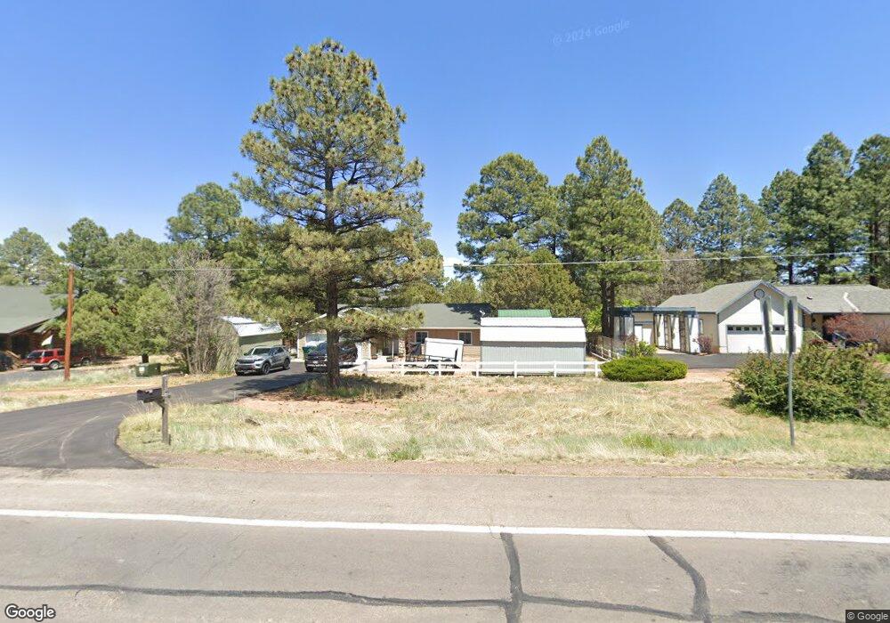
1021 N Clark Rd Show Low, AZ 85901
Estimated Value: $439,551 - $550,000
--
Bed
--
Bath
1,512
Sq Ft
$323/Sq Ft
Est. Value
About This Home
This home is located at 1021 N Clark Rd, Show Low, AZ 85901 and is currently estimated at $488,638, approximately $323 per square foot. 1021 N Clark Rd is a home located in Navajo County with nearby schools including Whipple Ranch Elementary School, Show Low High School, and Show Low Junior High School.
Ownership History
Date
Name
Owned For
Owner Type
Purchase Details
Closed on
May 18, 2015
Sold by
Allsup Margaret E
Bought by
Solomon Donald G
Current Estimated Value
Home Financials for this Owner
Home Financials are based on the most recent Mortgage that was taken out on this home.
Original Mortgage
$201,435
Outstanding Balance
$154,953
Interest Rate
3.64%
Mortgage Type
VA
Estimated Equity
$333,685
Purchase Details
Closed on
Nov 9, 2006
Sold by
Brown Ray and Brown Georgia
Bought by
Hightower Alma L and Hightower Andrew T
Purchase Details
Closed on
Jun 1, 2005
Sold by
Edgar E Charles and Edgar Regina A
Bought by
Allsup Margaret E
Home Financials for this Owner
Home Financials are based on the most recent Mortgage that was taken out on this home.
Original Mortgage
$82,500
Interest Rate
5.55%
Mortgage Type
Purchase Money Mortgage
Create a Home Valuation Report for This Property
The Home Valuation Report is an in-depth analysis detailing your home's value as well as a comparison with similar homes in the area
Home Values in the Area
Average Home Value in this Area
Purchase History
| Date | Buyer | Sale Price | Title Company |
|---|---|---|---|
| Solomon Donald G | $195,000 | Pioneer Title Agency | |
| Hightower Alma L | -- | None Available | |
| Allsup Margaret E | $182,500 | Transnation Title |
Source: Public Records
Mortgage History
| Date | Status | Borrower | Loan Amount |
|---|---|---|---|
| Open | Solomon Donald G | $201,435 | |
| Previous Owner | Allsup Margaret E | $82,500 |
Source: Public Records
Tax History Compared to Growth
Tax History
| Year | Tax Paid | Tax Assessment Tax Assessment Total Assessment is a certain percentage of the fair market value that is determined by local assessors to be the total taxable value of land and additions on the property. | Land | Improvement |
|---|---|---|---|---|
| 2026 | $1,704 | -- | -- | -- |
| 2025 | $1,676 | $35,270 | $4,463 | $30,807 |
| 2024 | $1,575 | $34,949 | $4,121 | $30,828 |
| 2023 | $1,676 | $28,482 | $3,060 | $25,422 |
| 2022 | $1,575 | $0 | $0 | $0 |
| 2021 | $1,597 | $0 | $0 | $0 |
| 2020 | $1,487 | $0 | $0 | $0 |
| 2019 | $1,487 | $0 | $0 | $0 |
| 2018 | $1,409 | $0 | $0 | $0 |
| 2017 | $1,287 | $0 | $0 | $0 |
| 2016 | $1,270 | $0 | $0 | $0 |
| 2015 | $1,431 | $11,926 | $2,500 | $9,426 |
Source: Public Records
Map
Nearby Homes
- 1031 N 43rd Cir
- 931 N 43rd Cul
- 1040 N 43rd Dr
- 4231 W Willis
- 1148 N 43rd Dr
- 4321 W Mogollon Dr
- 1200 N 45th Dr
- 4381 W Adams
- 1420 N 41st Dr
- 620 N 41st Ave
- 0 N 43rd Ave
- 1221 N Bison Golf Ct
- 4580 W Mogollon Dr
- 520 N 42nd Dr
- 4490 W Hawthorn Rd
- 4300 W Burke
- 3985 W Cooley Dr
- 1100 N 34th Dr
- 4640 W Tatanka Loop
- 4646 W Tatanka Loop
- 1001 N Clark Rd
- 1041 N Clark Rd
- 425 N Clark Rd Unit 35
- 1061 N Clark Rd
- 991 N Clark Rd
- 1021 N 43rd Cir
- 949 N 43rd Cul
- 1101 N Clark Rd
- 955 N 43rd Cul
- 1041 N 43rd Cir
- 961 N Clark Rd Unit (Highway 260)
- 1051 N 43rd Cir
- 1011 N 43rd Cir
- 961 N 43rd Cul
- 1030 Fairway Cir
- 1060 Fairway Cir
- 1060 N Fairway Cir
- 1107 N 43rd Loop
- 871 N 43rd Way
- 931 N Clark Rd