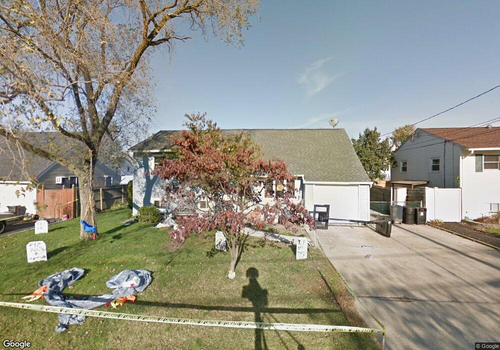
1021 N Ontario Ave Lindenhurst, NY 11757
Estimated Value: $558,152 - $683,000
--
Bed
--
Bath
2,051
Sq Ft
$300/Sq Ft
Est. Value
About This Home
This home is located at 1021 N Ontario Ave, Lindenhurst, NY 11757 and is currently estimated at $615,288, approximately $299 per square foot. 1021 N Ontario Ave is a home located in Suffolk County with nearby schools including William Rall School, Lindenhurst Middle School, and Lindenhurst Senior High School.
Ownership History
Date
Name
Owned For
Owner Type
Purchase Details
Closed on
Feb 18, 1999
Sold by
Brown Jacqueline and Brown James
Bought by
Crawford Wayne and Crawford Gina
Current Estimated Value
Home Financials for this Owner
Home Financials are based on the most recent Mortgage that was taken out on this home.
Original Mortgage
$145,000
Interest Rate
6.92%
Create a Home Valuation Report for This Property
The Home Valuation Report is an in-depth analysis detailing your home's value as well as a comparison with similar homes in the area
Home Values in the Area
Average Home Value in this Area
Purchase History
| Date | Buyer | Sale Price | Title Company |
|---|---|---|---|
| Crawford Wayne | $153,000 | First American Title Ins Co |
Source: Public Records
Mortgage History
| Date | Status | Borrower | Loan Amount |
|---|---|---|---|
| Previous Owner | Crawford Wayne | $145,000 |
Source: Public Records
Tax History Compared to Growth
Tax History
| Year | Tax Paid | Tax Assessment Tax Assessment Total Assessment is a certain percentage of the fair market value that is determined by local assessors to be the total taxable value of land and additions on the property. | Land | Improvement |
|---|---|---|---|---|
| 2024 | $11,380 | $3,310 | $290 | $3,020 |
| 2023 | $11,380 | $3,310 | $290 | $3,020 |
| 2022 | $9,662 | $3,310 | $290 | $3,020 |
| 2021 | $9,662 | $3,310 | $290 | $3,020 |
| 2020 | $10,127 | $3,310 | $290 | $3,020 |
| 2019 | $10,127 | $0 | $0 | $0 |
| 2018 | $9,582 | $3,310 | $290 | $3,020 |
| 2017 | $9,582 | $3,310 | $290 | $3,020 |
| 2016 | $9,619 | $3,310 | $290 | $3,020 |
| 2015 | -- | $3,310 | $290 | $3,020 |
| 2014 | -- | $3,310 | $290 | $3,020 |
Source: Public Records
Map
Nearby Homes
- 1029 N Niagara Ave
- 456 Heathcote Rd
- 430 Heathcote Rd
- 16 Burton Place
- 156 Farmers Ave
- 45 Feustal St
- 165 Tremont Rd
- 61 Kellum St Unit A and B
- 61 Kellum St Unit 61A
- 957 N Fulton Ave
- 0 Tenety Ave Unit 3461459
- 83 Justice St
- 108 Justice St
- 45 Farber Dr
- 166 & 170 Woodrow Pkwy
- 86 Farber Dr Unit 86
- 940 N Erie Ave
- 669 East Dr
- 200 Farber Dr Unit 200
- 210 Farber Dr Unit 210
- 1017 N Ontario Ave
- 1025 N Ontario Ave
- 1020 N Putnam Ave
- 1016 N Putnam Ave
- 1024 N Putnam Ave
- 1013 N Ontario Ave
- 1029 N Ontario Ave
- 1020 N Ontario Ave
- 1020 N Ontario Ave Unit B
- 1020 N Ontario Ave Unit 2nd FL
- 1012 N Putnam Ave
- 1016 N Ontario Ave
- 1028 N Putnam Ave
- 1024 N Ontario Ave
- 1009 N Ontario Ave
- 1033 N Ontario Ave
- 1012 N Ontario Ave
- 1028 N Ontario Ave
- 1008 N Putnam Ave
- 1032 N Putnam Ave