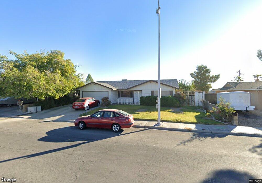
1021 Palmhurst Dr Las Vegas, NV 89145
Charleston Preservation NeighborhoodEstimated Value: $394,354 - $438,000
4
Beds
2
Baths
1,855
Sq Ft
$225/Sq Ft
Est. Value
About This Home
This home is located at 1021 Palmhurst Dr, Las Vegas, NV 89145 and is currently estimated at $417,089, approximately $224 per square foot. 1021 Palmhurst Dr is a home located in Clark County with nearby schools including Helen M Smith Elementary School, Walter Johnson Junior High School Academy of International Studies, and Bonanza High School.
Ownership History
Date
Name
Owned For
Owner Type
Purchase Details
Closed on
Oct 17, 2016
Sold by
Koranda John Robert
Bought by
John R Koranda Living Trust
Current Estimated Value
Purchase Details
Closed on
Jun 29, 2016
Sold by
Koranda Thomas R and Koranda Ann A
Bought by
Koranda John Robert
Purchase Details
Closed on
Nov 30, 1994
Sold by
Koranda Thomas R and Koranda Ann A
Bought by
Koranda Thomas and Koranda Ann
Create a Home Valuation Report for This Property
The Home Valuation Report is an in-depth analysis detailing your home's value as well as a comparison with similar homes in the area
Home Values in the Area
Average Home Value in this Area
Purchase History
| Date | Buyer | Sale Price | Title Company |
|---|---|---|---|
| John R Koranda Living Trust | -- | None Available | |
| Koranda John Robert | $116,774 | None Available | |
| Koranda Thomas | -- | -- |
Source: Public Records
Tax History Compared to Growth
Tax History
| Year | Tax Paid | Tax Assessment Tax Assessment Total Assessment is a certain percentage of the fair market value that is determined by local assessors to be the total taxable value of land and additions on the property. | Land | Improvement |
|---|---|---|---|---|
| 2025 | $1,293 | $62,308 | $35,350 | $26,958 |
| 2024 | $1,293 | $62,308 | $35,350 | $26,958 |
| 2023 | $1,293 | $61,741 | $34,650 | $27,091 |
| 2022 | $1,256 | $54,525 | $29,050 | $25,475 |
| 2021 | $1,219 | $50,992 | $26,250 | $24,742 |
| 2020 | $1,181 | $49,972 | $24,850 | $25,122 |
| 2019 | $1,146 | $46,768 | $21,350 | $25,418 |
| 2018 | $1,113 | $43,713 | $18,900 | $24,813 |
| 2017 | $1,401 | $42,730 | $17,150 | $25,580 |
| 2016 | $1,055 | $39,971 | $13,300 | $26,671 |
| 2015 | $1,052 | $37,303 | $10,500 | $26,803 |
| 2014 | $1,021 | $32,229 | $6,300 | $25,929 |
Source: Public Records
Map
Nearby Homes
- 933 Palmhurst Dr
- 1020 Alan Shepard St
- 7540 Crystal Cave Dr
- 804 Vincent Way
- 1341 Marina Del Rey Ct
- 917 Sproul Ct Unit 1
- 7428 Doe Ave
- 809 Peacock Ct
- 1504 Ten Palms Ct
- 908 Rockaway St
- 904 Rockaway St
- 1448 Canyon Ledge Ct
- 7612 Seagull Ave
- 613 Biljac St
- 7421 Silver Palm Ave
- 7814 Gable Ln Unit 12112
- 7820 Ravenhollow Ln Unit 11812
- 1721 S Tioga Way
- 6741 Chehalis Cir
- 1901 Rosemere Ct Unit 5
- 1017 Palmhurst Dr
- 1025 Palmhurst Dr
- 1024 Eugene Cernan St
- 1024 Eugene Cernan St
- 1024 Eugene Cernan St
- 1020 Eugene Cernan St
- 1016 Eugene Cernan St
- 1013 Palmhurst Dr
- 1029 Palmhurst Dr
- 7121 Harrison Schmitt Ave
- 1020 Palmhurst Dr
- 1016 Palmhurst Dr
- 1012 Eugene Cernan St
- 7201 William Anders Ave
- 1009 Palmhurst Dr
- 1012 Palmhurst Dr
- 7117 Harrison Schmitt Ave
- 1021 Eugene Cernan St
- 1008 Eugene Cernan St Unit n
- 1008 Eugene Cernan St