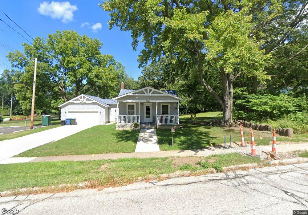
1021 Park Ave Amherst, OH 44001
Estimated Value: $209,000 - $308,042
3
Beds
2
Baths
1,472
Sq Ft
$182/Sq Ft
Est. Value
About This Home
This home is located at 1021 Park Ave, Amherst, OH 44001 and is currently estimated at $267,511, approximately $181 per square foot. 1021 Park Ave is a home located in Lorain County with nearby schools including Powers Elementary School, Walter G. Nord Middle School, and Amherst Junior High School.
Ownership History
Date
Name
Owned For
Owner Type
Purchase Details
Closed on
Jul 14, 2004
Sold by
Staveski James R
Bought by
Moore James E and Moore Kathleen
Current Estimated Value
Purchase Details
Closed on
Apr 26, 2000
Sold by
Staveski Shawn
Bought by
Staveski Ii James R
Purchase Details
Closed on
Feb 8, 1999
Sold by
Smarsh Judith and Hippler Mary Ellen
Bought by
Staveski Ii James R and Staveski Shawn L
Home Financials for this Owner
Home Financials are based on the most recent Mortgage that was taken out on this home.
Original Mortgage
$75,000
Interest Rate
6.88%
Create a Home Valuation Report for This Property
The Home Valuation Report is an in-depth analysis detailing your home's value as well as a comparison with similar homes in the area
Home Values in the Area
Average Home Value in this Area
Purchase History
| Date | Buyer | Sale Price | Title Company |
|---|---|---|---|
| Moore James E | $98,000 | -- | |
| Staveski Ii James R | -- | -- | |
| Staveski Ii James R | $95,000 | Guardian Title |
Source: Public Records
Mortgage History
| Date | Status | Borrower | Loan Amount |
|---|---|---|---|
| Previous Owner | Staveski Ii James R | $75,000 |
Source: Public Records
Tax History Compared to Growth
Tax History
| Year | Tax Paid | Tax Assessment Tax Assessment Total Assessment is a certain percentage of the fair market value that is determined by local assessors to be the total taxable value of land and additions on the property. | Land | Improvement |
|---|---|---|---|---|
| 2024 | $3,850 | $95,344 | $19,233 | $76,111 |
| 2023 | $4,481 | $93,517 | $14,480 | $79,037 |
| 2022 | $4,295 | $93,517 | $14,480 | $79,037 |
| 2021 | $3,579 | $77,711 | $14,480 | $63,231 |
| 2020 | $1,543 | $29,750 | $12,120 | $17,630 |
| 2019 | $1,553 | $29,750 | $12,120 | $17,630 |
| 2018 | $1,561 | $29,750 | $12,120 | $17,630 |
| 2017 | $1,269 | $22,710 | $10,070 | $12,640 |
| 2016 | $1,280 | $22,710 | $10,070 | $12,640 |
| 2015 | $1,274 | $22,710 | $10,070 | $12,640 |
| 2014 | $1,333 | $23,650 | $10,490 | $13,160 |
| 2013 | $1,338 | $23,650 | $10,490 | $13,160 |
Source: Public Records
Map
Nearby Homes
- 891 Park Ave
- 1140 Woodside Dr
- 179 Jackson St
- 825 Cleveland Ave
- 105 N Woodhill Dr
- 2176 Myla Way
- 135 Ridgeland Dr
- 653 Brennan Dr
- 726 Sunrise Dr
- 0 Middle Ridge Rd Unit 5102632
- 0 Middle Ridge Rd Unit 5160578
- 7475 S Dewey Rd
- 707 Greenlawn Dr
- 923 Longitude Ln
- 812 Bearing Ct
- 6394 Balsam Dr
- V/L Middle Ridge Rd
- 394 Long St
- 8 Riviera Ave
- 574 Fieldstone Dr
- 1031 Park Ave
- 190 Orchard Hill Dr
- 1020 Park Ave
- 1042 Park Ave
- 1058 Park Ave
- 230 Taylor St
- 925 Park Ave
- 1080 Park Ave
- 1037 Park Ave
- 187 Orchard Hill Dr
- 186 Orchard Hill Dr
- 980 Park Ave
- 251 Taylor St
- 240 Broadway St
- 950 Park Ave
- 238 Taylor St
- 1112 Park Ave
- 915 Park Ave
- 250 Taylor St
- 182 Orchard Hill Dr