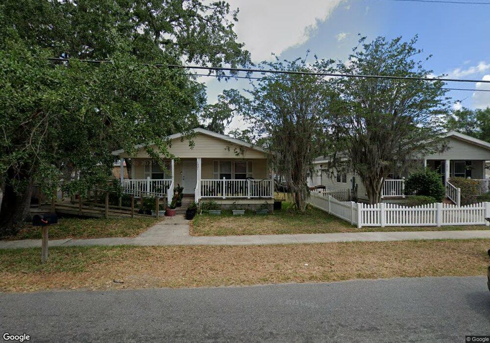
1021 Patrick St Kissimmee, FL 34741
Downtown Kissimmee NeighborhoodEstimated Value: $225,000 - $399,000
3
Beds
2
Baths
1,296
Sq Ft
$250/Sq Ft
Est. Value
About This Home
This home is located at 1021 Patrick St, Kissimmee, FL 34741 and is currently estimated at $323,667, approximately $249 per square foot. 1021 Patrick St is a home located in Osceola County with nearby schools including Thacker Avenue Elementary School For International Studies, Denn John Middle School, and Osceola High School.
Ownership History
Date
Name
Owned For
Owner Type
Purchase Details
Closed on
Oct 9, 2025
Sold by
Basdewa Sita L
Bought by
Basdewa Sita L and Chowbay Kheimraj D
Current Estimated Value
Purchase Details
Closed on
May 29, 2009
Sold by
City Of Kissimmee Community Redevelopmen
Bought by
Basdewa Sita L
Home Financials for this Owner
Home Financials are based on the most recent Mortgage that was taken out on this home.
Original Mortgage
$31,000
Interest Rate
4.81%
Mortgage Type
Purchase Money Mortgage
Create a Home Valuation Report for This Property
The Home Valuation Report is an in-depth analysis detailing your home's value as well as a comparison with similar homes in the area
Home Values in the Area
Average Home Value in this Area
Purchase History
| Date | Buyer | Sale Price | Title Company |
|---|---|---|---|
| Basdewa Sita L | $100 | None Listed On Document | |
| Basdewa Sita L | $158,000 | Osceola Title Ins Agency Inc |
Source: Public Records
Mortgage History
| Date | Status | Borrower | Loan Amount |
|---|---|---|---|
| Previous Owner | Basdewa Sita L | $31,000 |
Source: Public Records
Tax History Compared to Growth
Tax History
| Year | Tax Paid | Tax Assessment Tax Assessment Total Assessment is a certain percentage of the fair market value that is determined by local assessors to be the total taxable value of land and additions on the property. | Land | Improvement |
|---|---|---|---|---|
| 2024 | $490 | $60,406 | -- | -- |
| 2023 | $490 | $58,647 | $0 | $0 |
| 2022 | $481 | $56,939 | $0 | $0 |
| 2021 | $484 | $55,281 | $0 | $0 |
| 2020 | $483 | $54,518 | $0 | $0 |
| 2019 | $483 | $53,293 | $0 | $0 |
| 2018 | $482 | $52,300 | $0 | $0 |
| 2017 | $484 | $51,700 | $0 | $0 |
| 2016 | $491 | $52,100 | $0 | $0 |
| 2015 | $505 | $52,500 | $0 | $0 |
| 2014 | $511 | $52,900 | $0 | $0 |
Source: Public Records
Map
Nearby Homes
- 212 S Clyde Ave
- 22 S Clyde Ave
- 812 Bryan St
- 200 S Lilly St
- 204 Lilly St
- 206 S Vernon Ave
- 118 N Dillingham Ave
- 1308 Verona St Unit 1308 & 1310
- 1317 W Emmett St
- 1006 Penfield St
- 0 S Vernon Ave Unit MFRS5092303
- 312 N Randolph Ave
- 709 S Dillingham Ave
- 0 Patrick St
- 1614 Verona St
- 1323 Kory St
- 314 Alma St
- 0 W June St
- 1003 S John Young Pkwy
- 1905 Emmett St
- 1017 Patrick St
- 1013 Patrick St
- 121 S John Young Pkwy
- 1024 Patrick St
- 1020 Patrick St
- 1020 Bryan St
- 204 S Randolph Ave
- 122 S Dillingham Ave
- 116 S Dillingham Ave
- 1012 Bryan St
- 213 S Randolph Ave
- 110 S Dillingham Ave Unit 110
- 110 S Dillingham Ave Unit 1/2
- 110 S Dillingham Ave Unit 112
- 110 S Dillingham Ave
- 112 S Dillingham Ave
- 218 S Dillingham Ave Unit 220
- 204 S Dillingham Ave
- 104 S Dillingham Ave
- 216 S Randolph Ave