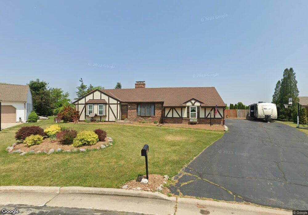
1021 Pheasant Run Union Grove, WI 53182
Estimated Value: $405,810 - $519,000
3
Beds
3
Baths
1,844
Sq Ft
$251/Sq Ft
Est. Value
About This Home
This home is located at 1021 Pheasant Run, Union Grove, WI 53182 and is currently estimated at $462,703, approximately $250 per square foot. 1021 Pheasant Run is a home located in Racine County with nearby schools including Union Grove Elementary School, Union Grove High School, and Union Grove Christian School.
Ownership History
Date
Name
Owned For
Owner Type
Purchase Details
Closed on
Oct 10, 2017
Sold by
Nelson Renee and Prideaux Randall
Bought by
Young Shawn B and Young Joanna L
Current Estimated Value
Home Financials for this Owner
Home Financials are based on the most recent Mortgage that was taken out on this home.
Original Mortgage
$208,050
Outstanding Balance
$171,249
Interest Rate
3.82%
Mortgage Type
New Conventional
Estimated Equity
$291,454
Create a Home Valuation Report for This Property
The Home Valuation Report is an in-depth analysis detailing your home's value as well as a comparison with similar homes in the area
Home Values in the Area
Average Home Value in this Area
Purchase History
| Date | Buyer | Sale Price | Title Company |
|---|---|---|---|
| Young Shawn B | $223,000 | None Available |
Source: Public Records
Mortgage History
| Date | Status | Borrower | Loan Amount |
|---|---|---|---|
| Open | Young Shawn B | $208,050 |
Source: Public Records
Tax History
| Year | Tax Paid | Tax Assessment Tax Assessment Total Assessment is a certain percentage of the fair market value that is determined by local assessors to be the total taxable value of land and additions on the property. | Land | Improvement |
|---|---|---|---|---|
| 2025 | $5,074 | $381,200 | $82,700 | $298,500 |
| 2024 | $4,539 | $282,100 | $47,000 | $235,100 |
| 2023 | $4,513 | $282,100 | $47,000 | $235,100 |
| 2022 | $4,737 | $282,100 | $47,000 | $235,100 |
| 2021 | $4,440 | $282,100 | $47,000 | $235,100 |
| 2020 | $4,384 | $222,000 | $41,000 | $181,000 |
| 2019 | $4,493 | $222,000 | $41,000 | $181,000 |
| 2018 | $4,314 | $222,100 | $41,000 | $181,100 |
| 2017 | $4,089 | $198,600 | $40,600 | $158,000 |
| 2016 | $4,088 | $198,600 | $40,600 | $158,000 |
| 2015 | $4,355 | $198,600 | $40,600 | $158,000 |
| 2014 | $4,283 | $198,600 | $40,600 | $158,000 |
| 2013 | $4,469 | $198,600 | $40,600 | $158,000 |
Source: Public Records
Map
Nearby Homes
- 1134 Bluebird Ln
- 91 York St
- 145 Victoria Cir
- 1020 Main St
- 1030 Main St
- 431 Nottingham Dr
- 1870 Nottingham Ct
- Lt0 Durand Ave
- 1723 State St Unit 43
- 1072 5th Ave
- 1350 15th Ave
- 528 Kiddle Ln
- 1770 Main St
- 1239 Kiddle Ln
- 1308 Kiddle Ln
- Lt110 Kiddle Ln
- Lt90 Kiddle Ln
- 1318 Kiddle Ln
- Lt94 Kiddle Ln
- 1261 Kiddle Ln
- 1031 Pheasant Run
- 200 Pheasant Run
- 198 White Oak Ct
- 195 White Oak Ct
- 1075 Pheasant Run
- 230 Pheasant Run
- 1070 Pheasant Run
- 184 White Oak Ct
- 191 Mill Ave
- 185 White Oak Ct
- 201 Mill Ave
- 187 Mill Ave
- 260 Pheasant Run
- 231 Pheasant Run
- 1133 Pheasant Run
- 231 Mill Ave
- 190 11th Ave
- 183 Mill Ave
- 174 White Oak Ct
- 1100 Pheasant Run
Your Personal Tour Guide
Ask me questions while you tour the home.