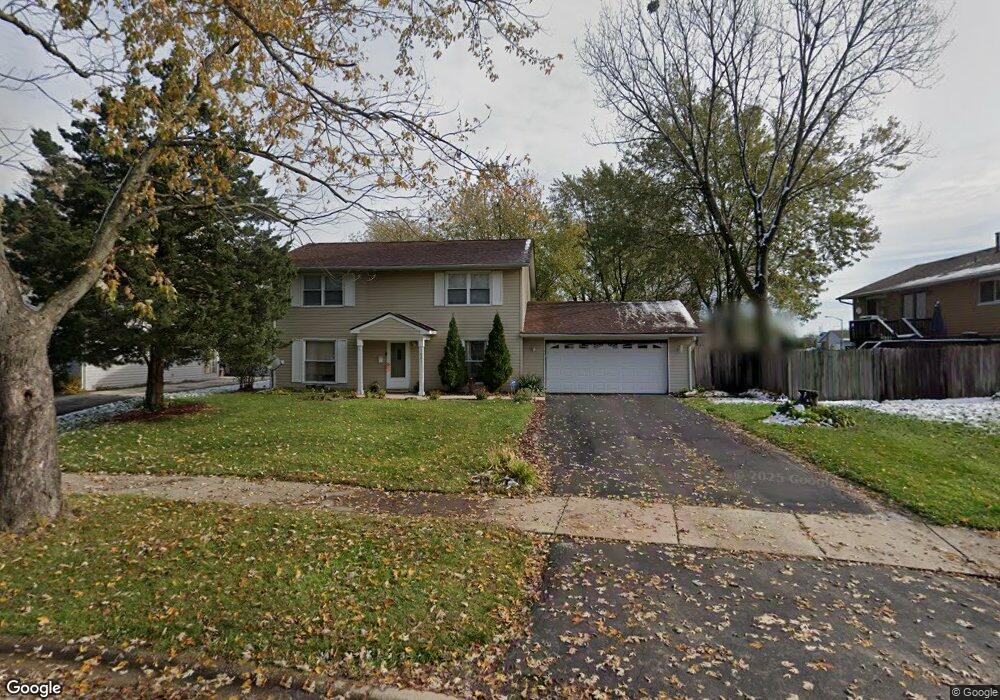
1021 Purdue Ln Matteson, IL 60443
West Matteson NeighborhoodEstimated Value: $208,000 - $256,000
4
Beds
2
Baths
1,637
Sq Ft
$144/Sq Ft
Est. Value
About This Home
This home is located at 1021 Purdue Ln, Matteson, IL 60443 and is currently estimated at $235,748, approximately $144 per square foot. 1021 Purdue Ln is a home located in Cook County with nearby schools including Colin Powell Middle School.
Ownership History
Date
Name
Owned For
Owner Type
Purchase Details
Closed on
Jun 8, 1998
Sold by
Reynolds Gary N and Reynolds Dartera L
Bought by
Reed Vincent and Baxter Reed Karla
Current Estimated Value
Home Financials for this Owner
Home Financials are based on the most recent Mortgage that was taken out on this home.
Original Mortgage
$84,560
Outstanding Balance
$15,880
Interest Rate
7.32%
Mortgage Type
FHA
Estimated Equity
$219,868
Create a Home Valuation Report for This Property
The Home Valuation Report is an in-depth analysis detailing your home's value as well as a comparison with similar homes in the area
Home Values in the Area
Average Home Value in this Area
Purchase History
We collect this data history from publicly available records. To have your information removed, we recommend requesting removal directly through your county’s website.
| Date | Buyer | Sale Price | Title Company |
|---|---|---|---|
| Reed Vincent | $85,000 | -- |
Source: Public Records
Mortgage History
We collect this data history from publicly available records. To have your information removed, we recommend requesting removal directly through your county’s website.
| Date | Status | Borrower | Loan Amount |
|---|---|---|---|
| Open | Reed Vincent | $84,560 |
Source: Public Records
Tax History
| Year | Tax Paid | Tax Assessment Tax Assessment Total Assessment is a certain percentage of the fair market value that is determined by local assessors to be the total taxable value of land and additions on the property. | Land | Improvement |
|---|---|---|---|---|
| 2025 | $6,087 | $18,000 | $3,512 | $14,488 |
| 2024 | $6,087 | $18,000 | $3,512 | $14,488 |
| 2023 | $4,165 | $18,000 | $3,512 | $14,488 |
| 2022 | $4,165 | $11,199 | $3,073 | $8,126 |
| 2021 | $4,252 | $11,199 | $3,073 | $8,126 |
| 2020 | $4,228 | $11,199 | $3,073 | $8,126 |
| 2019 | $4,175 | $11,071 | $2,853 | $8,218 |
| 2018 | $4,111 | $11,071 | $2,853 | $8,218 |
| 2017 | $4,029 | $11,071 | $2,853 | $8,218 |
| 2016 | $4,363 | $10,928 | $2,634 | $8,294 |
| 2015 | $4,220 | $10,928 | $2,634 | $8,294 |
| 2014 | $4,132 | $10,928 | $2,634 | $8,294 |
| 2013 | $4,450 | $12,302 | $2,634 | $9,668 |
Source: Public Records
Map
Nearby Homes
- 5503 Georgetown Dr
- 937 Notre Dame Dr
- 903 Notre Dame Dr
- 953 Dartmouth Ave
- 920 Central Ave
- 997 Regent Dr
- 5631 Colgate Ln
- 651 Central Ave
- 5327 Northwestern Dr
- 5245 Southwick Ct
- 5226 Southwick Ct Unit 2
- 21223 Alessandra Dr
- 909 Berkshire Dr
- 322 Central Ave
- 5620 Feathercreek Rd
- 21249 Sophia Dr
- 910 Great Plains Ave
- 6216 Pond View Dr
- 6037 Spring Ln
- 5171 Monroe St
- 1013 Purdue Ln
- 5452 Georgetown Dr
- 1022 Notre Dame Dr
- 1007 Purdue Ln
- 1014 Notre Dame Dr
- 5434 Georgetown Dr
- 1022 Purdue Ln
- 1008 Notre Dame Dr
- 1012 Purdue Ln
- 1001 Purdue Ln
- 1006 Purdue Ln
- 1002 Notre Dame Dr
- 5443 Georgetown Dr
- 5449 Georgetown Dr
- 959 Purdue Ln
- 5435 Georgetown Dr
- 5455 Georgetown Dr
- 966 Purdue Ln
- 5461 Georgetown Dr
- 1021 Notre Dame Dr
Your Personal Tour Guide
Ask me questions while you tour the home.