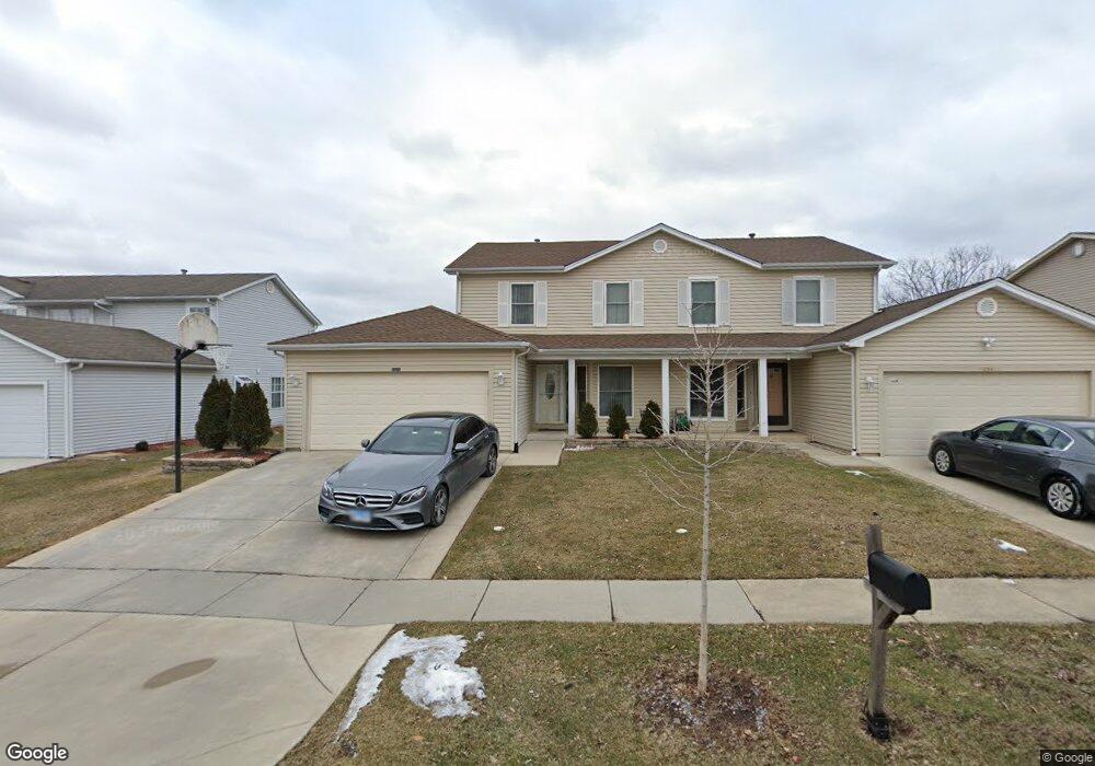
1021 Southbridge Ln Schaumburg, IL 60194
West Schaumburg NeighborhoodEstimated Value: $346,590 - $366,000
3
Beds
2
Baths
1,395
Sq Ft
$256/Sq Ft
Est. Value
About This Home
This home is located at 1021 Southbridge Ln, Schaumburg, IL 60194 and is currently estimated at $357,648, approximately $256 per square foot. 1021 Southbridge Ln is a home located in Cook County with nearby schools including Neil Armstrong Elementary School, Dwight D Eisenhower Junior High School, and Hoffman Estates High School.
Ownership History
Date
Name
Owned For
Owner Type
Purchase Details
Closed on
Apr 28, 1999
Sold by
Radfar Farhad
Bought by
Ali Syed Ahmed and Arshi Qudsia
Current Estimated Value
Home Financials for this Owner
Home Financials are based on the most recent Mortgage that was taken out on this home.
Original Mortgage
$124,500
Outstanding Balance
$29,150
Interest Rate
6.87%
Estimated Equity
$328,498
Create a Home Valuation Report for This Property
The Home Valuation Report is an in-depth analysis detailing your home's value as well as a comparison with similar homes in the area
Home Values in the Area
Average Home Value in this Area
Purchase History
| Date | Buyer | Sale Price | Title Company |
|---|---|---|---|
| Ali Syed Ahmed | $166,000 | First American Title |
Source: Public Records
Mortgage History
| Date | Status | Borrower | Loan Amount |
|---|---|---|---|
| Open | Ali Syed Ahmed | $124,500 |
Source: Public Records
Tax History
| Year | Tax Paid | Tax Assessment Tax Assessment Total Assessment is a certain percentage of the fair market value that is determined by local assessors to be the total taxable value of land and additions on the property. | Land | Improvement |
|---|---|---|---|---|
| 2025 | $6,892 | $31,000 | $6,003 | $24,997 |
| 2024 | $6,892 | $28,000 | $5,000 | $23,000 |
| 2023 | $6,642 | $28,000 | $5,000 | $23,000 |
| 2022 | $6,642 | $28,000 | $5,000 | $23,000 |
| 2021 | $5,538 | $21,645 | $3,393 | $18,252 |
| 2020 | $5,519 | $21,645 | $3,393 | $18,252 |
| 2019 | $5,518 | $24,050 | $3,393 | $20,657 |
| 2018 | $5,424 | $21,532 | $2,871 | $18,661 |
| 2017 | $5,356 | $21,532 | $2,871 | $18,661 |
| 2016 | $5,247 | $21,532 | $2,871 | $18,661 |
| 2015 | $5,613 | $21,431 | $2,479 | $18,952 |
| 2014 | $5,565 | $21,431 | $2,479 | $18,952 |
| 2013 | $5,405 | $21,431 | $2,479 | $18,952 |
Source: Public Records
Map
Nearby Homes
- 1975 Leiter Way Unit 12002
- 1982 Leiter Way Unit 13004
- 1985 Leiter Way Unit 1102
- 1988 Leiter Way Unit 13001
- 1979 Leiter Way Unit 12004
- 1981 Leiter Way Unit 12005
- 1994 Leiter Way Unit 14003
- 1977 Leiter Way Unit 12003
- 1986 Leiter Way Unit 13002
- 1989 Leiter Way Unit 11004
- 845 Harmon Blvd
- 1026 Denham Place Unit 1
- 1190 Woodcreek Ln
- 775 Harmon Blvd
- 1975 Windsong Dr Unit 333E1
- 1365 Newcastle Ln
- 1355 Blair Ln
- 1700 Robin Ln Unit 1D
- 1300 Chatsworth Ln
- 1880 Bonnie Ln Unit 416
- 1019 Southbridge Ln
- 1025 Southbridge Ln
- 1015 Southbridge Ln
- 1027 Southbridge Ln
- 1000 Sweetflower Dr
- 1004 Sweetflower Dr
- 994 Sweetflower Dr
- 1013 Southbridge Ln
- 1101 Southbridge Ln
- 990 Sweetflower Dr
- 1010 Sweetflower Dr
- 1014 Sweetflower Dr
- 984 Sweetflower Dr
- 1020 Southbridge Ln
- 1022 Southbridge Ln
- 1103 Southbridge Ln
- 1016 Southbridge Ln
- 1009 Southbridge Ln
- 980 Sweetflower Dr
- 1020 Sweetflower Dr