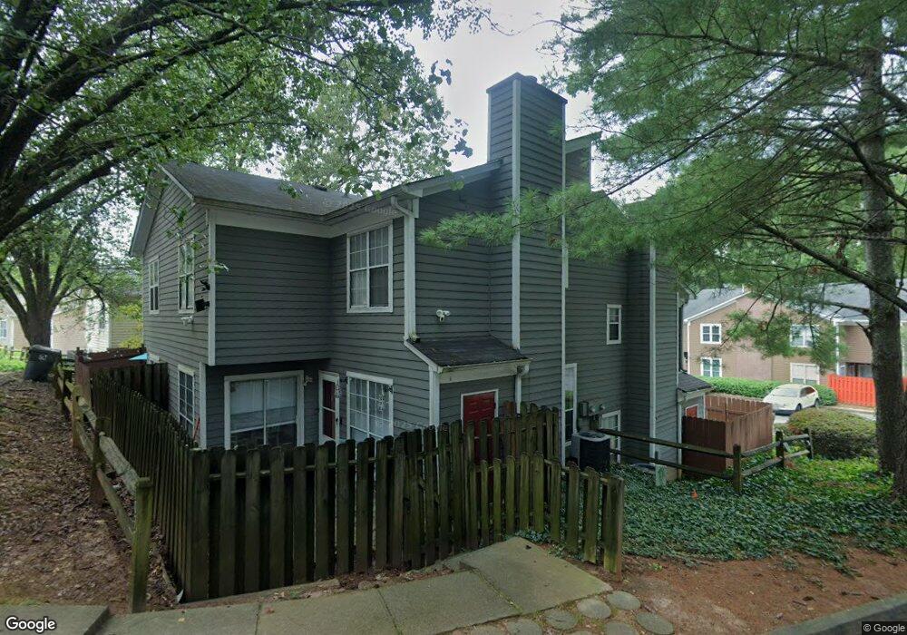
1021 Thornfield Ct Unit 1021 Norcross, GA 30093
Estimated Value: $206,000 - $238,000
2
Beds
3
Baths
1,608
Sq Ft
$140/Sq Ft
Est. Value
About This Home
This home is located at 1021 Thornfield Ct Unit 1021, Norcross, GA 30093 and is currently estimated at $224,418, approximately $139 per square foot. 1021 Thornfield Ct Unit 1021 is a home located in Gwinnett County with nearby schools including Ferguson Elementary School, Louise Radloff Middle School, and Meadowcreek High School.
Ownership History
Date
Name
Owned For
Owner Type
Purchase Details
Closed on
Jun 7, 2000
Sold by
Minor Pearl F
Bought by
Whitlock Frances M
Current Estimated Value
Home Financials for this Owner
Home Financials are based on the most recent Mortgage that was taken out on this home.
Original Mortgage
$87,785
Outstanding Balance
$30,939
Interest Rate
8.63%
Mortgage Type
FHA
Estimated Equity
$193,479
Purchase Details
Closed on
Mar 17, 2000
Sold by
Chism Vivian P
Bought by
Minor Pearl F
Create a Home Valuation Report for This Property
The Home Valuation Report is an in-depth analysis detailing your home's value as well as a comparison with similar homes in the area
Home Values in the Area
Average Home Value in this Area
Purchase History
| Date | Buyer | Sale Price | Title Company |
|---|---|---|---|
| Whitlock Frances M | $90,500 | -- | |
| Minor Pearl F | $72,500 | -- |
Source: Public Records
Mortgage History
| Date | Status | Borrower | Loan Amount |
|---|---|---|---|
| Open | Whitlock Frances M | $87,785 |
Source: Public Records
Tax History Compared to Growth
Tax History
| Year | Tax Paid | Tax Assessment Tax Assessment Total Assessment is a certain percentage of the fair market value that is determined by local assessors to be the total taxable value of land and additions on the property. | Land | Improvement |
|---|---|---|---|---|
| 2025 | $559 | $106,720 | $14,000 | $92,720 |
| 2024 | $560 | $100,720 | $14,000 | $86,720 |
| 2023 | $560 | $89,400 | $12,000 | $77,400 |
| 2022 | $521 | $73,120 | $8,000 | $65,120 |
| 2021 | $514 | $58,080 | $8,000 | $50,080 |
| 2020 | $512 | $54,240 | $6,600 | $47,640 |
| 2019 | $483 | $47,720 | $6,600 | $41,120 |
| 2018 | $472 | $39,480 | $6,600 | $32,880 |
| 2016 | $967 | $25,640 | $4,800 | $20,840 |
| 2015 | $806 | $20,840 | $4,000 | $16,840 |
| 2014 | -- | $20,840 | $4,000 | $16,840 |
Source: Public Records
Map
Nearby Homes
- 1049 Knights Bridge Ct
- 1037 Dover Way
- 1066 Rock Creek Ln
- 1097 Rock Creek Ln
- 5016 Comanche Ct NW
- 1451 Indian Way NW
- 5148 Whited Way NW Unit 1
- 4608 Warners Trail Unit 3
- 1411 Indian Way NW
- 1020 Park Forest Dr NW
- 5181 Cold Springs Dr NW
- 862 Brandlwood Way NW Unit 2
- 4652 Parklake Ct
- 1060 Heatherwood Ct
- 1360 Dickens Rd NW
- 849 Cadet Ct NW
- 1066 Worcester Place NW Unit 4
- 1014 Brockdell Ct
- 783 Silvercreek Ct NW
- 1082 Ashmore Trace Unit 1082
- 1057 Mansfield Ct Unit 1057
- 1057 Mansfield Ct
- 1057 Mansfield Ct Unit 64
- 1047 Dover Way
- 1063 Rock Creek Ln
- 1024 Wiltshire Way
- 1079 Brittwood Place
- 4862 Wessex Way Unit 4862
- 1079 Knights Bridge Ct Unit 7022
- 4863 Westridge Dr Unit 4863
- 1036 Rock Creek Ln Unit 64
- 1036 Rock Creek Ln
- 1084 Burnside Way
- 1096 Rock Creek Ln
- 1047 Mansfield Ct
- 1047 Mansfield Ct Unit 1047
- 4869 Wuthering Way Unit 4869
- 4885 Warners Trail
- 1097 Dover Way