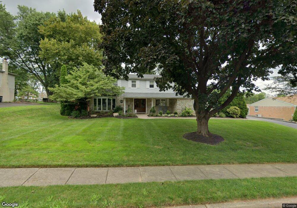
1021 Twin Silo Ln Huntingdon Valley, PA 19006
Lower Moreland NeighborhoodEstimated Value: $696,316 - $762,000
4
Beds
3
Baths
2,648
Sq Ft
$270/Sq Ft
Est. Value
About This Home
This home is located at 1021 Twin Silo Ln, Huntingdon Valley, PA 19006 and is currently estimated at $716,079, approximately $270 per square foot. 1021 Twin Silo Ln is a home located in Montgomery County with nearby schools including Pine Road Elementary School, Murray Avenue School, and Lower Moreland High School.
Ownership History
Date
Name
Owned For
Owner Type
Purchase Details
Closed on
Jul 13, 2006
Sold by
Seltzer Steven M and Seltzer Karen E
Bought by
Link Robert George and Link Kristen
Current Estimated Value
Home Financials for this Owner
Home Financials are based on the most recent Mortgage that was taken out on this home.
Original Mortgage
$350,000
Outstanding Balance
$208,016
Interest Rate
6.67%
Estimated Equity
$508,063
Create a Home Valuation Report for This Property
The Home Valuation Report is an in-depth analysis detailing your home's value as well as a comparison with similar homes in the area
Home Values in the Area
Average Home Value in this Area
Purchase History
| Date | Buyer | Sale Price | Title Company |
|---|---|---|---|
| Link Robert George | $438,000 | None Available |
Source: Public Records
Mortgage History
| Date | Status | Borrower | Loan Amount |
|---|---|---|---|
| Open | Link Robert George | $350,000 |
Source: Public Records
Tax History Compared to Growth
Tax History
| Year | Tax Paid | Tax Assessment Tax Assessment Total Assessment is a certain percentage of the fair market value that is determined by local assessors to be the total taxable value of land and additions on the property. | Land | Improvement |
|---|---|---|---|---|
| 2025 | $10,673 | $211,420 | -- | -- |
| 2024 | $10,673 | $211,420 | -- | -- |
| 2023 | $10,201 | $211,420 | $0 | $0 |
| 2022 | $9,902 | $211,420 | $0 | $0 |
| 2021 | $9,698 | $211,420 | $0 | $0 |
| 2020 | $9,410 | $211,420 | $0 | $0 |
| 2019 | $9,269 | $211,420 | $0 | $0 |
| 2018 | $1,987 | $211,420 | $0 | $0 |
| 2017 | $8,742 | $211,420 | $0 | $0 |
| 2016 | $8,659 | $211,420 | $0 | $0 |
| 2015 | $8,135 | $211,420 | $0 | $0 |
| 2014 | $8,135 | $211,420 | $0 | $0 |
Source: Public Records
Map
Nearby Homes
- 985 Milkweed Ln
- 3617 Sipler Ln
- 3750 Wheatsheaf Rd
- 1018 Corn Crib Dr
- 1035 Wright Dr
- 1212 Leedom Rd
- 3567 Oriole Dr
- 3945 Blue Bird Rd Unit 71
- 3886 Dempsey Ln
- 3843 Loop Rd
- 1291 Mettler Rd
- 1363 Byberry Rd
- 3370 Paper Mill Rd
- 1427 Byberry Rd
- 1439 Byberry Rd
- 111 Beechwood Dr
- 3505 Heaton Rd
- 468 Long Ln
- 122 Stephenson Way
- 3574 Glen Way
- 1033 Twin Silo Ln
- 1007 Twin Silo Ln
- 984 Hunters Turn
- 1022 Twin Silo Ln
- 1045 Twin Silo Ln
- 993 Twin Silo Ln
- 1008 Twin Silo Ln
- 1034 Twin Silo Ln
- 972 Hunters Turn
- 1048 Twin Silo Ln
- 3700 Albidale Dr Unit A
- 3700 Albidale Dr
- 1011 Warfield Ln
- 997 Warfield Ln
- 1057 Twin Silo Ln
- 1025 Warfield Ln
- 981 Twin Silo Ln
- 960 Hunters Turn
- 983 Hunters Turn
- 984 Twin Silo Ln