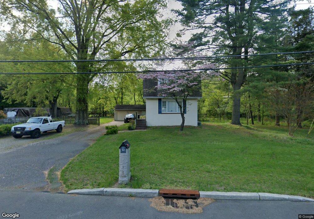
1021 Union Mill Rd Mount Laurel, NJ 08054
Estimated Value: $363,000 - $507,000
2
Beds
2
Baths
1,500
Sq Ft
$292/Sq Ft
Est. Value
About This Home
This home is located at 1021 Union Mill Rd, Mount Laurel, NJ 08054 and is currently estimated at $438,090, approximately $292 per square foot. 1021 Union Mill Rd is a home located in Burlington County with nearby schools including Parkway Elementary School, T.E. Harrington Middle School, and Mount Laurel Hartford School.
Ownership History
Date
Name
Owned For
Owner Type
Purchase Details
Closed on
Apr 29, 2021
Sold by
Ciurcio William T Di
Bought by
1021 Union Mill Road Llc
Current Estimated Value
Home Financials for this Owner
Home Financials are based on the most recent Mortgage that was taken out on this home.
Original Mortgage
$100,000
Interest Rate
2.96%
Mortgage Type
Purchase Money Mortgage
Create a Home Valuation Report for This Property
The Home Valuation Report is an in-depth analysis detailing your home's value as well as a comparison with similar homes in the area
Home Values in the Area
Average Home Value in this Area
Purchase History
| Date | Buyer | Sale Price | Title Company |
|---|---|---|---|
| 1021 Union Mill Road Llc | -- | Golden Title Agency Llc |
Source: Public Records
Mortgage History
| Date | Status | Borrower | Loan Amount |
|---|---|---|---|
| Previous Owner | 1021 Union Mill Road Llc | $100,000 |
Source: Public Records
Tax History Compared to Growth
Tax History
| Year | Tax Paid | Tax Assessment Tax Assessment Total Assessment is a certain percentage of the fair market value that is determined by local assessors to be the total taxable value of land and additions on the property. | Land | Improvement |
|---|---|---|---|---|
| 2025 | $5,932 | $187,900 | $87,800 | $100,100 |
| 2024 | $5,708 | $187,900 | $87,800 | $100,100 |
| 2023 | $5,708 | $187,900 | $87,800 | $100,100 |
| 2022 | $5,690 | $187,900 | $87,800 | $100,100 |
| 2021 | $5,575 | $187,900 | $87,800 | $100,100 |
| 2020 | $5,474 | $187,900 | $87,800 | $100,100 |
| 2019 | $5,299 | $183,800 | $83,700 | $100,100 |
| 2018 | $5,259 | $183,800 | $83,700 | $100,100 |
| 2017 | $5,123 | $183,800 | $83,700 | $100,100 |
| 2016 | $5,045 | $183,800 | $83,700 | $100,100 |
| 2015 | $4,986 | $183,800 | $83,700 | $100,100 |
| 2014 | $4,937 | $183,800 | $83,700 | $100,100 |
Source: Public Records
Map
Nearby Homes
- 23 E Oleander Dr
- 40 E Oleander Dr
- 74 Poppy Ct
- 10 Gretna Ct
- 9 Avandale Ct
- 9 Village Ct Unit BUILDING 2
- 42 Meadowrue Ct
- 60B Sumac Ct
- 1A Sumac Ct
- 56 Eddystone Way
- 124 W Berwin Way
- 31 Quince Ct
- 10 Hanover Ct
- 8 Raven Ct
- 17 Carlisle Ct
- 1302B Ginger Dr Unit 1302B
- 223 Saint David Dr
- 23A E Daisy Ln
- 12 B E Daisy Ln
- 301 Saint David Dr
- 32 E Oleander Dr
- 29 E Oleander Dr
- 27 E Oleander Dr
- 28 E Oleander Dr
- 30 E Oleander Dr
- 26 E Oleander Dr
- 31 E Oleander Dr
- 25 E Oleander Dr
- 22 E Oleander Dr
- 35 E Oleander Dr
- 21 E Oleander Dr
- 36 E Oleander Dr
- 1029 Union Mill Rd
- 1026 Union Mill Rd
- 37 E Oleander Dr
- 19 E Oleander Dr
- 42 E Oleander Dr
- 47 E Oleander Dr
- 45 E Oleander Dr
- 44 E Oleander Dr