Estimated Value: $127,123
--
Bed
--
Bath
1,272
Sq Ft
$100/Sq Ft
Est. Value
About This Home
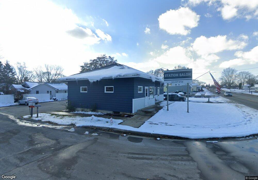
This home is located at 1021 W Lincoln Ave Unit Par 1, Ionia, MI 48846 and is currently estimated at $127,123, approximately $99 per square foot. 1021 W Lincoln Ave Unit Par 1 is a home located in Ionia County with nearby schools including Ionia High School, Saints Peter and Paul Catholic School, and Ionia Seventh Day Adventist Elementary School.
Ownership History
Date
Name
Owned For
Owner Type
Purchase Details
Closed on
Dec 31, 2018
Sold by
Nagy Christina M
Bought by
Dollface Beauty Company Llc
Current Estimated Value
Home Financials for this Owner
Home Financials are based on the most recent Mortgage that was taken out on this home.
Original Mortgage
$60,000
Outstanding Balance
$52,964
Interest Rate
4.8%
Mortgage Type
New Conventional
Estimated Equity
$74,159
Purchase Details
Closed on
Jul 16, 1999
Bought by
Anderson Christina M
Create a Home Valuation Report for This Property
The Home Valuation Report is an in-depth analysis detailing your home's value as well as a comparison with similar homes in the area
Home Values in the Area
Average Home Value in this Area
Purchase History
| Date | Buyer | Sale Price | Title Company |
|---|---|---|---|
| Dollface Beauty Company Llc | $75,000 | Sun Title Agency Mi Llc | |
| Anderson Christina M | $55,000 | -- |
Source: Public Records
Mortgage History
| Date | Status | Borrower | Loan Amount |
|---|---|---|---|
| Open | Dollface Beauty Company Llc | $60,000 |
Source: Public Records
Tax History Compared to Growth
Tax History
| Year | Tax Paid | Tax Assessment Tax Assessment Total Assessment is a certain percentage of the fair market value that is determined by local assessors to be the total taxable value of land and additions on the property. | Land | Improvement |
|---|---|---|---|---|
| 2025 | $2,349 | $50,000 | $9,800 | $40,200 |
| 2024 | $517 | $50,000 | $9,800 | $40,200 |
| 2023 | $493 | $40,400 | $7,500 | $32,900 |
| 2022 | $405 | $40,400 | $7,500 | $32,900 |
| 2021 | $1,787 | $37,400 | $7,500 | $29,900 |
| 2020 | $401 | $37,400 | $7,500 | $29,900 |
| 2019 | $403 | $48,000 | $10,500 | $37,500 |
| 2018 | $1,905 | $48,600 | $10,500 | $38,100 |
| 2017 | $406 | $48,600 | $10,500 | $38,100 |
| 2016 | $403 | $37,400 | $10,500 | $26,900 |
| 2015 | -- | $37,400 | $10,500 | $26,900 |
| 2014 | -- | $37,400 | $10,500 | $26,900 |
Source: Public Records
Map
Nearby Homes
- 556 Price St
- 916 Yeomans St
- 721 Chapman St
- 1133 Yeomans St Unit 99
- 1133 Yeomans St Unit 118
- 1133 Yeomans St Unit 105
- 1133 Yeomans St Unit 243
- 1133 Yeomans St Unit 55
- 1133 Yeomans St Unit 130
- 1133 Yeomans St Unit 129
- 1133 Yeomans St Unit 138
- 1133 Yeomans St Unit 256
- 1133 Yeomans St Unit 19
- 1133 Yeomans St Unit 193
- 407 Forest St
- 947 W Main St
- 710 Elmwood Dr
- 428 W Lincoln Ave
- 442 Baldie St
- 217 Dye St
- 1021 W Lincoln Ave
- 1027 W Lincoln Ave
- 479 Price St
- 1011 W Lincoln Ave
- 480 Price St
- 1039 W Lincoln Ave
- 471 Price St
- V/L Beresford St Unit Lot 1 and 2
- V/L Beresford St
- 470 Price St
- 511 Price St
- 1045 W Lincoln Ave
- 474 Beresford St
- 477 Nicholson St
- 510 Price St
- 510 Beresford St
- 463 Price St
- 1009 W Lincoln Ave
- 483 Beresford St
- 514 Beresford St