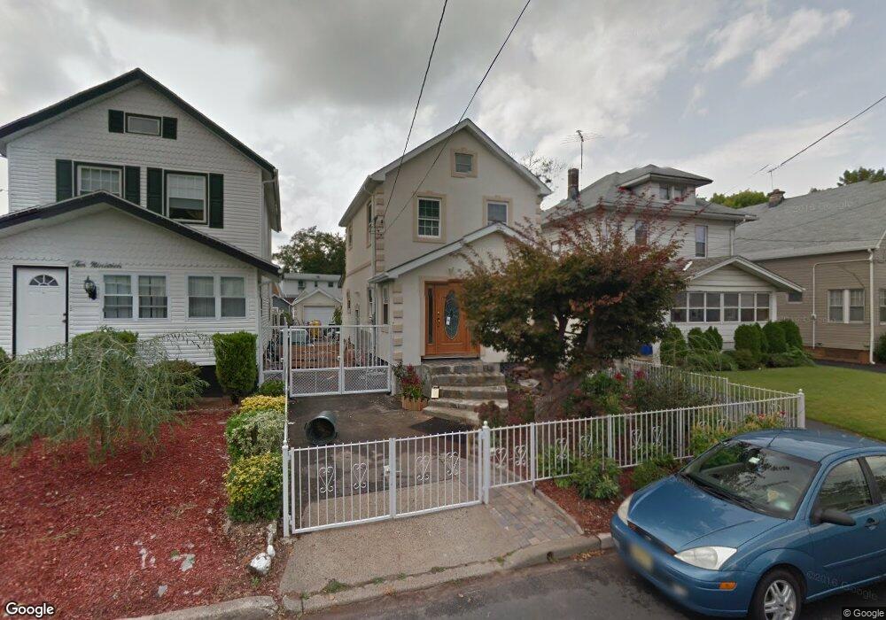
1021 Wheatsheaf Rd Linden, NJ 07036
Estimated Value: $415,994 - $442,000
--
Bed
--
Bath
666
Sq Ft
$639/Sq Ft
Est. Value
About This Home
This home is located at 1021 Wheatsheaf Rd, Linden, NJ 07036 and is currently estimated at $425,499, approximately $638 per square foot. 1021 Wheatsheaf Rd is a home located in Union County with nearby schools including Number 1, Joseph E. Soehl Middle School, and Linden High School.
Ownership History
Date
Name
Owned For
Owner Type
Purchase Details
Closed on
Jul 21, 2008
Sold by
Panzano Nancy
Bought by
Almeida Jose and Cerqueira Antonio
Current Estimated Value
Home Financials for this Owner
Home Financials are based on the most recent Mortgage that was taken out on this home.
Original Mortgage
$192,850
Outstanding Balance
$126,912
Interest Rate
6.47%
Mortgage Type
FHA
Estimated Equity
$298,587
Create a Home Valuation Report for This Property
The Home Valuation Report is an in-depth analysis detailing your home's value as well as a comparison with similar homes in the area
Home Values in the Area
Average Home Value in this Area
Purchase History
| Date | Buyer | Sale Price | Title Company |
|---|---|---|---|
| Almeida Jose | $200,000 | Vested Title Inc |
Source: Public Records
Mortgage History
| Date | Status | Borrower | Loan Amount |
|---|---|---|---|
| Open | Almeida Jose | $192,850 |
Source: Public Records
Tax History Compared to Growth
Tax History
| Year | Tax Paid | Tax Assessment Tax Assessment Total Assessment is a certain percentage of the fair market value that is determined by local assessors to be the total taxable value of land and additions on the property. | Land | Improvement |
|---|---|---|---|---|
| 2025 | $7,264 | $103,300 | $44,300 | $59,000 |
| 2024 | $7,105 | $103,300 | $44,300 | $59,000 |
| 2023 | $7,105 | $103,300 | $44,300 | $59,000 |
| 2022 | $7,142 | $103,300 | $44,300 | $59,000 |
| 2021 | $7,046 | $101,400 | $44,300 | $57,100 |
| 2020 | $7,009 | $101,400 | $44,300 | $57,100 |
| 2019 | $6,985 | $101,400 | $44,300 | $57,100 |
| 2018 | $6,983 | $101,400 | $44,300 | $57,100 |
| 2017 | $6,832 | $101,400 | $44,300 | $57,100 |
| 2016 | $6,617 | $101,400 | $44,300 | $57,100 |
| 2015 | $6,365 | $101,400 | $44,300 | $57,100 |
| 2014 | $6,241 | $101,400 | $44,300 | $57,100 |
Source: Public Records
Map
Nearby Homes
- 414 3rd Ave
- 812 Washington Ave
- 901 Clark St
- 559 Uncas Ave
- 633 Maple Ave
- 2209 N Wood Ave
- 813 N Wood Ave
- 574 Sherman Ave
- 721 N Wood Ave
- 725 N Wood Ave
- 1210 Orchard Terrace
- 1809 N Wood Ave Unit D1
- 115 Clark St
- 806 Roselle St
- 30 E Henry St
- 511 Brooklawn Ave Unit H1
- 721 E Curtis St
- 382 Douglas Rd
- 106 W Gibbons St
- 514 E Elm St
- 1019 Wheatsheaf Rd
- 1103 Wheatsheaf Rd
- 1011 Wheatsheaf Rd
- 1013 Wheatsheaf Rd
- 1105 Wheatsheaf Rd
- 1009 Wheatsheaf Rd
- 924 Washington Ave
- 930 Washington Ave
- 920 Washington Ave
- 936 Washington Ave
- 936 Washington Ave Unit 1
- 936 Washington Ave Unit 2
- 1111 Wheatsheaf Rd
- 1100 Wheatsheaf Rd
- 1014 Wheatsheaf Rd Unit 1016
- 1012 Wheatsheaf Rd
- 940 Washington Ave
- 1003 Wheatsheaf Rd
- 914 Washington Ave
- 1117 Wheatsheaf Rd